Ophir Canyon and Murphy Mine
Humboldt-Toiyabe National Forest
Click for map.
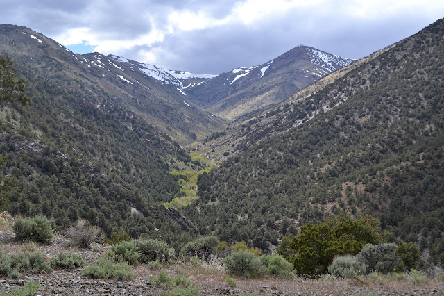
My trip to Ophir Summit came up short when I encountered and bothered to read a sign just before a junction explicitly forbidding sedans and 2WD pickup trucks. While that does not exactly include my vehicle, it certainly does get to the spirit of it. Besides, below that it classes jeeps as "not recommended". It looks like better road than that ahead of me, but I backed the little car into a shady spot next to an old mine and parked anyway. There is one other vehicle and the guy down in the creek doing some preliminary prospecting that goes with it pops up at the sound of my motor. Asked if the road is really that bad, he says he started up it and turned around when things got too narrow for his taste. The historic marker down at the start of this road talks up the ghost town of Ophir somewhere up there, so I know there is still something to see further up. The creek looks like it will not present a problem to cross, but vehicle fords do tend to lead to wet feet. He does not know how far up, but I have a few downloaded USGS quadrangles for the area on the computer. A little squinting and thumb wiggling leads to an estimate of three miles to see the ruins. A nice little afternoon jaunt. I go for it.


The road makes an easy way up along the creek. It fords the creek several times, but I must not be the only one willing to walk it once in a while. There are often rocks placed at one side or the other of the fords to help cross. I still have to wade across a couple, though.


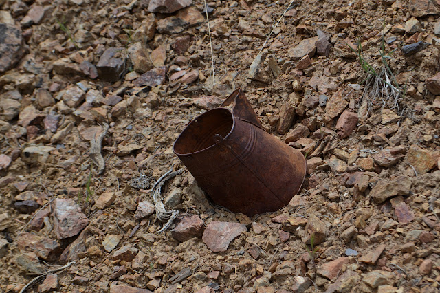
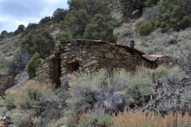
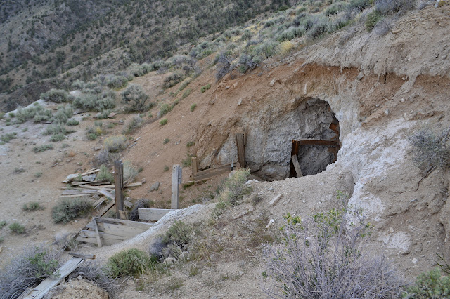
The canyon opens up a bit and there are bits of metal and even a few obvious mines along the way. A road comes down from above and I file it away for exploration on the way back. Just past the road and just about two miles in is the first of the crumbling rock buildings that are what is left of Ophir. From the sign below, what is left includes "the massive stone foundations of a costly and splendid stamp mill as well as the stone walls of an elegant office and mansion". This is probably neither of those. The community also had "a school, a church, various lodges, and, of course, several saloons." It is hard to tell much of what is left.

There is an upper building too, and I climb up to see it. Past it, there is a stick with a bit of metal stuck to it. This needs investigation, too. The metal is scratched with, "T.O. claim W.C. 190' north to cor". It is some sort of claim. The mining goes on. I head further up the hill to see what is marking this corner, but there seems to be nothing at all.


Continuing up, there are more buildings along the side of the road. A very few even go all the way up to the roof.


Past the small buildings, the tall walls of a monster rise. These housed the twenty-stamp mill with "the first experimental Stetefeldt furnace ever built." (Again, this is according to the historic marker sign.)


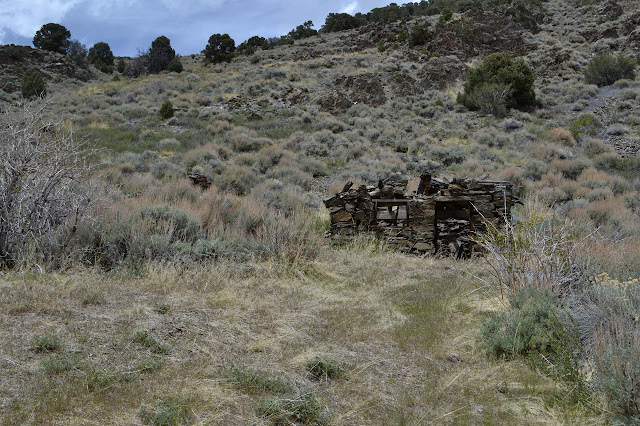
There are buildings among the scree from the mill and some low lines of rocks as remnants of more buildings. Old roads climb the hill in a series of diagonals where rock was collected. On the other side, there are a few holes from more rock collection. I continue until the road crosses the creek again to start the climb for the pass above, then turn back.


There is a photo here that claims to be the town in the 1870s, but I cannot seem to match up any of the geography, so am suspicious of the designation. There are things about the town that just do not seem right, too, but it has changed a lot in 140 years. At the far end again, I turn up the road and start climbing. From what I could observe while down in the canyon, it probably eventually gets back to the junction by where I parked, so I feel confident climbing it.

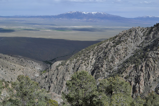
The road tops out at a saddle looking over into Wisconsin Canyon to the north. There is a junction and all the tire tracks of those who have driven it turn to continue upward. All maps only indicate a little further for it to go before stopping at another mine or prospect, probably quite like the one just west of the junction. The tire tracks make me think it must go further.

It is worrying that no one has chosen to go the other way. It makes me wonder if it goes through. The bottom by the junction had looked to get used, at least a little bit. I turn that way anyway. After all, it is easier for me to get through than a jeep. The first part to the lip of rock, the part I could see from below in the canyon, is fine. There are some small slides onto the road, but they only raise the road slightly. It even seems a jeep would be fine.
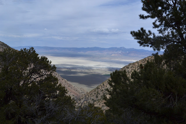
Starting down the other side, I can quickly see where I am parked. It would be absurd for there not to be a way there. I marvel at the way the green marking the path of the creek in the valley just seems to narrow and stop. Even the rivers, admittedly small, did not seem to quite get to the bottom of the valley before vanishing into whatever lies below.
The rest of the road continues to seem in rough but passable shape. The hillside beside it is absolutely riddled with holes from mines. Short spurs lead off to more mines. Sometimes a spur looks just as well used as the road itself. I manage to choose the right direction at a couple uncertain spots.


The road also gives some good views up and down the side of the Toiyabe Range.

My final thought on the road is that I have seen harder things in the Mount Pinos district of Los Padres marked "intermediate" while I was on my bike. Unlike those, this could be done with a stock vehicle. (It is possible that Pinos needs to reevaluate a few roads and is not a good yard stick.) On the way down, I noticed that a spur road I had passed on the way up is not just another mine but goes up to the cemetery, so stop by that before taking off for a camping spot. This one seems to be occupied. Besides, the water is probably a little higher in mercury than is strictly desirable.

A touch of geology can be found here with some more references to even more information.
©2017 Valerie Norton
Posted 25 May 2017
Liked this? Interesting? Click the three bars at the top left for the menu to read more or subscribe!


Comments