Troy Canyon
Humboldt-Toiyabe National Forest
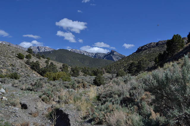
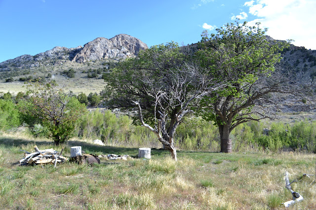
Click for map.It started off a frosty morning where I helped the ice off with a bit of windshield wiper fluid, then passed through a shadow and had the whole mess freeze again. After getting that more completely taken care of, I could head off to the edge of Quinn Canyon Wilderness with some stops on the way for hikes. The forest website claims that, "Extreme isolation defines Quinn Canyon, a remote central Nevada Wilderness." I am not so certain about that, but there is definitely not a lot of help in getting there. I turned down the highway to find one of two dirt roads with absolutely no designation that head south from Current, Nevada. The 4WD road that weaves back and forth across it is the Midland Trail. I went right through Current because I was expecting to see a sign that said something like "Current" on it. I had seen the school and it nagged at me that this was probably thought of as a population center for the area. There were also about six buildings, half of them clearly abandoned. For a second try through, I still could not find even one road heading south. On a third try, moving very slowly, I decided that the stop sign in the gravel probably designates a road from the rest of the gravel. I drove through the abandoned part of "town" and south on a very smooth dirt road.
The road dropped through a tight spot into a canyon, which was not in character with what I expected. I expected an entirely open and flat and distinctly south drive. The canyon was pretty and all, but wrong. The road also gradually turned east and as it left the canyon was barreling very much east. I was on the wrong one. As I hit SR-318, not that there was anything to tell me that is what it was, there was a mileages sign for those headed the other way. I turned south to make the other attempt at finding my way via a road from Sunnyside. I found out I was one day off from finding the road closed for an Ely to Las Vegas road race happening tomorrow, but I did not exactly find Sunnyside. It also has no sign, just a compound of buildings for an administrative site. On the far side of it was the road I wanted, marked Kirch Wildlife Refuge. I had seen that as something along the way, so made the turn. This, too, has a mileage sign including Cherry Creek Campground, my expected stopping point for the night and trailhead for tomorrow. I was feeling good about probably making it on this very long way around.
This road does have signs at the intersections. Except for one ranch that has a road in looking just as wide and used as the main road and did not include an arrow to show which road it is marking as it sits in the middle of the Y, everything was obvious. I probably should have changed my plans to something along that side, but I got determined to make sure I could get to the camp. I could. Then I went over the top to find my original destination. It was only mild guesswork to miss the ranches on the far side. At the bottom I realized that in a way, I was lucky to come from the other side. How would I ever have known to take a turn at the two mailboxes supported by an ancient oven clearly used for package delivery. There was also a third mailbox off on its own on top of its own wood crate partly flattened by some errant driver. I would have thought it was just another ranch road.

I guessed the miles to my next turn and had to get out the tracking GPS and estimate what it should read to be sure of it. I got really confident when I found the DUCK benchmark. Again, there was no sign. There had been one once. I started up the smooth technically 4WD road and finally found signs at the forest boundary. A little slapstick showed the road designation, 420, and as I looked left, I noticed the fallen form of a Humboldt National Forest sign. I had arrived in Troy Canyon where I wanted to be quite a few hours after I expected to. I should have grabbed the parking available there as the road starts hitting some harder and bigger rocks after that and getting a bit more serious about being 4WD. I foolishly pushed on in the baby car and tucked it in the first spot I saw to park. This is, it turns out, just short of an established campsite and slightly less short of the first creek ford. There was a ford of a ditch on the way in.

And while I realize most people reading through all that might be thinking I should get with the times and get a smart phone, I feel like AAA needs to launch another campaign for road signs.
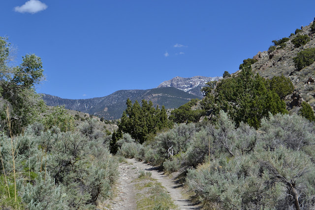
The road is easy walking and likely easy driving except for a few rough spots and the constant worry of having to deal with meeting someone on the road. The ford has no place to cross with dry feet for the lone hiker and a trail off to the side just goes to another spot on the creek with no way to keep the feet dry. It is a slightly warm afternoon and I plunge in. Another hike with extra heavy shoes and wet socks, but the alternative of taking them off to cross requires actually stopping.

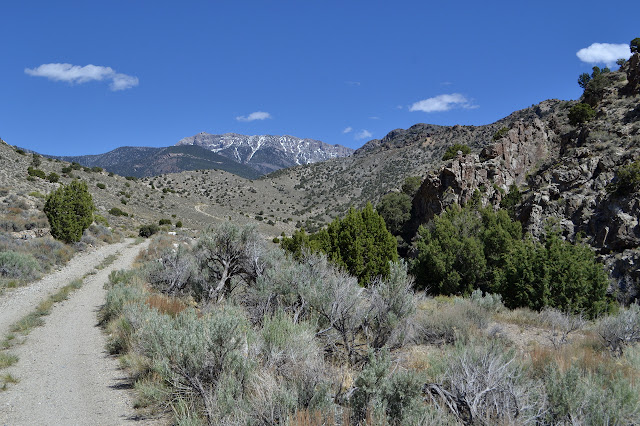

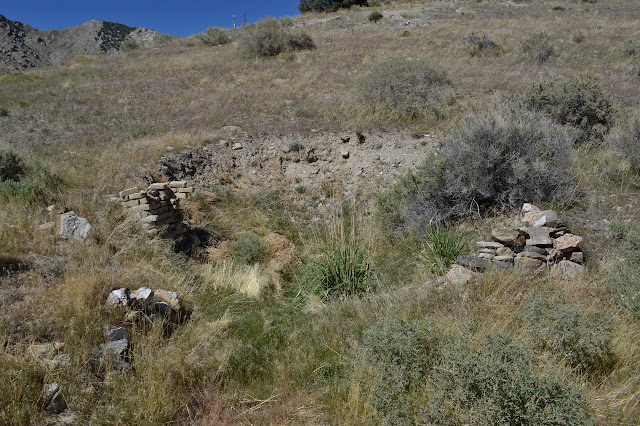
A small rock wall is to the side of the road. The remains of the room includes a fireplace that looks like more time was spent building it than burning anything in it. There are still two fords until the little rectangle on the map marked "ruins". The second ford has captured a bit of the creek to one half of the road. I walk on the other side, but just slog through when the full crossing comes. The third has captured the creek to both sides. I follow down the middle for the most part, but then it is another bit of splashing.

There is a thin trail to the side marked with a cairn, but I leave it not knowing why it might exist or how far it goes. (The map does show some caves far up there.) It looks like there is nowhere for it to go, really. Just over the hill is a collection of items that look like they could have washed down from cabins above or just be someone's poor idea of a firing range. The first of the marked ruins is easy to spot from far off as it comes in the form of a tall chimney on the other side of the creek.


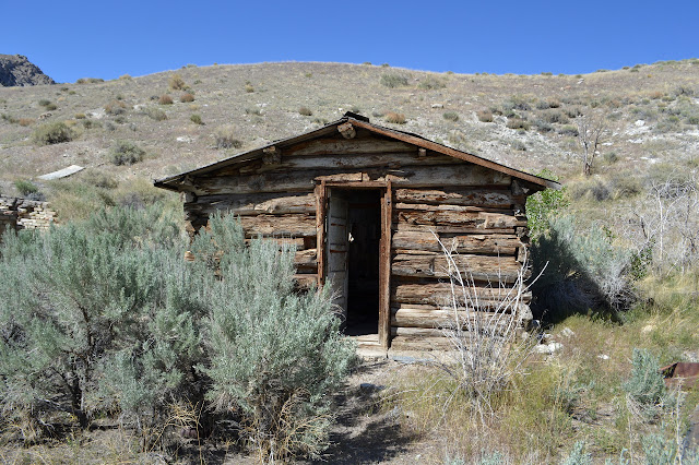
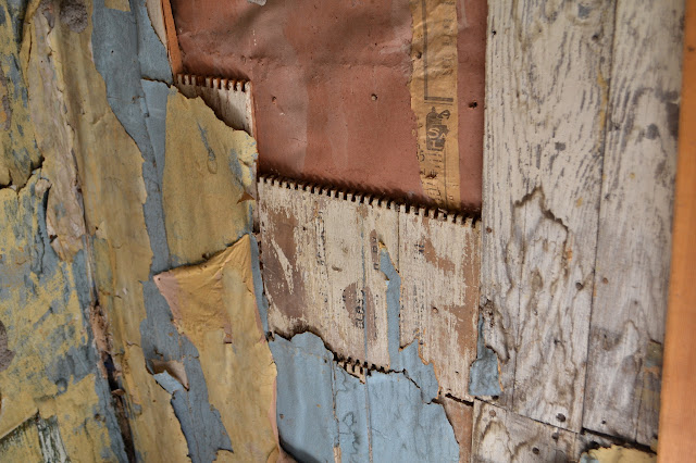
There is another almost vanished stone building with a fire place and then there are two buildings, one of stone and brick and the other of wood, still standing. Well, more half standing in the case of the brick. I poke my way in through the open door of the wooden building. The inside is curious. It is mostly covered in cardboard that has been nailed on. Some places there is a little wallpaper that looks more like shelf paper. One spot has fallen away to show bits of wood that look like they were once the sides of a drawer with dovetail joints.


I turn to slog through the next ford and over to the mill site. There is some machinery rusting over there. The forest service has seen fit to mark off one side of the inholding among the ruins.

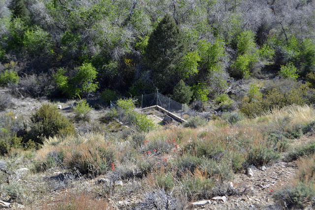
The map also has a cemetery marked in the canyon a little way up. I follow the road further. There are more evidence of mining operations along the way with hints that this may not be quite so old as the other places I have been. On one side of the road is a concrete foundation with 1947 scratched into the smooth surface, quite a bit more recent than the stop of operations in 1875. At a junction, one road turns away and climbs up the side and out again. A bit of erosion has deterred all but one rather creative driver from continuing straight.


The road gets a lot fainter after dropping through the wash. It passes a heap of bricks that seem to be melting into the earth. There is another junction soon after with road following another wash (technically the south fork), continuing along the creek (north fork), and crossing over to climb the north canyon wall. I want the one that crosses because it passes by the cemetery. This crossing is easy enough to jump across with one rock provided by the creek. Creek crossing is much easier without vehicles mucking it up.


There are only mining claim markers where I first look for the cemetery. I continue up the road looking for something near it, but it is supposed to be near the creek as well, so I quickly decide to expand my search. Climbing up the hill to the side will give a better view, so I do. The other side has a lovely flat area up above any flood area for the creek that looks like a fine place to put one. As I check the map again, I see I have looked off to the wrong side, so go up there to look instead. From afar, it does not look like it. From close up, it does not either.


As my wanderings looking for small clues of a cemetery take me to the edge of the hill near the creek, there it is. A fence and stones are at the bottom of the slope.
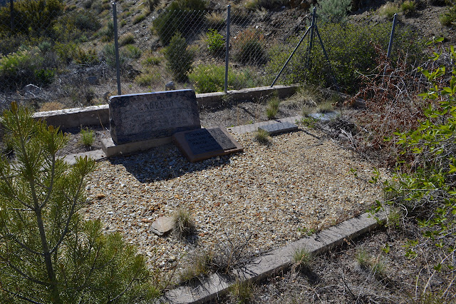
The stones are all for a single family who would have been here in the early part of the 20th century. I puzzle over what the stones mean exactly, then head off again. It is quite a winding route through the brush back to the road. There was no way I would have seen it from there even if I looked just the right place at just the right time. I got as far as my goal, so back I go and explore the mill area a little more.

The smoke stack for the mill, while standing, has some pretty obvious deficiencies in a number of places. It also looks suspiciously like the same bricks that are melting in a pile further up the road. I do notice that one of the bits of rusting iron looks more like a mower than mining equipment. Across the creek, the trees growing around what is now a campsite look rather like an orchard. The site even has an outhouse. It has a little half moon on the side even. Compelled to look, I find something rather unexpected: a flush toilet and faucet. The door has fallen off and the water is not hooked up any longer, but still quite the oddity.
After that little bit more exploration, I continue on back to the car with far too much unexplored, but apparently I had to waste half the day getting here the very, very long way. There are major mine workings up the hill along the road. The road up the south fork might be used to climb Troy Peak. It used to go up to a mine within a mile of the peak but still more than 2000 feet below so may not be a good way. Over the hill along some easy cross country is another mine camp in the next canyon. Up that mystery trail might be some caves. All could have been fun to do.

©2017 Valerie Norton
Posted 11 Jun 2017
Liked this? Interesting? Click the three bars at the top left for the menu to read more or subscribe!


Comments