Santa Cruz Trail work
Los Padres National Forest
Track on Alltrails.National Trails Day is the first Saturday in June, which can be a touch on the hot side in the local backcountry. Still, there is a great enthusiasm for it and there are always a few events around. I decided to hop over the hill to see Santa Cruz again. I hiked it after the burn, but rain storms had come after to add further injury. We gather at First Crossing even though we were meant to gather at Lower Oso because the gate is mysteriously closed. Apparently the new management company has decided that this is where the day use areas get closed overnight and that overnight should be from 5 PM to 8 AM. The advantage of using the other gate being that there is a clear sign warning about the closure so that people do not get locked in. There is some grumbling from people who have already been locked in without any reason to think it would happen. When the Parks Management employee sees fit to open up the gate around 8 AM, we can finally get moving to and through the expected locked gate. The road to Upper Oso is closed because of damage to the campground and road surface. It looks like the high water was as far over the bridge as the bridge is above the creek bed. However, the road has been in decay for so long that I cannot see any damage that was not already there. Parking in the upper lot, all but a few of about 30 volunteers walk the last 0.7 miles up the road to the trailhead.
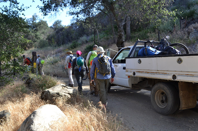

The trail is still marked as closed by the parking lot (with no closure order attached) but people are using it, at least a little way, and even signing in at the register. We stop to get our tools and hard hats and safety talk. With the big group expected today, they have flagged out sections for a bunch of subgroups to work in. We are only working as far as Nineteen Oaks today. The work is almost entirely moving dirt to try to discover the tread beneath. There is one tree across the trail to cut away just a few feet short of the Nineteen Oaks junction and there are a couple gas brush trimmers, but otherwise we are entirely outfitted with a McLeod and a Pulaski or a trail Smith before heading out.


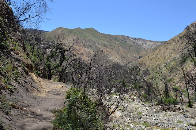
I set to finding the trail in the first section with a few others. Here, we have a few spots where debris is falling down making humps that slope outward steeply and one spot next to the rock edge that has gotten quite narrow along with a number of other narrowing spots. The rock even requires some chipping to help the trail.


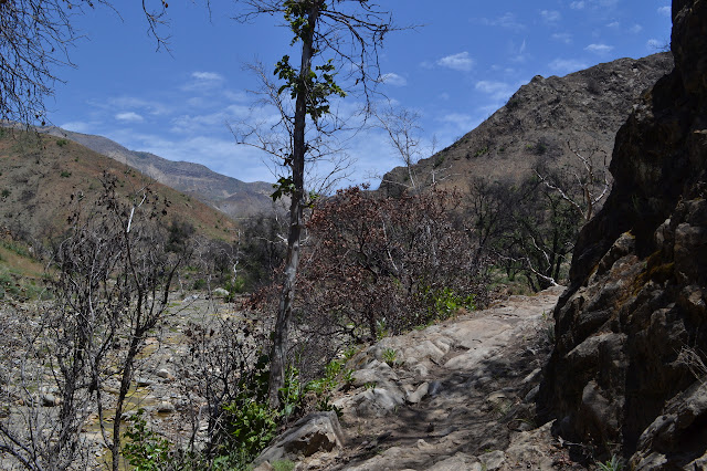

Walking our section when we are just about done, there is a spot with a bit of berm to take off and still a hump that really needs to go down a foot. The berm goes fast but the hump is just a terror. It may be down an inch or two as it becomes time to pack up and return.

We drop the borrowed tools and hats off at the truck and walk back to the cars. Oh, and there is plenty of food to be had at the finish.

©2017 Valerie Norton
Posted 16 Jun 2017
Liked this? Interesting? Click the three bars at the top left for the menu to read more or subscribe!


Comments