Cucamonga Wild: Ontario and Bighorn Peaks
Angeles National Forest
San Bernardino National Forest
Click for map.DAY 1 | DAY 2 | DAY 3
Although 2000 feet higher, Kelly Camp was not much cooler than Commanche Camp the night before. I pack up and tuck my gear away. This place does not have anything like the traffic at Icehouse Saddle, so I am not as worried about getting it totally hidden. Heading up the old camp steps along the trail gets me out of came and climbing to the ridge. In between is an area where burn and regrowth has left a trail that circles about in ridiculous ways.

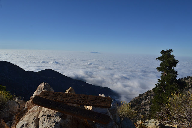
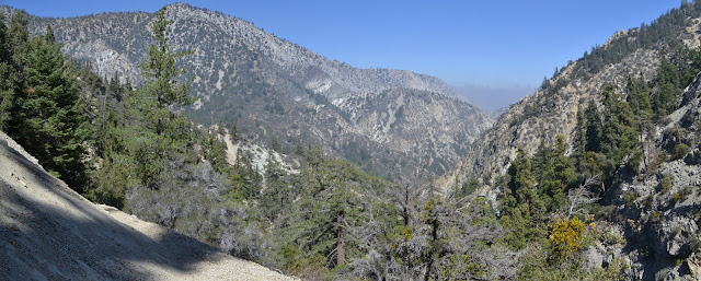
At the top of the ridge, it shows an advantage of saving these peaks with a similar view for a new day. It is a whole new world down there today compared to yesterday. The city grid stretching far west and east is now gone in favor of a sea of clouds with a few islands.
Trail at the top follows near the ridge east and west. I turn west for Ontario Peak. The trail follows through more of the burn, but now plots a typical ridge line path. It stays generally to the north side just a little and avoids going up and over the biggest bumps on the way.

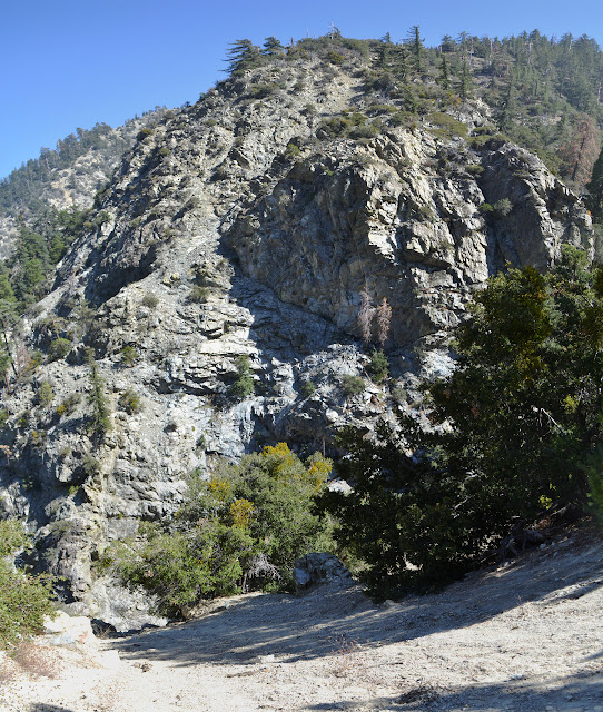
Just a little more climbing at the end and I am on Ontario Peak. It has a jumble of rocks to play around, but is a fairly small one. I cannot help but notice that someone has mounted a bottle opener to the stout, dead tree next to the summit block.


I am suspicious the next peak over might be a little higher and decide to hit it on the way over to Bighorn. Literature seems to put it about 3 feet shorter. There is no trail to get to the top, but it is easy enough. There is a small walled camp site and a register on it identifying it as "Not Quite Ontario" and indicating that most come up it hoping it actually is Ontario.


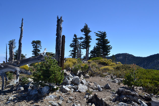
There are a couple women heading up Ontario as I come down. The route up to Bighorn Peak is shorter and so a bit more direct. It is a long peak and one that somehow projects a comfortable feeling. The top is marked with a post that I am rather suspicious used to hold up the sign at the junction along the ridge. I rather suspect there is a register somewhere, but not in any of the obvious spots. I should look these things up before coming up if I want to sign them.


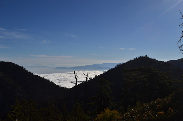
As I head down, I cannot help but notice that the low clouds are rising and breaking up to the west. South of me, they just seem to be rising.

As I get back to camp, I finally finish off the last of the water that was meant for hiking around yesterday. I really did not need to bring up so much. I pour out about 3 pounds of the stuff before packing up. What I still have will get me not just to the creek below, but all the way to the trailhead. The trail is much warmer and the air stiller now than it was in the early evening. I head down to Icehouse Saddle, and then down the Middle Fork once more.


As I head down from Commanche Camp, two things become quite clear. First, I passed through the best bit of the canyon in the dark when I could not see it. Second, I was right, there are some very scary bits of trail along here. Particularly the thin bit of sandy trail where now I can see there is nothing but sand at the angle of repose going down at least 100 feet. The scree sections are actually held in by some branches which are in turn held in by rebar. I could see the wood in the night, but not the metal tips spaced at less than a foot apart. Some 20 feet below are the larger metal anchors that once held the trail in. All this is nothing compared to the outright cliffs on the far side.


I meet a man coming up. One other person is actually hiking on this trail too! He says he is going for the peak (Cucamonga) from this side because he was late getting started, but he was even more pushed back because he could not get his truck all the way up the road. Finally the portions of the trail traversing high in the canyon start down some switchbacks to put me down in Third Crossing. There is no more here to indicate a named destination than at Commanche. It is just a few flat spots and some hand made fire pits that would be illegal to use.


I get a little down stream coming to the actual crossing, but it is easy enough to find the trail again on the other side. It does not get up quite so high below this, at least not until it splits for the Stone House.


At the split, I head low. This finds me in some very green spots. One area has ladybugs swarming along a log that lies next to the almost completely obscured trail. As I pass by, there is a sudden pain of little harpoons launching themselves into my thigh and knee. Stinging nettle, right through my trousers. Just past that trap is the second crossing.

Stone House Camp is a little way down and looks to be well used. There is a second site upstream from the main area. Past it is the first crossing. The trail gets a little washed out here before climbing up onto the bank.

The stone house itself eludes me as the trail starts up to the junction above where the rocks cross it to discourage passage this way. Old road is clear below the trail down in the creek bed. It comes up to the parking area next to the trail. Perhaps the end of it is where I should look. I am not quite that interested and pack up instead. I still have to navigate my ill-suited car down this road.
The road does not seem quite so bad going down. I am surprised at the section that stopped the pickup truck. It is something I had just rolled on through because although rather textured, my six inches of clearance would be enough. Coming down with breaking on all four wheels, I do manage to hit the right line on the particularly hard spot and thus there is not a single loud thump from the bottom of the Scion the whole way down. A new trail explored to an old haunt, four peaks bagged, and returning with my oil pan intact: this trip is quite the success. The three brown lines down the road from the less lucky car a couple days ago are beginning to fade.
©2017 Valerie Norton
Posted 25 September 2017
Liked this? Interesting? Click the three bars at the top left for the menu to read more or subscribe!


Comments