San Mateo Canyon: Tenaja Falls
Cleveland National Forest
Click for map.
DAY 1 | DAY 2
The night on the ridge line was wonderful and calm and warm with stars from ear to ear... or that is how smiles go. Anyway, there were a lot of stars to see with only one tiny bit of civilization glowing with its own stars. Well, not as many as there could be with the big moon. It is nice as the light brightens in the morning too. The warmth makes it easy to get up with that light.

Those sycamores I was looking for on Saturday are visible in the canyons on either side of me and even some in the tributaries. There should be water down there. Accessibility is another question. It is a gentle downhill the rest of the way along the ridge until a post marked with a message of "1.8" (miles, presumably) and "1300 feet down" with the "down" written vertically to help the reader understand the word. There was another, less perfect, site before the post, but there certainly is none after as it drops away and the semblance of road disappears. Not all that steep, but there are steep spots. Someone has tried to add in a switchback on the steepest bit, but no one seems to be taking it. When I get back from trying it, I find that is probably because it has only traversed half of the steep bit by the time it finishes. The only choice for the rest is straight down the edge. At least they tried. It really does need a switchback.


I can see a glint like there are pools below where I am approaching. The state of them remains to be seen, but they are capable of reflecting the morning sky from the deep canyon shadows. The trail becomes steeper and narrower as it wraps around the side of a highly vertical and crumbling canyon side. At some point, the rocks I am hiking among changed from granite to sandstone. My hope for water sours upon noticing the sandstone, although I may be wrong in thinking it is better for springs and getting water to stick around a little longer.

The trail ends with a second added switchback that is needed, but getting largely ignored by hikers. From the junction, the trail quickly turns to cross the creek bed where a thin, but beautiful, bit of water flows past. Had I known, I would have gladly invited the backpacker to dump his murky liquid and pulled out one of my bags to fill it right up, then "Drink it down, drink it down, I cannot seem to fit it all in," and filled it up again. We would have both been much happier. Of course, I would have known only if they had told me and if they knew, they would have already gathered from this flow and not needed any. I pause a moment to just watch its beauty before crossing. Admittedly, it does come from a series of large pools that are successively less attractive with muck and leaves.

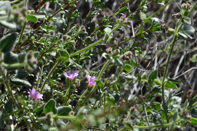
It is all uphill from here, give or take. The shade of the canyon feels colder now with the morning getting on than the ridge was at any time in the night. The uphill travel helps with that, or vice versa. There are flowers in the sun as I head up toward Fishermans Camp.


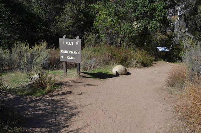
Signs mark both sides of Fishermans Camp. I can see two sites, not very far separate from the trail. One is in the sandy flood zone of the creek, so a sandy spot was available here, too. There is no water, though. It inspires no regret for not getting this far before camping. The trail promptly crosses both creeks that meet at the camp and I manage to go wrong following increasingly unlikely trail along the side of the creek before returning to the last known good spot, pulling out the map, discovering it thinks I should go downstream a bit before going up the far side, and eventually spotting the actual trail on the other side just the slightest way upstream. There is actually a wide rock ramp extending down into the stream bed to help mark it.

The delightful sounds of a young man whining, "Why are we even doing this?" drift down from above. He sounds like a (adult) child dragged along by his parents, but the quieter voices also seem young. Happily, they turn the other way and as I catch a glimpse they look like a group of friends. Why would someone come along who so desperately did not want to? They must be forgiving friends. I head up the ramp and can see more pools from my perch up the side of the canyon. There is more water at the next crossing. Plenty of water, accessible and clear. Sure would have been nice to know that before.


Unexpectedly, the trail splits. Marked by white posts, it seems to be a high route and a low route. The high route avoids two fords. It appears to be the more used one and I figure it will be shorter, so I go high. The low route crosses onto a low ledge below while the high wraps its way around a small stream, which does happen to be flowing too, and down into some oaks to rejoin the low route. It is probably more hill, longer, and I do not get to play in quite as much water on the way. They did warn me somewhat of the first and state the second.

The trail continues through the oaks and ends at another old road. This one is being kept wide by the tremendous number of feet that come down for the short route to Tenaja Falls. (This would have been a good spot to check for water myself although it is a bit of a drive.) I promptly manage to go the wrong way at the creek crossing again. Quite a lot of those feet have continued up the side of the creek and clambered over rocks that are amazingly smooth from hands and feet as the route becomes increasingly unlikely. Heading back again, the crossing is actually rather obvious. As an excuse, I had not quite understood that the width of the trail really was from being a road and not just the traffic. The car down the side further up helps clear that up. This is the old Tenaja Truck Trail, now identified as Tenaja Falls Trail on the map. There is a huge campsite on the far side of the creek that could have been a nice place to stay.

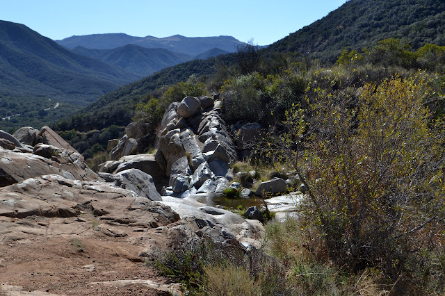
The old road climbs up out of the oaks and around to multiple lookouts for viewing the waterfall. There is not a lot of water coming down over it, but there is a little and I have it to myself on this Monday so I can listen to it too.


There is another campsite up at the top of the waterfall and another a little further up and probably a few more that are not so obvious. They look nice. It might be the water nearby, but they look a lot nicer than Fishermans Camp. If the decaying car was not enough to show this is a road, the concrete ford at the top of the waterfall and benchmark set in the rocks next to it are some more clues. From the top of the waterfall, the old road climbs high on the canyon wall and stays there. There is still water (and one decaying truck) far below, but no way to access it.

The rocks change back to granite, but there is still water flowing down in the bottom of the canyon. Up on the road, there is one hint of water, but mostly just views.


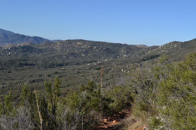
The canyon seems to come to a top, but past it is an expanse of flats. This is back to the area of ranches embedded in the middle of the wilderness. A building is visible sometimes and as the road clips a corner, some recent surveyor activity makes it easy to find the marker for it.


There is a sign marking a junction with no real choice of where to go. It is topped with a dinosaur like the posts along the San Mateo Peak Trail. It is the only one on this loop. The road is pretending it is not there as it continues straight. A distant sign says simply that there is private property ahead. The trail breaks off to circle the property heading back to Morgan Trail. There is a little bit of a climb to start, gaining a view over the flats.


That elevation is lost again as the trail makes the last loop back to Morgan Trail. Things look quite familiar as I drop toward the low, rocky hills I started among, passing a stand of small sycamores in the way.

Once back to the junction, there is just the climb back up to the ridge road. I finish before dark, so that choice to break the hike on the ridge instead of the original plan at Fishermans Camp worked out really well.
©2018 Valerie Norton
Posted 24 Feb 2018
Liked this? Interesting? Click the three bars at the top left for the menu to read more or subscribe!


Comments