Old Boney Trail
Rancho Sierra Vista/Satwiwa
Point Mugu State Park
Click for map.
Back not far from where I was hiking last week, I am out to either hike up to Tri Peaks again or take a big loop along the side of Boney Mountain. I probably should have chosen before starting, but I am still pondering. Although I want to go up to Tri Peaks again, I sort of want to do it via a different route than the one I have already done, so most likely this will be the larger loop to new spots. My start is new too. Previously, I started from by the cultural center, which has parking behind a gate that locks at sunset giving an annoying deadline for getting back. This time I am using the trail at the end of Windy Drive that everyone else seemed to be using so that I have no timing worries.

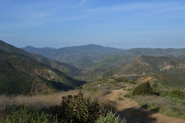
The trailhead has a sign about fire inspired by the Springs Fire of 2013. My previous trip was just 3 months after that fire, so this whole area was quite black. From here, loads of trails exist to choose from and I am not entirely sure which one I want to take. Toward Old Boney with a tendency to the right at first, then a left into the canyon will get me there, the first "there" being a little waterfall, and the exact trail does not matter so much. There are some very steep trails, one signed "no horses" and full of hoof marks in the dried mud, along the shortest route, the one I follow. Rabbits, with tails of white cotton, are still out and about as I go. There are a few poppies still twisted up tightly against the night.


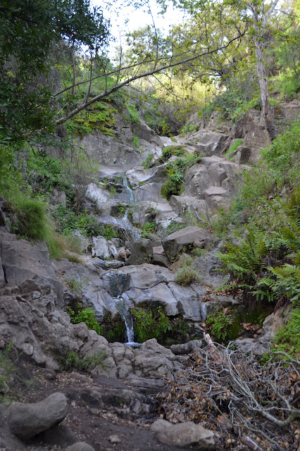
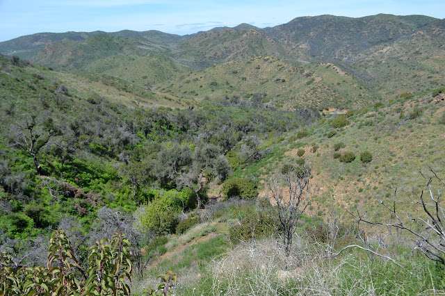
My route does seem to be the shortest to get up the hills and into the canyon. A trail to a lookout provides a brief temptation, but there should be enough hiking today. The sound of water below is unmistakable once I take that left turn and start down into the canyon. There should be flowing water in the waterfall today.


Crossing the creek, the trail climbs again as it continues up the canyon. An unmarked and unmissable trail heads off back to the bottom of the canyon as the main trail turns back to climb. I take the spur and it quickly dissolves into a scramble as it approaches the waterfall. It is more of a long cascade with lots of pools, but it is running. There is trail up past it that takes a bit more precarious scrambling and gives some better views of the pools, but does not seem to have much above.

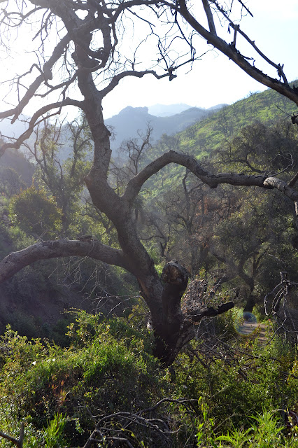
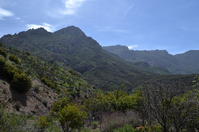
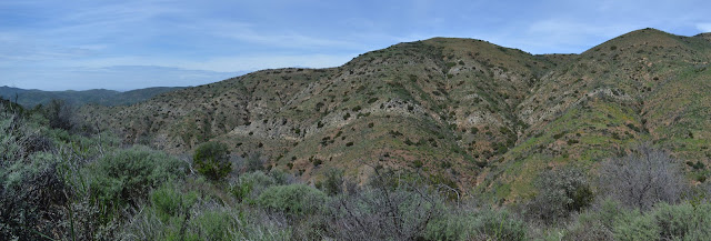
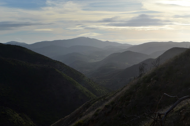
After checking out the waterfall, I return to the main trail and climb upwards along winding trail. It is not too much further to the junction where I need to choose if I go up the mountain or around its side. Approaching the mountain, I am reminded that much of it did not burn. The green has a distinctly different texture to it. I try to remember where the singed edge was.

At the junction, I do indeed choose to take Old Boney Trail, new trail for me. It actually takes a little longer to become new trail. At the high point, there is another unsigned trail, although this one is unofficial. This is the trail I came down from the peak before. In a sudden whim, I head up it just a little way to the "Hill 1918" benchmark. Although short, it is quite a slow steep climb. Still, got a bit of view at the top.


I head down off the little bump again and continue around. Now it is new trail to me. It seems to be out to showcase the various faces of Boney Mountain with its bulges of igneous rocks. Their shapes are a stark contrast to the softer sedimentary rocks that surround it. I have to constantly wonder at the sheer nonsense of calling its highest peak "Sandstone".

I pass a random sign marking the trail as Old Boney, then step aside to let a fellow pass while I sign a geocache I have just dug out of a bush. This is the start of a very strange interaction as he suddenly demands to know if I know where I am. What? I point out the sign I have just passed, wondering how could I not know, and he takes it in some other way. Have I ever been "here" before? Do I know where I am going? I am standing here holding a bright green plastic egg on a wire. Perhaps it is confusing him. Perhaps he is the sort who is sure that if someone is doing something confusing (to him), then that person must be confused. A mention of Fossil Trail coming up gets a long description of how it has no sign now, only a burned post. Perhaps I would not recognize I have come to a junction if it was "only" marked with a burned post? He tells me how to jog over to get to the road, something I can literally see from where I am standing. As he tries to tell me more and more directions, I start to wonder how you learn all this without ever noticing the dogs aren't allowed here. There are two of them, off leash, and they are not allowed in the State Park. They are especially not allowed in the State Wilderness. Surprisingly, the National Recreation Area will allow them on leash on some trails. I am starting to get rather grumpy and tell him outright that I am not in need of any directions. He tries a little more. No. Lots of trails down there, lots of choices. No more directions. He finally heads up the hill to allow me to finish signing the geocache and return it to its bushy hiding spot. If it was that the plastic egg that got him upset, he would have got a lot more out of a direct, "Why are you holding a plastic egg?"
I head down the last little bit to Fossil Trail and check the sign for the mileage since I want to do it as a spur. It is one mile down, so I go for it. I expect it is named for something that could be fun to discover. I do rather suspect that the most interesting ones will not be quite so obvious.
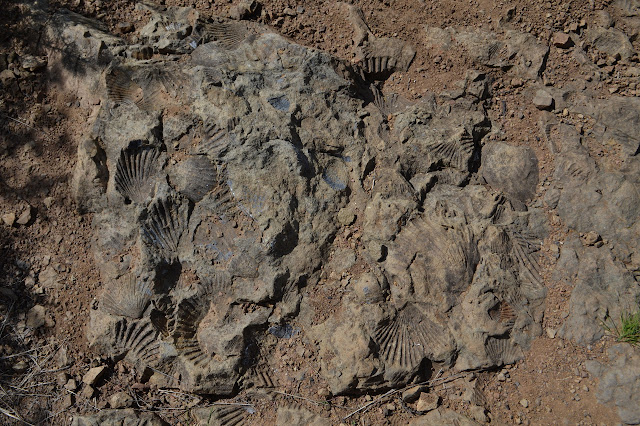
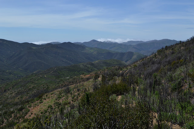
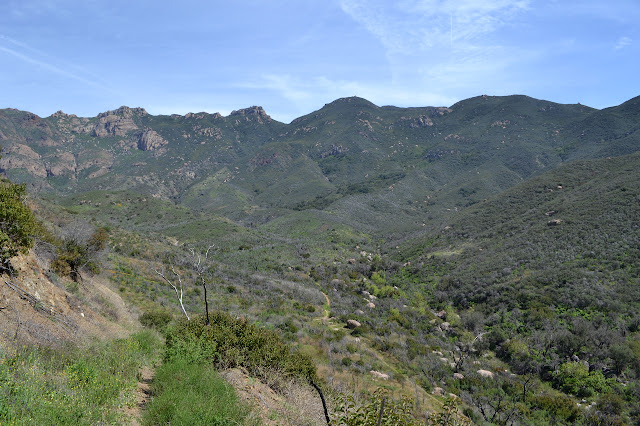
The trail is easy at first, then gets quite steep. As switchbacks start, I turn back up. The only obvious fossils were almost immediately below the junction. As I climb again, I can see a thin coating of water over the higher rocks in the canyon bottom. There is the smallest bit of flow here. Once back to the junction, it is a little more climb to the top of the next ridge. From there, it is a long downhill to the Backbone Trail as it follows the Blue Canyon Trail.


I spot a building down the canyon which is part of the Danielson Multi-use Area. It looks far off, but it is not very much further.


The Backbone Trail in this section is another bit of known trail to me. I take the right hand turn and walk it the same direction I walked it before. It crosses back and forth through washes with rocks lining the tracks. I expect this gets washed out at least every other year.


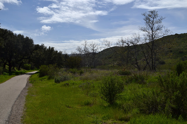
There is no indication of which way to go as the trail runs into a large picnic ground. It does not really matter, either. There are bathrooms, but they are all locked up. The spigot has water, but I have enough for myself still so do not take advantage. Further along is Big Sycamore Canyon Road. Which is paved. I forgot that. There are trails that parallel it on the other side of the creek, but I am not entirely sure how well. Sometimes they do not. Today, I will just go along the road.

As the road passes the trail up Upper Sycamore Canyon, I go for that one instead. It was not my original plan, but it gets me away from the pavement. I get off just soon enough to avoid some traffic. The creek bed is dry here, but not for long. There is one spot where I can watch a fair bit of flow just suddenly vanish into the gravel. Upstream there is a round of vanishing and reappearing. Both seem slower than the lower vanishing act.

There are some minor cascades along the way. As I come to the trail I came in on, I head off left and up the canyon side. At the top, I skip the trail I came in on. There are others I can take. It is still afternoon, although late, so I have plenty of time for a less direct route out.

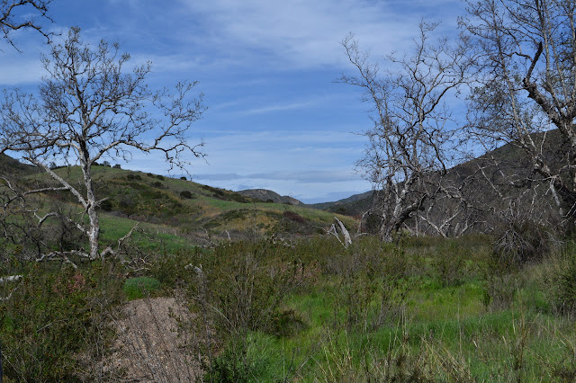
My longer route is not all that much longer and ends up joining back with my route in a little earlier than I had quite meant to. I still have to go down the rather steep hill instead of around it on whatever the horse route is. A large bird slides through the air around me as I cross the meadow. At first, I take it for a hawk, but the shape and the sound are a little off. There is no sound at all even when it maneuvers. It is an owl. It lands among cactus, then decides another spot might be better.

I head back to the car. It is probably time to wave to Boney Mountain.
©2018 Valerie Norton
Posted 11 Apr 2018
Liked this? Interesting? Click the three bars at the top left for the menu to read more or subscribe!


Comments