Pinos: San Emigdio Mesa
Los Padres National Forest
Map link.
DAY 1 | DAY 2 | DAY 3
I woke up well rested on day three. The night was colder than expected from the daytime temperatures, but still much warmer than the night before. Nothing was frozen. I got breakfast and broke camp and almost got out at a reasonable hour. It was feeling a little warm already once I got walking. The bit of trail I missed because I got interested in something off trail turned out to contain a sign with a better idea of how far this trail is, but some funny ideas further on.
 |
|---|
| As with so many other trails, this one was also once a road. |
 |
|---|
| The names have changed to honor the interesting, but here are some destinations. It is 4 miles to Mt. Able Trail (with a road designation 9N25?), 6 miles to Sheep Camp, and 7 miles (a bit shorter than actual) to Mt. Pinos. |
As I traveled the trail back up, its route seemed even crazier. It was reassuring to see my own footprints coming down it so I knew I was on something that would connect with the right canyon and climb.
 |
|---|
| The trail travels near the edge of the sloping mesa. Behind this bit is Cerro Noroeste (Mt. Abel). |
 |
|---|
| A look out over the tree tops of mesa. |
There was nothing difficult about finding the correct canyon to start up. The heat wasn't yet uncomfortable was I got to it and started to climb into the cool higher elevations. From Mesa Spring Camp, there is nearly 3000 feet to climb to the highest point and some of those feet have to be climbed twice.
 |
|---|
| The trees quickly get taller in the canyon and the types seen start to change. |
A bit of extra bird song signaled coming to the short stretch of running water by the meadow. I stopped for a bit for a snack in the meadow to listen to the chatter. Eventually, I continued on my way to the top. I noticed a lot of old trash along this trail. Pull tab cans (with the familiar "do not litter, dispose of properly") and rusted tin cans are common. I also saw a broken, glass 5 gallon jug and picked up the remains of a rubber balloon.
 |
|---|
| Probably spring fed a little further up and vanishes back into the ground a short way down, this bit of flowing water was a welcome sight. |
 |
|---|
| I guess it's shorter in this direction because it's downhill. |
Once at the junction, I turned right toward Pinos to start on the second half of the elevation I needed to gain. As I got near Grouse Mountain, I started to notice some fresh running shoes covering my own prints. Someone had been by.
 |
|---|
| Back to the cairn that marks the use trail up Grouse Mountain but points down the proper trail. |
 |
|---|
| The junction to Sheep Camp and Lily Meadows. I didn't drop down to it a second time although maybe I should have given myself anther day to hang out there. |
A big yellow sign on the side of a tree reminded me that I'd seen a location poster on the way in. I turned to another tree to find it again and as I went to see what the one with the large sign had on it, I noticed a large tube with rocks stacked around it. I'd found boundary post no. 21 for the U.S. Forest Reserve, as the National Forest was known in 1905 when the post was planted. It kind of makes up for not finding the LA/Kern County boundary post on Wednesday.
 |
|---|
| The boundary post, set in 1905, with its location encoded on the side. |
I made my way the rest of the way up Sawmill, finally gaining most the elevation. Then I started down the other side and lost at least 400 feet of it. I finally bumped into people at the saddle, and their cute little bull dog pack animal on a leash. Always good to see responsible dog owners. They said she was only carrying her own blankets. They were headed into Sheep Camp for the weekend. See, I should have planned one more day and joined the party. We mutually complained about bikes on the trail, especially the motor ones, but also the mechanical ones that had left fresh tracks where we were. It would probably help if there wasn't a sign claiming they are allowed on the trail while not mentioning at the Wilderness boundary that they are not allowed any further. I got to climbing the last 500 feet to Pinos.
 |
|---|
| There's that moon again, rising over Mt. Pinos and ready to keep the first half of another night bright. |
I stopped once again at the platform at the top of Mt. Pinos to give the sore feet a little rest and even paint a little. It was nice up there, until I started to pull out the art supplies. A bone chilling breeze started up as I started. I continued on, but my fingers were downright frosty by the finish. As I painted, a couple more backpackers and there terrier came along. This dog wasn't on a leash and although they told her to do a few things, was oblivious to voice commands. To Sheep Camp too? Maybe, they only said "hi" and "here girl" and "oh, there's the trail down there".
 |
|---|
| A bit of the southwest view and Mt. Pinos. |
I decided to hit at least one of the half dozen benchmarks that are on Pinos and don't seem to be on the other peaks. The easiest looks to be the one by the communications site. Two are marked here, but one is probably inside the fence. The other was easy to find and may be on the high point.
 |
|---|
| A USGS benchmark for Mt. Pinos set in 1941 and looking a little beat up. |
After the benchmark, I wandered a few of the spur roads that seemed aimed at other benchmarks. The first on the left goes on past the benchmark (probably) and didn't have obvious paths from those going before. The next, on the right, goes toward a benchmark that is quite low on the mountain, so I wasn't going to try for that one. The second left road pops up to a peak where I found an abandoned slumber bag. A trail heads down from there and may lead to the benchmark, but I didn't take it. As I got back to the road, a bicyclist I'd seen just ride up came zooming down and I zoomed down, much more slowly, after her.
 |
|---|
| A little bit more of the mountain. |
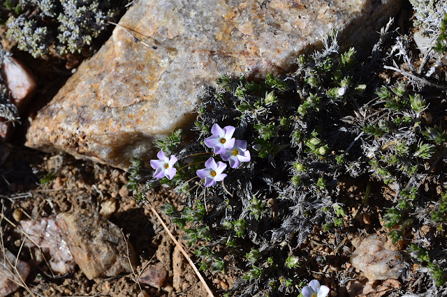 |
|---|
| Most things looked like they were just starting to come up, but there are a few flowers out on the mountain. |
©2013 Valerie Norton
Posted 21 Apr 2013
Liked this? Interesting? Click the three bars at the top left for the menu to read more or subscribe!


Comments