Posts

Showing posts from February, 2020

Beith Creek loop

Image
Arcata Community Forest Click for map. I headed up to the little local bit of Community Forest for some redwoods and to check if, maybe, the Arcata Ridge Trail goes through yet. There's not much signage visible from the road. You just have to get to the right neighborhood corner and find the steps up. It seems I'm picking a time when quite a lot of people are suddenly coming out to be enveloped in the green at the top of those steps. Plenty of information signs at the top of the steps including a map of the paths available here. Maps are also online. No paper maps are provided. I think I'll go up to the top first and come back around clockwise. Up via trail or road? Well, trail of course. The trees are a little closer that way. Annoyingly, the dog leavings are little tufts of mold everywhere. They actually provide bags for dog walkers near the signs, but the use is probably a little less than half. I have seen plenty of people leave it, plenty pick it up, an...

Mad River Fish Hatchery

Image
Blue Lake area Click for map. Continuing up Hatchery Road to the end is the actual fish hatchery. They have river access and public areas to poke around. The sign on the parking lot says it will close at 5:30 PM. I plan on taking the trail up along the edge of the river, but first, fishies! More signs say anyone and any pets that have been in the Mad River may not enter the hatchery area for fear of New Zealand mud snails. Most the pools are dry (ish) and empty, but a couple have fish and labels so you can know just what sort of trout or salmon are swirling around down there. Loads of trout in a pool. The shadow of the mountain has already moved over, so it's rather hard to see them all crowded in there. Past the ponds, they've got picnic tables and river access and a number of people fishing. There's paths wandering all over including around more primitive ponds. One could get in quite a bit of wandering aimlessly here. I decide to stop at the chain althoug...

Mad River Levee

Image
Blue Lake area Click for map. There's not much parking right by the levee, so I parked along the street a block away where there was plenty of room. Also Mad River Brewing across the street. I understand some people really need to know that sort of thing. The levee itself is open to the public along the top and the slope down to the river, according to the sign on the gravel side. There's a space for a missing sign on the paved side that gets a lot more use. Open an hour before sunrise to an hour after sunset as a walking path and river access. And in the future, I should try to notice when that lens hood is out of alignment. The paved side of the levee path, which sees more people. The Mad River. This time of year, it should be much higher. I head down the paved section because that's the way that will get me to the geocaches I'm plotting to find today. There are a few other walkers, but most of the activity today seems to be fishing. They...

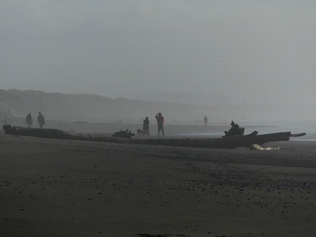
Mad River Beach

Image
Humboldt County Park Click for location. I finally did something about the fact that the dSLR (Nikon D3100) has a number or problems (main lens clouding up in the cold, vibration reduction sometimes becoming vibration creating, odd light metering, probably a number of other small things I've forgotten about) by the purchase of something new. Fixing it is likely to cost just as much since it is a dSLR, even if it was about the cheapest such. I've really never used it in a way that justified having a dSLR, so I have reverted back to a superzoom. It's still a step up from my last superzoom and not just because technology has marched on in the years since I purchased the last one. I went with a Panasonic Lumix FZ300. It can run from 25mm to 600mm (35mm equivalent), which isn't quite as wide as I would like on the wide end. On the other hand, I should be able to judge the correct exposure compensation better because the view finder is fed by a LCD and not a mirror. It...

Bruhel Point

Image
Caltrans vista point Click for location. The unassuming sign for the parking just says "vista point" and points at a block of parking spaces on the side of CA-1, but there's much more than that. Signs beside the parking help to point out how much more. One talks about the small wetland. It was this that drew the interest to purchase the parcel for preservation in the first place. One talks about the ocean preserve off the edge of the cliffs. The oldest illustrates the trails. One is accessible with benches every 100 feet, which is great except that it doesn't really help to see more to go parallel to the cliff. This trail rates a "meh" in my book. The other trail trots right on down to a bench up upon those cliffs looking out over that marine preserve. This one is absolutely brilliant. There are also more trails that are dirt, but as this is a wetland and I haven't got any Wellies, I didn't get very far on the one that loops around to the end ...

Ten Mile Dunes and Inglenook Fen

Image
MacKerricher State Park Click for map. I'm not sure if I'm sneaking into the state park or not because the state consistently fails to mention if a park is free to visit. I tend to assume a state park will cost, but many do not and others only have fees in a few areas. (Hum, maybe I should take note of that. If I have not stated a cost to visit a place, it is because it was free when I went. Most places I go are free.) I cannot find any fees associated with any areas of MacKerricher State Park outside of the campground. There is certainly none from the little parking area at the north end which also accesses the Old Smith Ranch which is part of the Mendocino Land Trust. It's a handy spot to access the Ten Mile Dunes and that's what I'm looking for. I haven't been on dunes for a while. There is also Inglenook Fen, the "only remaining coastal fen in California". What's a fen? It's a peat forming wetland where the water wells up from the ...

Ecological Staircase to the Pygmy Forest

Image
Jug Handle State Natural Preserve Click for map. I noticed an Earthcache that looked interesting as it asks for study of an area with some unusual geology. The marine floor has been uplifted without tilting slowly over time resulting in terraces. Leaching processes slowly change the nature of the soil so that it supports different plant communities as it ages. Up the hill, where it is oldest, the soil is so bad that the forest that grows upon it is severely stunted. There's no fee to stop and see. Brochures for the interpretive trail are available at the trailhead or can be downloaded . It says, "Welcome to the Jug Handle State Natural Reserve. You are standing on one of the most interesting geological areas in the northern hemisphere. Here, time, geological forces and climate have all interacted to form a staircase of distinct plant communities and associated soils, culminating in the unique Pygmy Forest." Alright then. Signs to explain how this bit of land ...

Chamberlain Waterfall Trail

Image
Jackson State Demonstration Forest Click for map. I heard there was a cute little waterfall and decided to go see it. Many of the roads in Jackson State Demonstration Forest are closed this time of year due to the wet, but the one to the waterfall is not. Signs for the various roads come after making a turn to give confirmation, but no direction. My offline OpenStreetMap shows a pair of roads getting where I want. I found a rather nice map at a picnic area showing the roads properly so that I knew which to turn up to get to the waterfall and which would get me to Chamberlain Creek Conservation Camp (AKA "the prison"). Besides the waterfall, the area also boasts some old growth within this working forest. I found the parking area empty of cars so should get to have it all to myself. The only markings for the trail visible from the road is the wooden railing with a "TH" attached to it. Wooden railing is all that marks the trail from the road, but once...