Mad River Levee
Blue Lake area
Click for map.
There's not much parking right by the levee, so I parked along the street a block away where there was plenty of room. Also Mad River Brewing across the street. I understand some people really need to know that sort of thing. The levee itself is open to the public along the top and the slope down to the river, according to the sign on the gravel side. There's a space for a missing sign on the paved side that gets a lot more use.


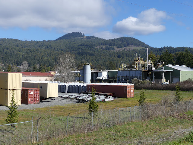
I head down the paved section because that's the way that will get me to the geocaches I'm plotting to find today. There are a few other walkers, but most of the activity today seems to be fishing. They're all along the river, usually in tall waders and standing knee deep in the flow. On the other side, it's a tad bit industrial.
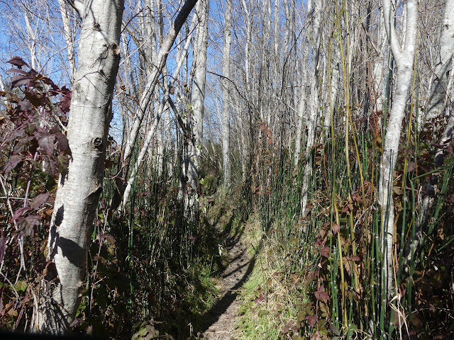
The paving comes to an end. There is a loop trail that heads back into the city streets and along a creek, but a lot more trails snake their way downward into the river flood plain. That's my route. The trail joins road again before leaving it again. It must be public, because there's a few more fishermen who have parked themselves out on the gravel bar in the river via it. It's a little more like an undeveloped park in this area.

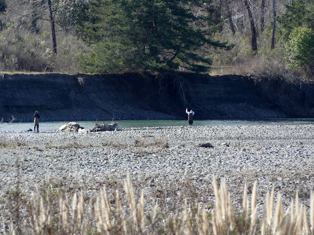
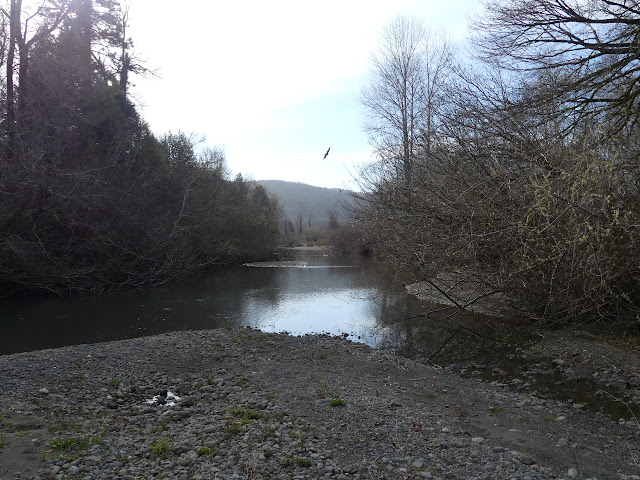
I run out of places to keep going, although there does seem to still be the barest scamper of a trail right beside the water, before turning back. I wander along closer to the river. It seems to have some inlets to get around along the bend. I hadn't noticed them on the more used trail that cuts off the bend. I hadn't seen a few of the fishermen either. Or the Fish and Game fella. With a bucket. Is he stocking the river? Is that cheating for the fishermen? They're only allowed to take the ones with a notch on them showing that they are from the hatchery. I guess that bucket couldn't hold too many salmon anyway.

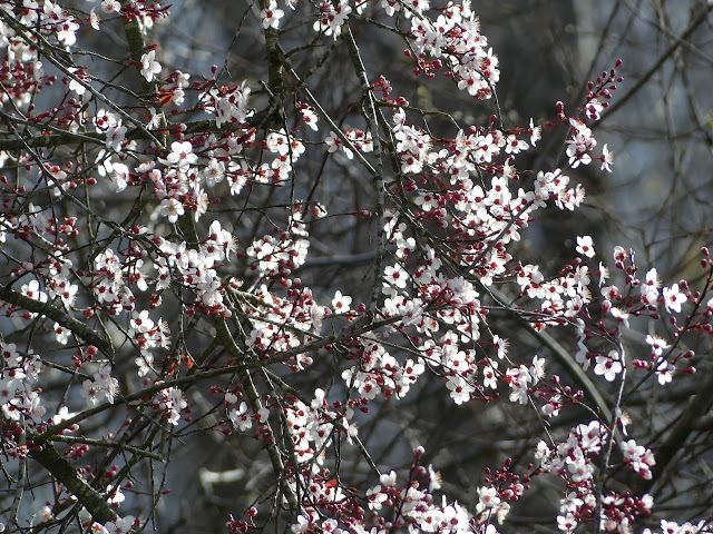
The area is a birding spot in some times of the year, but I just spot a drone. It is hard to miss as it buzzes and hovers directly over my head while I snack by the side of the river. I decide to head over along the other section of levee. It's a little more natural with a backing of cattle grazing and there is immediately a big sign of spring coming.


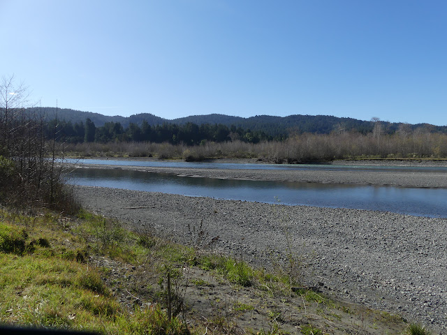
The path sort of ends at a gate. There is a space to walk through and the levee clearly continues, but there is also the remains of a no trespassing sign. I mean, that could still mean on the levee and down to the river is fine. I'm having a pleasant walk, but decide to turn back and explore down a few paths that drop to the river. Here, the river is only a smaller fork that combines down by Hatchery Road.


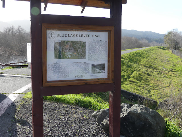
To my surprise, there's a sign on the far side when I get back. I had grumbled to myself about the dreadful people of this world who destroy signs for no good reason. I was totally out of line. There hadn't been any sign yet. The guys putting on the finishing touches have their own grumble that it was 2 years ago they were told to get the kiosk up and they finally can do the sign. There's information on one side marking the loop as the Blue Lake Levee Trail and a watercolor on the other side. Now I know that I'll probably never really see the Blue Lake the place is named for. It was filled from the river before the levee was put in and now only gets filled by rains. Also 65% of the county gets their water from this unusually low river.
I have to admit the levee walk was surprisingly pleasant. I suppose my expectations weren't so high, but it exceeded them easily. Yes, even with the bits of industry.
©2020 Valerie Norton
Written 8 Mar 2020
Liked this? Interesting? Click the three bars at the top left for the menu to read more or subscribe!


Comments