Mad River Fish Hatchery
Blue Lake area
Click for map.
Continuing up Hatchery Road to the end is the actual fish hatchery. They have river access and public areas to poke around. The sign on the parking lot says it will close at 5:30 PM. I plan on taking the trail up along the edge of the river, but first, fishies! More signs say anyone and any pets that have been in the Mad River may not enter the hatchery area for fear of New Zealand mud snails. Most the pools are dry (ish) and empty, but a couple have fish and labels so you can know just what sort of trout or salmon are swirling around down there.

Past the ponds, they've got picnic tables and river access and a number of people fishing. There's paths wandering all over including around more primitive ponds. One could get in quite a bit of wandering aimlessly here. I decide to stop at the chain although I watch someone step right over it.

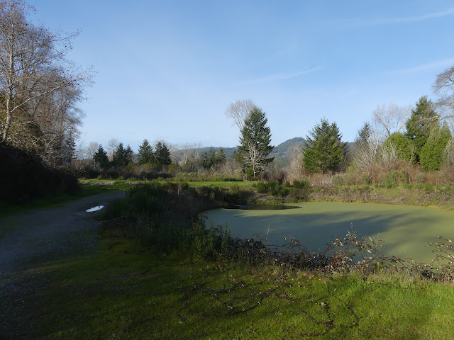
Without too many fish to watch, I was quickly done poking around. There are tours to be had, so I probably didn't get to looking at half of what is available.

Around past the bathrooms is the trail along the river. It is obviously old road and well traveled.

It quickly shrinks, but still shows lots of travel.


The trail is starting to look less used and maybe a little mad when it stops at a stream. I can see the old bridge supports from when it was a road. Even those only still exist on one side. At first, I think the trail has finished, but off to my left, only slightly hidden by vegetation, is a continuation climbing down to the creek and back up the other side.
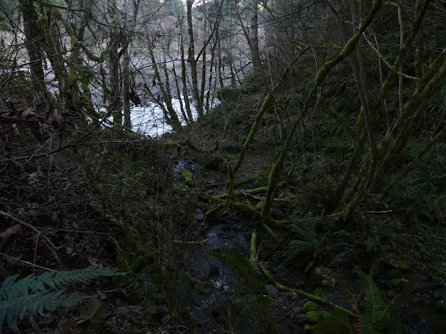
The trail just gets madder and madder. The mad trail along the Mad River. I guess it's fitting? Bits are falling away. It only roughly follows the road. In places, the road has become support for thick dirt and vegetation and the trail is below it. Although I managed to cross the stream, I don't get very far before deciding to turn back. I do have a time deadline since I don't want to be locked in the parking lot.

I head back, marveling at all the little clues that this skinny, failing track was once a full road. It was built of concrete blocks, which seems like something meant to last. Maybe it was something that could be taken up and put down in the next place instead.


I'm back at the lot with 10 minutes to spare. It's really quite full still, considering. There's geocaches up that trail, miles along the river. I'm not sure how. I know they mention having to cross it sometimes. I'm not entirely certain if it is low enough for that quite yet. I didn't even get to the first crossing, although I did get to the first (non-premium) geocache just past the stream. (Didn't find it, but I'm not sure I gave it a proper looking.)
©2020 Valerie Norton
Written 14 Mar 2020
Liked this? Interesting? Click the three bars at the top left for the menu to read more or subscribe!


Comments