Posts

Five and Ten Divide trail work
Image
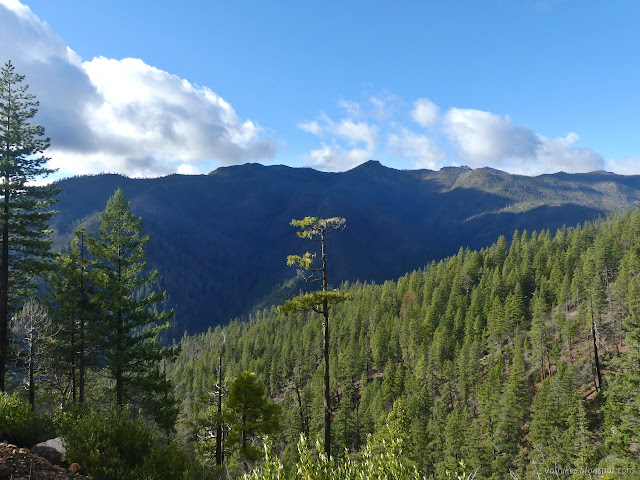
Klamath National Forest (Map link.) It has been a couple years since I actually did some trail work besides kicking the odd log and a lot of sticks off the path. There have been some excursions by the Siskiyou Mountain Club that got far enough south to tempt me, but none had worked out thus far. I noticed they would be working out of Clear Creek for five days and that sounded long enough to make it worth the drive. Is it odd that these California trails are getting a lot of maintenance by people from Oregon? Yep. I also notice that the folks driving out of Ashland are actually a couple miles closer to the trail than I am. I'm coming from another county too. Judging by the license plates on the way, it looks like more people from Oregon are using these areas too. In fact, you can find it covered in guide books for southern Oregon. Thursday The lower (last) parking area at No Mans Trailhead with the traditional burn area hazards signs marking the trailhead itself. The wo...

Winter Backpacking in and around Humboldt

Image
I have only had one single solitary backpacking trip this year and it is not nearly enough. It has me thinking about winter backpacking opportunities in the area. I am specifically thinking about trips that, in a fair weather window, require no special winter equipment, although microspikes might still be a good idea. While you shouldn't need to exercise any special winter skills, the are still important to have. Weather tends to be a bit less predictable and a swollen creek will be more dangerous than one the same size that usually runs high. I'll start with some I have done, one way or another, then move on to trips that are speculation. These do happen to be reasonable summer trips, too. Keep in mind that while a trail may be low enough and not cross large bodies of water, access may still be a problem for potential backpacking areas. Anything over 3000 feet can have snow that sticks around for a while. Storms can bring snow levels down to 1000 feet and less. For elevation c...

Double Janes Creek Loops

Image
Arcata Community Forest (Map link.) I headed off to the Arcata Community Forest to, uh, frolic along the creek. Give or take. For this hike, I started at the entrance off Diamond Drive. This entrance has parking along the street in a break between the houses. A dirt turnout provides a turn around and parking for horse trailers. (You do see horses from time to time in the forest.) The entry from Diamond Drive. Ah, the trees! (Ah, the stumps... it is second growth redwoods.) It is most decidedly mushroom season. I passed the spur to the parking on California Ave., which is not quite so easy to utilize, and looked for trail 10 (Vista Trail, but these names are only on the maps) to cut over to the top of the South Fork Janes Creek Loop Trail. I found it and quickly was reminded that it's a trail worthy of travel just because. It is quite a nice stretch through the forest as it dips down across a stream, then climbs again. A little at the start of trail 10. Trail 10 ...

(South Fork Eel) River Trail

Image
Humboldt Redwoods State Park Click for map in new tab. For a second day among the redwoods, I proposed to wander the gentle loop of Rockefeller Grove and cross Bull Creek in my ripped up old shoes, then put on my good shoes and socks to hike beside the Eel River for as far as I got. (Perhaps I should refer to it throughout as the Wiya't River in a private little campaign against banal river names foist upon already well known bodies of water.) I figured this would be an excellent way to take in the autumnal season. Okay, I was worried it might stay too far up above the side of the river to really see those colorful trees at the edge, but it would be a good hike and I'd probably have it to myself without the bridges put away. The start of a trail over a flat expanse covered in huge trees. I was surprised to find no notes at the kiosk warning that the bridges were gone for the season and held out a little hope that they might still be out for my use. The trail is ...

Five Allens' Trail

Image
Humboldt Redwoods State Park Click for map in new tab. In deciding where I might hike this day, I got a little fixated with Allen's Trail, or perhaps the Five Allens' Trail, as it is marked on the Humboldt Redwoods State Park brochure map . It was meant to be the first hike of the day, but I missed the exit and went somewhere familiar instead. I was expecting to miss the start on the first pass too. Redwood Hikes warns that it is hard to find. I was taking a quick, I'm-actually-driving-a-curving-road-here type, glance at some cascading water when I noticed a small wooden sign that included a big "A" on it. I then, wonder of wonders, actually acted on this impression and pulled into the large turnout that presented itself on the other side of the road. Indeed, the sign beside a small trail said "Allen's Trail". Why the five have been reduced to one, I do not know, but I had managed to find it on the first pass. I very much doubt I would have s...

Addie Johnson and Homestead-Bull Creek Loop

Image
Humboldt Redwoods State Park Click for map in new tab. I want new trails! These aren't exactly new trails, but I did the Homestead Trail in the gathering gloom at the end of a long hike and I did the (other side of the) Bull Creek Trail even longer ago in the gathering gloom at the end of a long hike . Anyway, the promised sunny day was looking good right until I got to the park, where everything was enveloped in thick clouds, so going with the plan of high trails for views didn't seem reasonable. Besides, there was some suggestion while zooming along the freeway that there might be some good fall scenes if I stayed near the running water. I ended up back at the bottom of the Look Prairie Trail, but this time turned to the Homestead Trail. It is marked by a short post. The trail immediately crosses Harper Creek, which was showing no color on its leafy trees. The Addie Johnson Trail crosses at a rather acute angle. It has it's own parking somewhere a little past...

Humboldt Bay South Spit

Image
Table Bluff County Park South Spit Wildlife Area (CDFW) Humboldt Bay National Wildlife Refuge (Map link.) I headed out to the Ocean Ranch Unit of the Eel River Wildlife Area to hike the little bit of old road and levee, making various stops by the waters and looping back along the beach to see what the storms have washed up. That was all very well and good, but as I got there, I saw three diggers hanging out by the ranch and a great big closed sign. It is "closed due to a restoration project until rain and weather shut down operations." I was left with my "rest of the day" plan, which was find things to do on the South Spit. The Ocean Ranch has very little trail, but the spit has even less. My first stop became the parking lot that is the entirety of the Table Bluff County Park that the public may visit. From there, I could check out what was up, at least. The road behind the dunes is blocked for the restoration work. I crossed over to the access road...

Elk River and South Side Trail

Image
Headwaters Forest Reserve (Arcata BLM) (Map link.) I've got the Elk River Trail penciled in for February to try to catch the fetid adderstongue (specifically Scoliopus bigelovii ) in bloom, but by that time the river will be high again and the South Side Trail closed again. To see what it offers, I would have to get out much sooner, so I did. The South Side Trail provides a longer dirt alternative to the paved first mile of the Elk River Trail. Well, unless you are dog walking or bicycling. Neither are allowed on any of the trails south of the Elk River. They're less serious about being a reserve on the north side and allow leashed dogs along with bicycles. Just a little of the information available at the trailhead and the start of a mile of ADA accessible trail. A few feet along, there are signs marking the west end of the South Side Trail. The second is a long explanation for why dogs, no matter how small or leashed, are not allowed on the south side. One hopes i...