Halfway Spring
Humboldt-Toiyabe National Forest
Click for map.
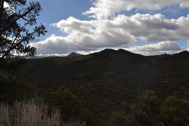
The road around to White River got rather rough in spots, but never too much for a little careful first gear work. The road along White River after a junction turning once more toward the highway was much better. I decided to hike to another spring that was on my map with a road toward it. Finding the road was not so simple. This one has no sign.. I eventually selected a track in roughly the right place and without any markers saying it was not a road. I even took a little time to search for a benchmark that should be nearby, but was unable to find it. There had also seemed to be a road a little west (should be very short and going to a prospect) and a maybe second near a campsite with a toilet to the east. A little more west was an obvious road to the south which runs to various mines and springs.

The road is initially a clear, sandy track between the trees. It looks like something far too long established to not have markers blocking it if it was not meant to exist. Along the way, most of the view is of pinon pines. I do have a landmark, a distinctly cone shaped nearby peak. It should stay about so far to my left while the specific direction to it slowly changes. This is my landmark to judge if I am going in roughly the right direction.

The road abruptly changes to two rough tracks although it is supposed to be much longer. An elk skin that looks distinctly like some hunter's lost trophy sits at the edge of the transformation. I can see where vehicle turned around here, but another continued. The fading tire tracks make it easier to follow the fading road.

The road, or at least the tracks, follows along the bottom of a very shallow wash for a while. Eventually, they start to take a turn and climb a slight hill. Some new mountains toward the north become visible as it climbs. Then it stops. The tire tracks made a few tries to get through the trees ahead, but could not find an opening and turned back.


The spring is nowhere to be seen. I suspect it should be further along, but cannot detect any place that looks the slightest bit more green or denser with vegetation in that direction. None of the detailed maps I printed cover this area and the 120 foot contours really do not have the detail needed. I will just climb the landmark instead and see if it really is a volcano.

The going gets steeper for most of the climb. The footing is very soft resulting in some extra climbing. My instinct says the first peak is false, but go for it anyway. My instinct was spot on, there is another higher peak after a short drop.

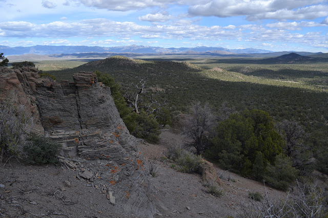
The next peak really is the top. There are some class 2 options, but that is as hard as it gets. The view is superb from the top. It has really cleared up since midday. If predictions hold, the weather has turned and it should be nice for the rest of my time in Nevada.


The direct way back looks find overall, but the immediate route looks a bit tough. Circling a bit south first works better. I pass by outcrops of basalt and walk through a large patch of ash. At some point there is just no mistaking this little peak for anything other than a volcano.

I meander downward, trying to keep my direction between Red Mountain and a little hill next to the road. It is a wide area to hit, so quite easy. There must be a seam of hard rocks along my chosen path because I keep getting into small, rocky canyons. They are just high enough to be hard to get out of when they choke down and have a short drop. I try to drift away from them as I go and am somewhat successful.


My rough navigation pays off well. When I get to the main road, the car is just a few hundred feet off. It is about the same length as from my parking spot to the faint road I started on. With the changed weather (at least I hope) it seems time to go for some of the planned mountain climbing, especially since I saw a nice camp spot up in the approximate area I want to start.
©2017 Valerie Norton
Posted 6 Jun 2017
Liked this? Interesting? Click the three bars at the top left for the menu to read more or subscribe!


Comments