Harris Canyon and Mokomoke Mountains
Humboldt-Toiyabe National Forest
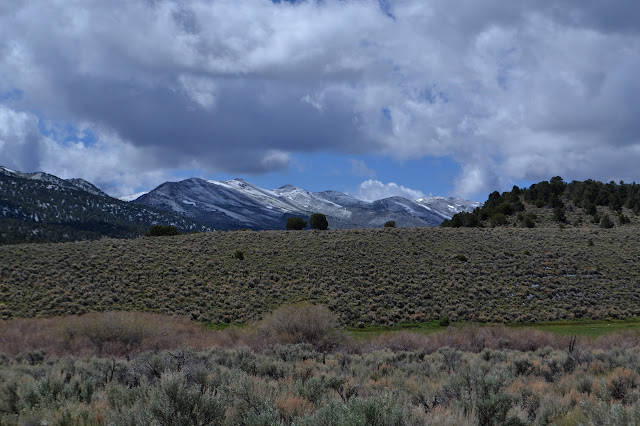
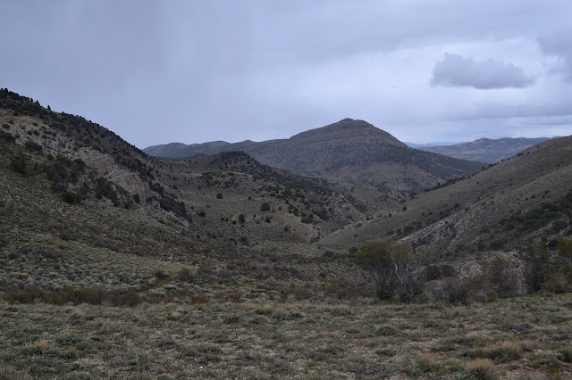
Click for map.It was an extremely windy night full of worry about losing a stake until I realized I already had. As I placed it back and an extra to help and pulled out the never-used ties specifically for holding the tent tight in windy situations, I found it had snowed but the only evidence left was a small drift tucked under one side of the rain fly. By morning, there was snow settled on everything, but it was sunny and it all quickly melted. Looking over to the highpoint of the Shellback Wilderness, it looked like this would be a fine day to go even with the snow of the previous night. Unfortunately, the "light duty" road I wanted to take decays sharply as it crosses the forest boundary where it is marked with a vertical number. This means 4WD. As I pushed on, it seemed simple enough although narrow. Crossing the creek, I came to a nice section of ditches to straddle and had to ask myself if I really wanted to push on down this road for another eight or more miles. Or I could go back less than a quarter of a mile and get started hiking up the dashed line of a jeep trail I had spotted a yesterday and thought could be a good hike. Maybe staying lower would be a good idea. I turned back and found a place to park by the invisible confluence of Cottonwood Creek and Illipah Creek.

This time I do not start off without my raincoat. In fact, I also have a puffy jacket and pants to keep me happy as the weather takes a turn for the worse. I actually expect it to be bad at times over the next two days. This road actually seems better than the other as I start down it. A mine on the right seems to have been used for camping. The creek is flowing well as I hit the first creek crossing. Unexpectedly, there is a rock set just below the ford to help cross it without wet feet. The next crossing also is adjusted to make it easier for the hiker. Someone must hike this from time to time. The third crossing looks to be a bit of a challenge as road and creek are one for a bit, but there is a pony trail along the scree to the side and I go for that.

Between the willows and the roses, there is no opportunity to cross the creek on the far side of the long ford. The trail does continue, so I continue on it looking for a break. Eventually, I am just expecting to have the road come back, but up ahead is a cliff. Finally there is a break in the growth by the creek and I can cross without too much difficulty or shredding of skin. The road crosses right back over, but again with a hiker route.

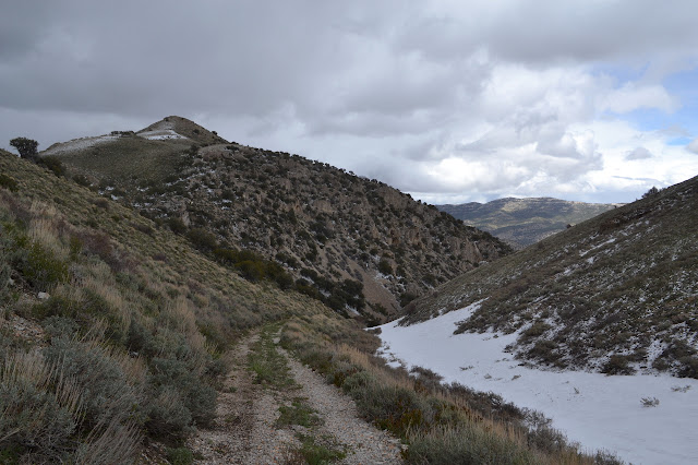
A fence stretches down from the hillside to a cowboy gate, but the gate is rolled to the side so it sits wide open. It is too early for cows, the best time to be anywhere that cows are brought into. The canyon opens up after and eventually there is even a meadow. The road nearly vanishes as it hits that meadow, but I can find it again at the edge. Somewhere along here, I am looking for a spur road that stays by the creek, probably near a junction with another road that heads south. It will cut off an extravagant detour to take the spur and then just bushwhack to the road on the other side. I do wonder why it is just a spur rather than going through.
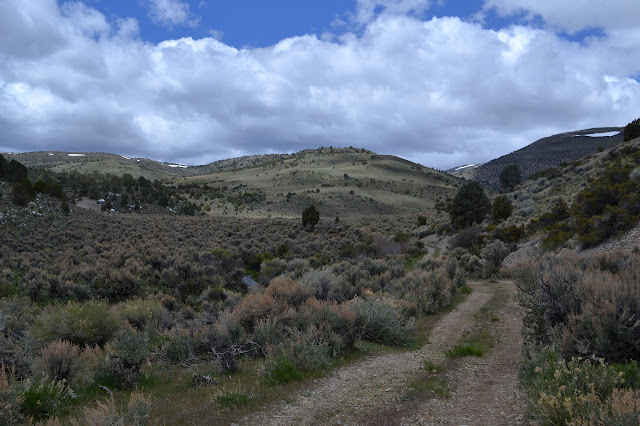


I did not see where it left, but there does seem to be a road heading off from the meadow and up a far hill. I cannot correlate it to anything on the map. I check from time to time that I am going in a generally southwest to west direction. Whatever else goes on, I am where I think I want to be. What is going on seems to be that it is getting really, really cold with a bitter wind. There is not much work to this practically flat grade to keep me warm. It is so bad, I decide to get go for the puffy pants. Working muscles need warmth to work properly. There are two more roads head off to the north although I only expect one. Then, after a distance a bit longer than the spur looks to be, the vegetation starts to encroach on it quite a lot. A little further and there is a spot that is no longer wide enough for a car. Not too much further than that, it stops anyway. A strong hiking trail does continue.

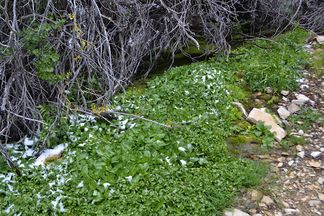
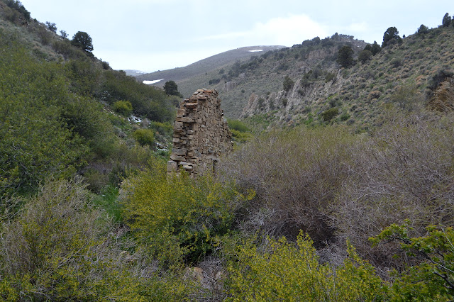
This part of the trail has the only crossing without some rocks or something to get across without getting wet feet. I backtrack for a trail up into the rocks that turns out to come out on the back side of two mysterious walls. They are what is left of a good sized building with the creek running through it. It looks like it was meant to be that way. Spring houses are built over the water to keep cool, but building over a creek has a lot of flood danger. It is an interesting curiosity. The light snow that has been building seems to be stopping again, so I ponder the thing over a snack. Stopping does require putting on my coat.

Crossing the creek is much easier on the other. Collected in the area are some of the sturdiest riveted pipes I have ever seen. The creek shrinks quickly and even vanishes entirely into the rocky soil as I continue up. The canyon here has a serene feel with bright green grass on the narrow, flat bottom. Scattered bones provide contrast. It probably was not very serene when those got here.


The canyon walls drop away and there is road again. From here, I can go up to the area I bypassed by staying near the creek, up onto some gentle hills, or into another narrow canyon, but now the walls are very vertical. These walls even support some caves. I definitely have to go up the slot. That is the continuation of the canyon, anyway.

The canyon is not much wider than the road through it. The pipes are here too. There is a spot where there was a blowout that has nearly a dozen hose clamps holding on a patch and there is a mysterious tower of pipe with a closed top. The road climbs and the canyon opens up again.
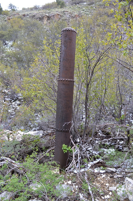


A hawk lands up on a crag above me and squawks a bit. The cry of a hawk can be a bit haunting. There are no junctions as the road climbs. Snow has drifted into the depression beside the road and another piece of heavy pipe works sticks out of the white. As I near the top, it starts to snow again while the wind is still biting.
There is a huge stone structure beside the road. Looking it over, it appears to be some sort of reservoir. These two stone buildings connected by pipes capable of high pressure must all be related. Maybe part of Hamilton's rather expensive water supply, but the thick pipes seem excessive for that. I take some time to look around it and then use it to hide from the wind and snow for more food.

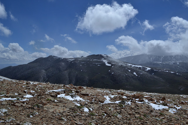
There is a balaclava in my pack I have been meaning to take out. That would have been nice to remember yesterday. Now it really helps for my ears against the wind. The map shows a loop to get back to just above the first stone building. A long one and short one is possible. I want to climb the nearby peak, but I can just do it from Hamilton tomorrow rather than now in the driving snow. It seems a bit much to do anyway, but I will take the loop back.


This road follows beside a fence. The flurry of snow passes by, but the wind keeps going. Wandering along the ridge, hitting the bumps a little too much, I notice a thin track heading off to my left. Eventually, I realize this is probably the short loop rather than evidence of some off-roading. Deep down, I kind of wanted the long one anyway. It gets near another peak that might be the high point of the Mokomoke Mountains as well. It does mean that I turned away from one feeling it was too far only to go further.

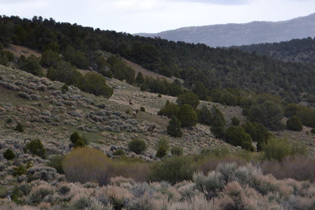
Over one bump, there is a group of wild horses gazing. There are a couple foals in the group. Some older ones are play fighting a little. They are tucked just far enough down the side to be mostly out of the wind. They wander further when they notice me. The wind is an all consuming thing. I start to notice that the vegetation beneath my feet predicts how bad the wind will be. When the sages are no more than a few inches high and nothing else grows, the wind is like a sharp piece of frigid getting deep into me and I am amazed my water has not frozen yet. When the sages are taller and there are even a few small trees, the wind is nearly unnoticeable and the spot is actually just a little bit warm in the sun. This wind now is definitely the prevailing wind that shaped the vegetation.


Over another bump and the horses are back, grazing just about on the road. They seem to take longer to notice me this time, but eventually drop down the hill on the other side.

Some thought entices me to turn back and look. One of the horses is trotting up behind me, prancing and shaking his mane. He turns away as I notice him, but still seems to be a little threatening in his stance. Horses can be mean and spiteful and violent, so I keep watching him.

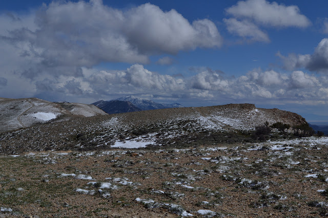
I continue on after he takes off, but check behind me frequently. The road actually goes around a few peaks instead of over. A small cairn marks thin tracks that take off down the hill that get more obvious further down. This is my route back. Keeping on going to the peak, I am racing against the incoming snow fairly certain I will lose. The wind is getting stronger and colder, but still has not frozen my water in the hose. The road splits and I go right. There is another gate, but this one is closed. I have passed through many open ones, this must just be forgotten.

The wind is even fiercer as I climb the last few feet to the peak. It should be an easy walk, but across the wind is one challenge and as I turn into it that is another challenge. The snow has not quite got here as I reach the top. I won after all. I celebrate as quickly as possible trying to take it all in.


I head down quickly. I cut off a little of the curve of the road as it climbs to the crest and then along there on the way up, I cut even more off on the way down. The wind does not seem any less sharp lower on the mountain. I cut off a bit at the junction, too. There is a little worry I could get to the road and miss that it is there, but not too much at it is incorrect. The road is obvious enough once standing on it.

The snow blows through again, but does not take long. There are places along this wide and open valley where the wind barely blows. It is nice, but I still hurry. There is one more road than appears on the map, but looking a little more closely, perhaps there is another one on there. The scale on the west half of Ely Ranger District map is so small. A good number of deer run off ahead as I nearly close the loop.
I had thought to go up along the road again, but it looks so dreadfully long and uphill and that is not what I am doing right now. I head into the canyon with the parallel stone walls and out the other side instead.
As I get to the long creek crossing, I try to look for a route across that will allow less walking on scree, even if it is along a developing trail. There does not seem to be a way, so I have to return to where I crossed before and cross back. The other crossings are as they were as I return to the car to drive into the snow already falling around Illipah Reservoir. It was quite a day, nearly all road hike and yet I had the place all to myself.
©2017 Valerie Norton
Posted 2 Jun 2017
Liked this? Interesting? Click the three bars at the top left for the menu to read more or subscribe!


Comments
I looked a little more into Hamilton's water supply to find this. According to it, water came from Illipah Springs through a 12 inch pipe for 3 miles. I don't see "Illipah Springs" on the map, but I do see a spring marked on the district map and the map of the local wildernesses (and a Waterworks Spring on Google maps) near where the vertical pipe was along Illipah Creek. Just above this was a pair of pools set out for cattle. Such pools are usually spring filled. It would be a little more than three miles to get up to the top and back down to Hamilton, but the pipe is in the range of 12 inches. The first stone building is a bit further down the canyon, but above it the surface water went from good flow to dry implying it is just below some large springs. I think it is likely this really is what is left of the waterworks.
The water supply cost $380,000 at a time when a loaf of bread would have been about a nickle. That's quite expensive.