Agua Tibia: Eagle Crag
Cleveland National Forest

Click for map.
DAY 1 | DAY 2 | DAY 3
It was a mild night and with the sunrise, I can have breakfast in bed. Or actually, make breakfast in bed, but then pack up my gear while the pistachio pudding full of coconut and chia seeds "refrigerates" in the morning chill. My water looks so low. I used 4 of 2.5 liters for the hike up. There is still enough to go up Eagle Crag, and then I will be right back here and can evaluate it again. Perhaps if I can hike it with just the water left over from the second bag of water, then it will be fine, so I set that line and eat my breakfast.


I toss in another bag of water and what I need for day hiking. With my gear and extra water tucked away, I am ready to hike nearby Eagle Crag. I still see none of the poodledog that is supposed to be choking Crosley Saddle. Another write up for the loop seemed to imply the dominant vegetation up here would be manzanita and ribbonwood. I suspect ribbonwood is the one that reminds me of the redshank in the Santa Monica Mountains and it vanished as I climbed. (Ribbonwood is a less common name for redshank, so there you go.) It clearly does not grow this high. No, what is choking the saddle is white thorn ceanothus. A blue and white checked piece of flagging waves beside the gauntlet of its sharpened twigs marking what is obviously Cutca Trail. There is room for me between the points and it thins out as I climb out of the saddle. There were trees up here before the fire, but now they are a morning jungle-gym.

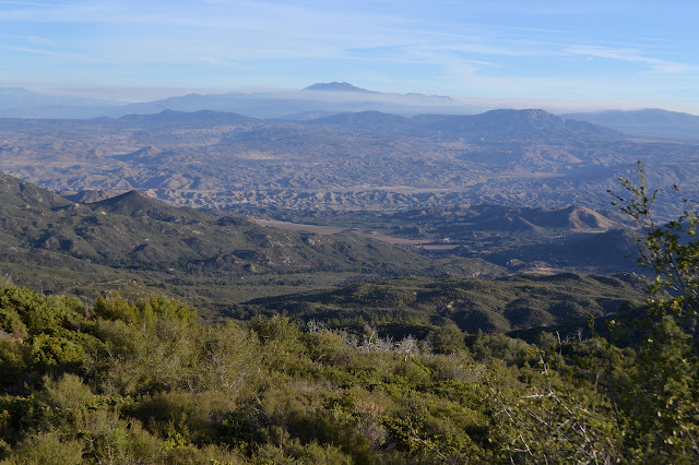
There are trees up here. They show burn scars from the fire, but were healthy enough when it came through to survive or the undergrowth was not so bad here. I have a few easy downed trees to cross, but otherwise the way is clear and easy. It is another old road.

I am looking for a cairn, or at least a bit of trail, heading up a gully. A small cairn set in the middle of the old road brings my attention to a much larger one marking a gully and... no trail. Very definitely no trail up behind it. I wander up a little further before doubling back and seeing where this can take me. The first part is rather rocky and not the sort of thing to hold a trail. Still, there seems to be nothing above either. Too far up, it is a mess of green bark ceanothus. It is a little nicer than the white thorn, but still not something to just power through without tools or a bit of trail. I work to the side that seems to be correct for getting closer to the peak. There are places to work upward, but the green bark keeps making an appearance. No trail markers do. Some animal trails do, but never the way I want to go. It is a wasted effort, wasted energy, wasted water.
I head back down to try again. I am sure the trail should have been coming to a high point when I broke off. It was not. So back to the trail and up I go again. Not far. It is less than a quarter of a mile to another cairn. This one comes with a faint trail and trail marker ribbons, including another of those blue and white checked ones that come up from time to time. This gives me a lot more confidence and I start up it. It is a mild challenge to follow, but there are frequent markers to confirm my tracking.

There is a break in the trail as I come to a number of downed trees. One group of trees did not fare so well in the fire. I seem to be getting into vegetative blockages again as I work my way southwest toward the peak. A little backtracking and trying again just gets me to the same point, so I try a little harder and after a short push, there is a cairn again. Now I am faced with another area that is rumored to be choked with poodledog. I see knee high manzanita, which tends to mean just about any route will work. A little way into the manzanita, there it is. The decaying skeletons of poodledog. It has a strange internal structure that comes on display a year or two after it dies and that is what is here now. It is clear sailing all the way up to the top of Eagle Crag.

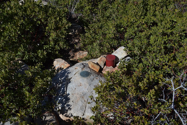
Things seem to not be working out quite as I search the flat top for a register. It does not seem to be there. There is no denying that there are higher peaks just down the ridge a quarter mile. Also no denying that this is where the use trail was heading and this is what the map marks as "Eagle Crag". I give up and go sit among the rocks that are so prominent on the south side of the peak only to find myself next to the register. The crag. Right. And just like that, I am done playing the game of 100! (Well, of peaks done to my own standards, meaning no drive ups. With drive ups, I finished back on Butterfly Peak a couple days ago. Drive ups are not accomplishments.) That is what the Hundred Peaks Section's rather long list of peaks is ostensibly about and this is the 100th peak on the list that I have hiked up. So I lounge among the rocks and put my note in the register so that I can have a little celebration with whoever reads it next since there is no one else here now.

There is no problem retracing my steps back down to the trail and even less problem returning to Crosley Saddle. I kick over the misleading cairns on the way. I usually neither build nor destroy them, but sometimes I must. I did get into the next bag of water for a couple of sips. That is not so bad, though. I ponder the reports that the trail ahead is so thick with vegetation, including around fallen trees to make them especially difficult to pass. It sounded like I would ultimately bounce off it if I tried it. My water is lower than I would have liked, but the level will certainly not get to dire if I go for it. It really is quite a short section of trail, maybe three miles.

In a flash of feeling like it would just be too silly to not even try, I have decided to continue on. Maybe I will not get to pass among those tall trees lower down in the light after all. Magee-Palomar Trail is clearer than Cutca Trail at first, anyway. The same blue and white checked marker tape hangs beside it to mark the obvious trail. It continues to appear infrequently, although I am not certain why. As I climb, it does get worse. I pull on my shirt backwards as the ceanothus gets too tight and it really is much nicer than taking on all the scratches. When I have to crouch, though, it drags in front of me and becomes a nuisance. When I have to crawl, I break down and put it on properly.

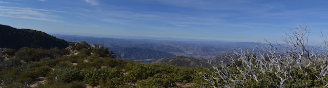
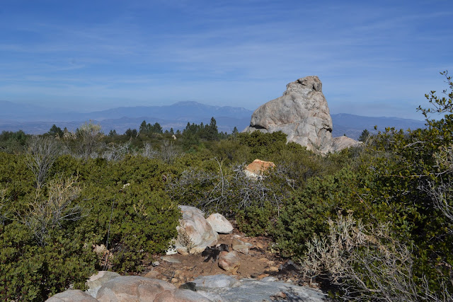
In the heat, the long shirt is uncomfortable at first. Gradually, as I enjoy not having direct sunlight on my arms, it starts to feel better. I can climb over most the trees, but two I have to crawl under. There is nothing that requires me to take off the pack to get through and certainly no "army crawl" necessary. After the first mile, things seem much easier and the trees fewer. It might have something to do with how the trail is out on a south slope. There is a lot of sunlight and I drop into a bit of shade under a coulter pine for a little relief from it, just looking over Eagle Crag and slowly noticing the observatory on Palomar in the distance. Even more slowly, I notice the huge pine cone with its wicked talons stabbing me in the side. Guess I was really ready for a rest and now I am ready to continue on.

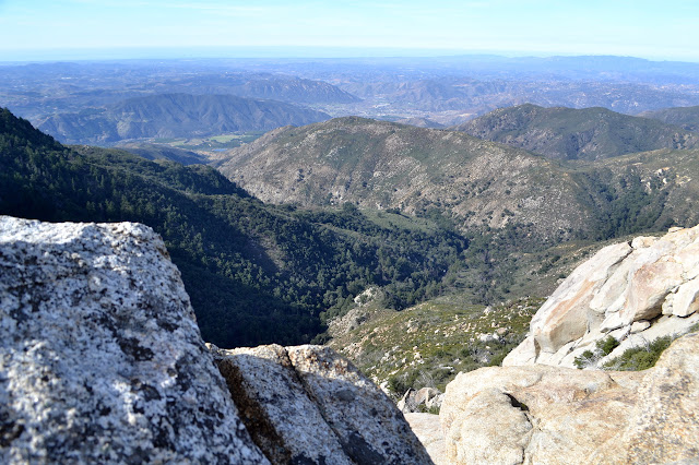
The trail swings back east briefly and it is time to start looking for some rocks that are something like a large, kicked over cairn. It should be near the top of the climb, but not too near. This will mark the route up to the Agua Tibia benchmark. The trail is traveling through thick brush, but right at a spot that feels right, there is a jumbled line of rocks across the side. It does not look like there is a smaller trail there. I step over them, and there is a little room there. I can see at least another step worth of movement and take it. There seems to always be a little more to travel, so I keep going until it opens up and then breaks out into the top. Considering the choking vegetation on the way up, it is quite nice on top. There is even a nice big camp site just before the top.

This one is on the Lower Peaks Committee list and they specify that they class 3 summit block is not required to claim it. I pass over one of the reference benchmarks on the way to what seems to be the tallest rocks, take a moment following its arrow and find myself next to the rock anyway. It has good handholds, so I scramble up for a look around and then down again a little less quickly. A little more poking around and there is a station with a register tucked in beside it, but I cannot find the other reference.


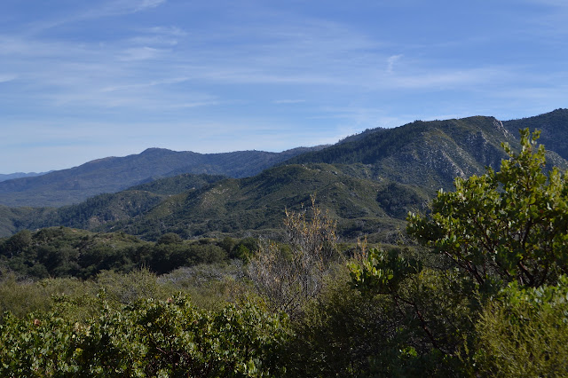
I head down to the trail again and now I have confidence that I will get through. People reporting on their trip up to the peak via Dripping Springs complain about how brushy the trail becomes after the junction, but no one says it is particularly hard. It is brushy and there is a long section of stooping to get through. It does rate complaints, but nothing more.
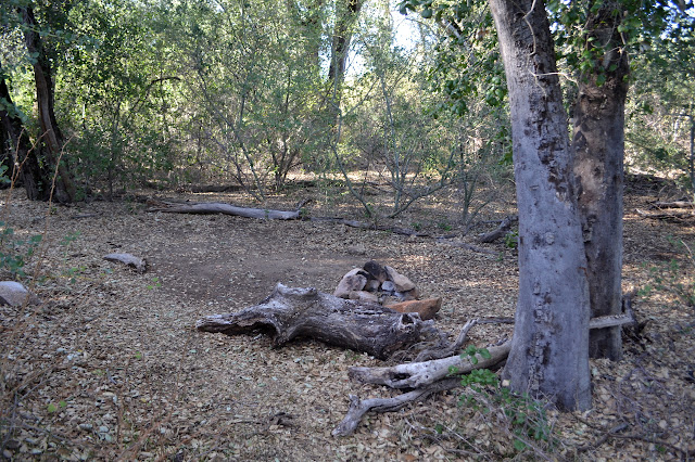
There is nothing at the junction to indicate a junction except the sign. One map I saw shows Palomar-Magee continuing out onto the long, flat ridge, but there is absolutely no indication of it doing so from here. I continue a little further to see if I can find the campsite that is supposed to be here. It is, well, not quite miserable. The big oaks are actually quite nice. But it is not particularly flat anywhere. Someone has built a campfire ring although campfires are always illegal in Cleveland. I am thinking things would have worked out quite well if I had camped a little after dark last night and left those miles to today, then camped at the top of Agua Tibia. It is still mid afternoon. I could just continue down. My legs are tired, the oaks are pleasant, I will stay.

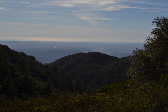
I sit down under the oaks happily. Not five minutes later, there is another backpacker coming up Dripping Springs. He has a pack about the same size as mine, but it has a tent hanging off the back. It could make one spot a bit too tight, but I am sure he will find a way for that brief obstacle. Day hikers come up a bit after and sit down at the junction as the finish of their hike. It bugs me a bit. Not the sounds of their chatter, but that if I had just hiked up toward a saddle, I would be wanting a view of the other side. I pop over to mention that there is one just a little bit further and they are happy to hear it, then a little more listening to the birds in the oaks. Maybe it is not so bad to not know what to do and rest. Realizing I did not really see the sunset yesterday, I head off to the same lookout as they are leaving. It does not have a good place to sit and see, but the hill behind works well.

I neglected to bring my light along, so decide not to wait quite until dark before heading back. I can see the lights coming out to the north as I return before tucking away under the trees where things should stay a little darker.
Continue to the next day ⇒
©2018 Valerie Norton
Posted 15 Feb 2018
Liked this? Interesting? Click the three bars at the top left for the menu to read more or subscribe!


Comments