Posts

Showing posts from August, 2018

Trail Through Time

Image
McInnis Canyons National Conservation Area Click for map. I keep thinking, "Oh, I should do that," as I pass by the exit for the Trail Through Time. It may just be that these lower level areas of Colorado don't hold so much pull for me, but I have actually turned off the interstate at this very exit to take a hike before. Maybe it just feels a little more "built up" than my usual. Today that is changing. Happily, it is not near the 104°F it was when I last hiked the area. Today I will stop by to see the bones. A set of information signs to start off the trail. One illustrates the general area of the McInnis Canyons National Conservation Area and one maps out the trail ahead. The walk into the loop along the road that services the dinosaur bone quarry area is a bit uninspiring, it must be said. Interpretive signs start up quickly with background information about the Jurassic Period and such things that are relevant to the dinosaurs found in th

Loveland Pass to some westerly peaks

Image
Arapaho National Forest Click for map. I may have claimed a few hours before that I would not get to go up any peaks in the Rockies, but there was an accident ahead blocking the tunnel on I-70 and the four lanes that feed the two lanes were turning into a parking lot. I decided to show that I could read and take the alternate route suggested. I wasn't sure I was in good company after watching someone take the sharp corner to exit via the entrance, but so it goes. Once at 10 feet short of 12k on the Continental Divide, it was too much to pass up the chance for an evening stroll. Parking is marked 7AM to 7PM, at least on some of the signs, but I suspect no one will bug me while it is still light. The peaks to the east look quite impressive. (They should. There are a couple 14k peaks over there.) The peaks to the west look a little closer at hand so better with only a couple hours to dark. Loveland Pass got a little crowded with the other folks who could not pass up stoppi

Woodpecker Trail

Image
Coralville Lake Click for map. As I dropped down off the mountains and into Denver, there was just one brief look out over what I knew was there, an infinite seeming plane of grass known as the Great Plains. It was nice to finally find hills again in the west of Iowa. On the way back through, I took a turn for something tucked into those hills: a lake. This particular one is actually a dammed bit of the Iowa River. It has a few clusters of trails and I ended up at the Woodpecker system, a loop with a couple trails across that allow the short loop to become even smaller. A trail segment across a bridge connects it with the Squire Point system, of similar size, and both are shown on the map at the trailhead. The parking is sunny, but the trail plunges quickly into shady forest. The trees are some broad leaved oaks, cottonwoods, and somewhere there are a few walnuts. The thick green hulls and a few shells lie scattered on the ground. Trail heading under shady trees. The sig

Winston Ridge and Peak

Image
Angeles National Forest San Gabriel Mountains National Monument Click for map. My last hike for the day of a Hundred Peaks Section listed peak is out to Winston ridge. I hiked Winston Peak already one afternoon , but had not realized that I was "supposed" to continue on to the ridge beyond. They are a logical pair. Now I go for the ridge and will probably stop by the peak on the way back. First around the side. The road is a single gentle slope down to the saddle where use trails start out to the high point of the ridge beyond the saddle. The Pacific Crest Trail winds and dips and climbs so that it is both longer and steeper. I have been on both and know this, but the thought of taking the road when the trail is available seems wrong. Besides, it should have a bit more shade in the warm day. So, with my water filled up again, I turn down the trail right of the road at the side of the turnout to wind along the trail. Angeles sometimes has these dinky little w

Kratka Ridge

Image
Angeles National Forest San Gabriel Mountains National Monument Click for map. My second little hike of Hundred Peaks Section listed peaks for the day is actually the high point of a ridge. The usual approach for this is from Vista Picnic Area or the old ski resort east of the high point. Not for me, though. I once went exploring up a mystery road just slightly east of the Buckhorn Campground to find use trails climbing both ways on the ridges once at the saddle above. I liked the spot enough to paint it later . I later explored the road further to find myself at the top of Waterman Mountain for the sunset . Today I will explore those ridge routes with a little more idea of where I will end up. First off to the east to grab the ridge high point then off to the west maybe as far as the Waterman benchmark. (This is not quite as far as Waterman where the benchmark reads "Twin".) Something about this gate makes me think this road has been very thoroughly abandoned

Mount Lewis

Image
Angeles National Forest San Gabriel Mountains National Monument Click for map. Speaking of list padding, next up is Mount Lewis. Okay, so apparently it is the high point of the Pleasant View Ridge Wilderness, but it is also a brief jaunt up from the road at Dawson Saddle. Trails from the same area climb south a bit longer and a bit higher to Throop Peak. I was up on Throop once upon a time feeling thankful I threw in an extra dinner ( but that story has already been told ) and not noticing the peaks to the north of it particularly. I made plans for three little hikes to grab three more Hundred Peaks Section listed peaks while I was in the neighborhood and this is the first as determined by being the next one along the road. There is a big turnout and a couple little ones to provide parking near the saddle. The only official trail is near the east end of the big turnout, but there seems to be a second trail heading south nearer to the saddle. The unofficial trail up Mount Le

Vincent's Cabin

Image
Angeles National Forest San Gabriel Mountains National Monument Click for map. I thought I'd spend the night over by Vincent's place. The cabin is supposedly built by a Civil War veteran, so it has some years on it and I will certainly not be staying in it. It is a little way down the Mine Gulch Trail, one of the five trail routes and four road routes to leave Vincent Gap. It is not the hardest to find. That one goes northwest and is a National Recreation Trail, so should get better treatment, but currently has not so much as a sign. The Pacific Crest Trail wanders through from the northeast to the southwest (for the northbound direction) and gets quite a lot of traffic going up Mount Baden-Powell. I ignored that and skirted a permanently locked gate on an old road headed south. A short way down, it is signed for Big Horn Mine along road on the right and Mine Gulch along trail on the left. I hung the left. The right is quite a popular destination and I could hear pe

Pine Mountain, Dawson Peak, Wright Mountain

Image
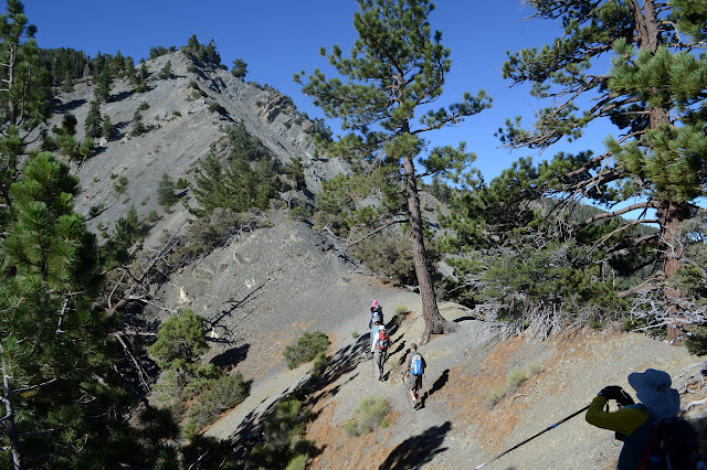
San Bernardino National Forest San Gabriel Mountains National Monument Click for map. I seem to be on some sort of kick to climb a bunch more Hundred Peaks Section listed peaks . I signed up for an official outing to climb three peaks clustered north of Mount San Antonio, better known as Baldy. The section will let anyone come along, free of charge, although they do like to know something about you for the harder hikes so it is best to sign up for something easy first. This one mentions some "loose and exposed Class 2 terrain" as a reason it is "not for beginners", so probably counts as a harder hike. But they know me by now. At some point years ago, I had taken note of Pine Mountain, the North Backbone Trail that crosses it, and the Blue Ridge Road and put them in the list of things I wanted to experience, so an outing doing Pine Mountain and a few others seems like a perfect way to do it. Meeting at the turn to Blue Ridge at 6:30AM to beat the heat a lit

follow by email