Posts

Showing posts from June, 2019

Santa Fe Baldy

Image
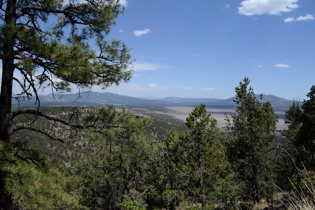
Santa Fe National Forest Click for map. I've been given a short list of unsolicited you-must-go-tos, and one of them is the Pecos Wilderness. Besides, it's about time for another grand peak and New Mexico's 4th highest county high point should qualify. The shortest way there is a 7 mile hike on Winsor Trail, an old supply route, but I have decided to go along the far less practical route via the Skyline Trail for 10 miles. The thing is, I'm not entirely sure how I'm supposed to get to the start of it. It seems to start at the top of the ski runs and the sanctioned approaches seem to be from Aspen Vista or Big Tesuque Campground down the road a bit. It's not an attractive option, but I bet there's ways on the ski runs themselves, so I'm going that way. Right past a sign warning of man made and natural dangers ahead. It's not like there's any skiers coming down and they don't seem to be catering to mountain bikers and Frisbee golfers

La Ventana Arch

Image
El Malpais National Conservation Area Click for map. I find myself rushing north and passing areas that look like they really ought to be explored, but it's already a bit hot out here. Still, I can do some quick sightseeing for a particularly fun feature along the way. The stop has bathrooms, picnic tables, interpretive signs along a paved path, and very little shade. Oh, and the cholla are in bloom. It's been a while since I was trying to get through the dense stands of teddy bear cholla of the Gila Bend Mountains, for instance, so I can stand to see cholla again, especially in bloom. The ones here aren't plastered with flowers like some, but there's still a pretty bloom or two. Meanwhile, high up in the rocks, is the whole point of it all: a massive natural arch. La Ventana Arch as it appears from near the parking lot. It is visible from the road, so can get a lot of viewers. One cholla flower out on this plant, but there's two more getting rea

Quemado Lake

Image
Apache National Forest Click for map. I decided Timmy should get a little stroll out to the lake. I don't want it to be too late in the day because the poor boy seems to start feeling the heat around 70°F with all that fur. It's the same start on Largo Trail #14 as before, and this time I'll get those benchmarks along the way. When the road tops out on a little hill, it'll be time to turn down a use trail and wander toward the lake. Following the road, driveway really. The overlook is above, but we'll not go that far. The little bit of use trail at the top of the tiny hill. Timmy knows benchmarks are boring. He gave it a sniff at least.

Escondido Mountain

Image
Apache National Forest Click for map. What struck my fancy to hike while at Quemado Lake was Escondido Mountain, although I'm not sure how one can get away with calling a 1800 foot prominence peak "hidden" is beyond me. It has no trails up it, so I have to determine my own route. Escondido Trail caught my eye first, but it really doesn't go high up the mountain and it doesn't do it on one of the steeper slopes. The road it starts from looks like a better bet, follow it up as far as it goes then grab the ridge tot the right. The easiest way up, though, looks like a 4WD road that starts further south on the (should be) Scion friendly Baca Road #13D. This one climbs high up to a saddle west of the peak leaving less than a mile of ridge walking to the top. Although it means a couple miles road walking on something I can drive, I think I'll combine the two into a loop. I just have to find parking near the intersection of 13D and 4018J, which is pretty eas

El Caso Lookout

Image
Apache National Forest Click for map. It's probably about time I made it out of Gila National Forest, but I didn't get all that far. I decided to hike up to yet another lookout from Quemado Lake and whatever else might catch my fancy. Hey, lookouts should have grand views. It's nice to be away from burn warnings, although I have spotted a few around looking exactly the same as the Gila ones, right down to the "Gila National Forest" at the bottom. I might be in Apache, but only the oldest signs say so. The area is administered by Gila. And it's smoky. It wasn't smoky yesterday when I sat and wrote, but now my view is grey. I sure hope it clears out by the time I get to the top. The trail starts at the west end of the first unit of El Caso Campground. (This campground is free. The two closer to the lake are pay, but come with much better views.) It is signed Largo Trail #14 and starts off along a pair of ruts that are the driveway for an inholding

Pinon Knob

Image
Gila National Forest Click for map. That bit of southbound Continental Divide Trail still awaits some walking, so that is for today. This bit of trail is, again, in its purest form just about exactly following that great divide. I picked out Pinon Knob as a destination, which should be a little less than 10 miles on the trail and then a short ramble up to stand on the named peak. It's quite a bit lower than the start, but it sticks out a bit so might have some good views. I think I'll go up an unnamed peak 9403 on the way out, too, for the high point of the day. The Forest Service claims I'll be going there anyway but OpenStreetMap thinks I'll more sensibly go around the side of it, but still mostly up it. It'll be another long day. Warnings about the dangers of entering burned areas, but nothing saying the CDT is here except the crest nailed to a tree a little way in. So I start the same direction as northbound, but on the other side of the fence.

Eagle Peak

Image
Gila National Forest Click for map. Eagle Peak stands with a little over 2000 feet prominence and is reachable in a long day hike along ridges via Trail 15. The fact that trail is only called by a number is not the greatest anti-enticement to actually walking it. From what I can see from the trailhead, the forest it goes through experienced devastating crown fire that killed and partly consumed every tree near it. Then, someone went through with chain saws and cut down every obviously dead tree that might fall upon the trail or the nearby fence. It is hard to say which they were trying to save. I've never seen that done for a trail, so probably the fence. The trail is cleared, so at least they were thinking about it. Since Eagle Peak is the tallest thing in the local area, I'm just going to try it anyway. Maybe the next mile gets better. Perhaps I'm letting the end justify the means. The start of Trail 15. It is not the road, although the salvage logging opera

follow by email