John Kerr Peak
Gila National Forest
Click for map.
I decided to stop by where the Continental Divide Trail, in its purest form following just about on top of the Continental Divide, edges right up to the road I happen to be driving north. (It's getting hotter and north is the way to go.) The spot actually comes with a third trail simply designated as #15, so I have plotted three excursions, "north" to John Kerr, "south" to Pinon Knob, and "west" to Eagle Peak. I have some chores for today, pancake mix to produce before I can make breakfast from it for the next two weeks and lentils to boil for suppers over the next couple days, so I'll go for the shortest one. John Kerr is only about 7 miles out while the other two are a little over or a little under 10 miles out. Today I am a northbounder, at least until I leave the trail for the road up the peak.

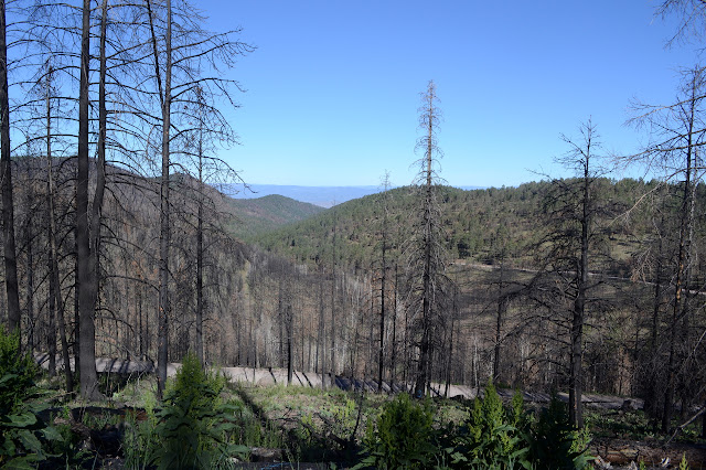
A sign points out Trail 15 by a small parking area, but nothing large marks the CDT. Signs enumerating the hazards of recent burn areas mark southbound and Trail 15. The burn was just a year ago and has absolutely destroyed much of the forest. A small sign warns hikers that there is logging in the area, but the salvage loggers have already finished here. I can hear them working way down in the valley with chainsaws and low geared machinery.
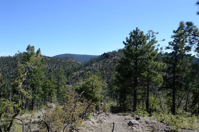
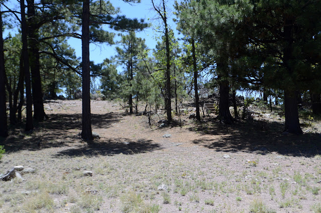
Crests are nailed to the trees to mark the route. Some are a bit melted, but new ones have been put up since the fire. They like the trees that already have blazes for this. There are also a few big cairns, which is funny to see along the side of a road. There is a second sign warning of logging in the area for southbounders on a bit of trail on the other side of a fence. I have missed the spot where the trail left the road. It only takes a little extra energy to put that right. The fire seems to have been everywhere, but affected different parts of the forest differently. All too much was devastating crown fire. Here, the fire was low and the trail is pretty obvious. The recent passage of all those through hiker feet probably help that a lot, but so has some recent trail work. As it annoys me to see a walk-around trail forming for something I can pick up and move, I do a little trail work too.


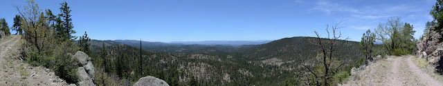
The trail comes around to a ranch gate in the fence anyway, so I wouldn't have been on the wrong side eventually. The grazing allotment is active and there are cows about, so I have to fiddle with it to get through. Trail and divide follow the flat top of a wide ridge. A drop falling here doesn't split into halves going to different oceans, it buries itself and gets sucked out by trees and grass. Toward the end, there is a large herd of elk sitting about with their young until they notice me and take off running down the steep, burned hill. Then there is view out to far peaks, and the crash of things the elk pushed and the high pitched cries of little elk who aren't sure where mom is. They are almost bird like except the cries of alarmed birds, not singing birds. And there are so many. Is this sudden trashing running at every human passing not possibly more dangerous than standing around too long when hunting humans come by? My ears are certain that two standing dead trees have just fallen and one big boulder rolled for minutes down the long hill.
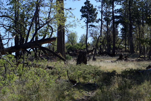
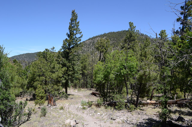
Trail wiggles down through an older burn with many trees down, many cut through, and many more to be done. Coming up through it all are far too many little oak trees. One switchback is on its way to going missing. The crying elk are on a different part of the hill and seem to be calming as they reestablish connections.

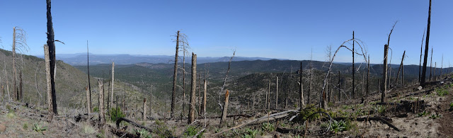
As the landscape gets a little steeper, the trail starts to slide off the divide to one side or the other. Never far and never long, but it means following a bit of creek bed and other things not of the character of a divide. Not that I would want to march up and down these hills. I think I found where the trail crew had lunch. They built in water bars with small logs and large rocks holding down the ends as well as some cairns, but the cairn taller than I am seems a bit much.

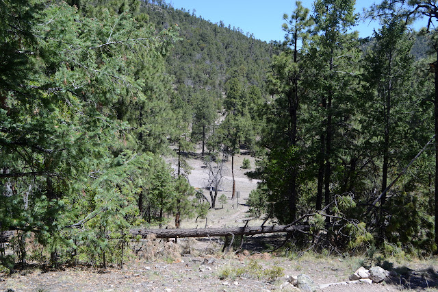
Round another hill and down again to meet road at the lowest point of the trip. The trail at the road has a crest on a stick and another warning sign about entering burned areas. Here, the trail used to turn and follow the road for quite a distance, but now there is trail built. That side has no warning, maybe some part of the forest isn't recently burned. I walk down it a short way, but decide it isn't quite going where I'm going. It'll cross the road a little past the turn for the peak, so I turn to follow the old route.
The trees were blazed along the side of the road. I look closely at a couple of the blazed trees and find nail holes on one above the blaze. There used to be crests here, but they were removed.


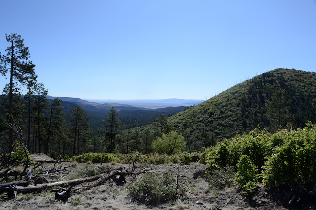
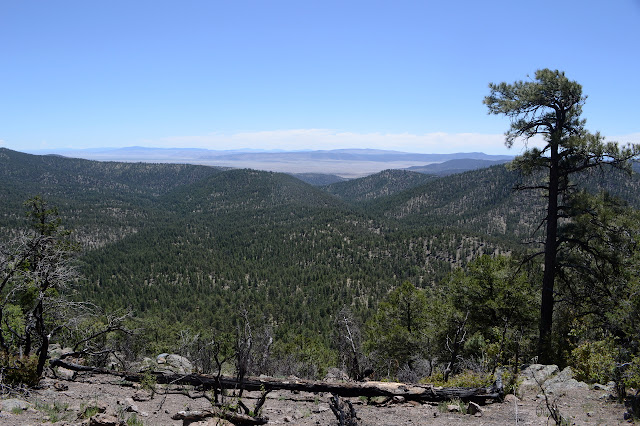
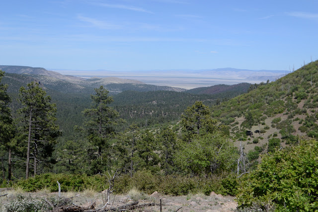
The old 4WD road up to the top of the peak is easy to find and minimally signed, but it doesn't look like it gets much use. A couple deer scamper upward as I come by. I have to duck under branches as I go. A rough spot makes it decidedly requiring high clearance and current obstacles to travel include an elk carcass and a couple rocks on the large side of movable. People have driven over some small trees fallen across it and another might get the same fate eventually. I do nothing to help clear the road. People who have just been resting on their seats can do that. There are some views as the road steadily wraps itself around the mountain upward.

Up at the top, there are four braces for a fire lookout that once adorned the peak. Of course, that explains why there is a road up. Someone has placed a fire ring right in the middle of it. The reference marks point right at the ring. Who would put a fire ring on top of a benchmark? I'm not too keen to try to dig through the ash and nails to find it. I wander along through a low saddle to a shorter peak passing steps that must have once gone up to a cabin and the foundation for a shed, as well as nicer spots folks have decided to put fire rings. There is a good sitting rock with a little view on the smaller peak, so I take advantage of it for a bit of lunch.

Then there is nothing but to return the same way I came. While there were views at the top, the better views were along the road near the top.
At the better road, I ponder going the other way and taking a little more of the CDT. I think not. I'm not out trying to step on as many feet of that trail as I can. So I roll down the road and then the rest is climb. Well, on average. John Kerr is actually lower than the start.


The climb back up is not bad and the trail easy to follow in this direction, too. The trail workers did not play favorites with direction, not that the indicators were really needed. A pleasant day and a pleasant peak and not quite as charred as feared.
©2019 Valerie Norton
Written 29 Jun 2019
Liked this? Interesting? Click the three bars at the top left for the menu to read more or subscribe!


Comments