Whitewater Baldy and Mogollon Baldy
Gila National Forest
Click for map.
I came around to the north side of the Gila Wilderness to get some elevation, including the Catron County high point and the area has a completely different look and feel. I took the road in from Glenwood (trailers dangerous, high clearance recommended) and got quite lucky with it because this road (which is a state highway) that has made some peakbaggers with sturdy 4WD question if they really wanted to go is currently in really good shape. I did stop to question if I really wanted to come this way once through Mogollon and the first four stream fords, but figured as long as they were paved it should be fine. The next one wasn't paved. I decided I could use one of the lower trailheads, but I never even saw the next and the one after had a massive gully between the road and the parking. Still, with only a little chasing elk the size of moose as my greatest difficulty, I got to the most sensible trailhead at Sandy Point which includes a large lot and bathroom. It looks like OpenStreetMap will not be helping me out with slightly better ideas of where the trails go around here. It seems to trace out the trails shown on the Forest Service quad and miss a few of those. Sandy point has a trail going down as well as up and it looks like it has traveled tread, but I can only find it on the Forest Service map. Anyway, my concern is with the trail on the other side of the parking lot. The register has recent entries saying "made it to Hummingbird Saddle" and one from Don't Panic. And they have elk the size of moose! (Disclaimer: It may have been about 30 years since I've seen a moose in person.)
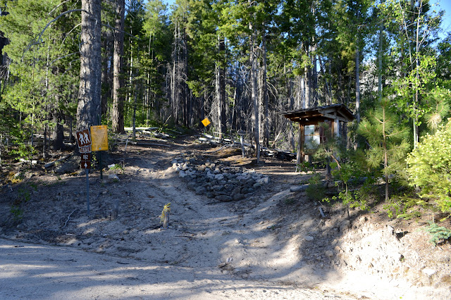
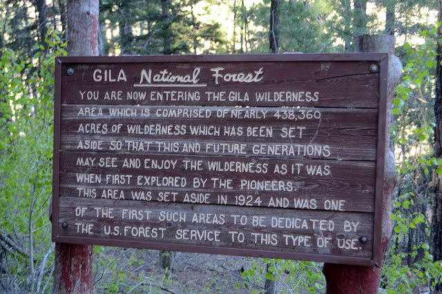
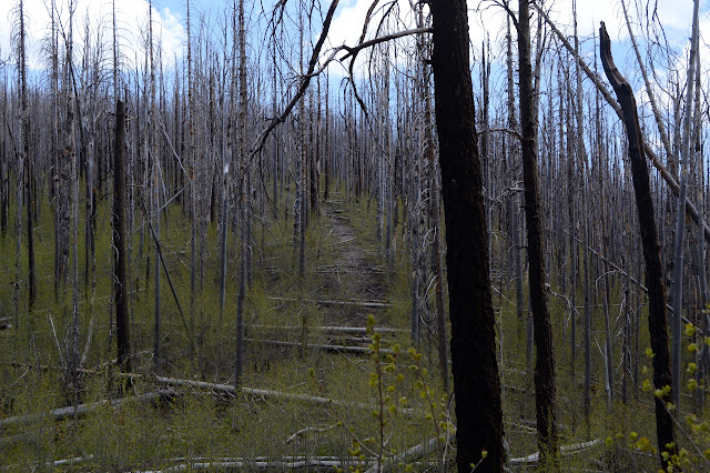
The trail starts off with a lot of signs. There is the usual burned area can be dangerous warning, but also a yellow diamond stating, "Trail not maintained difficult to find" even though it sits among fallen logs with cuts from many different times. Judging by the vehicles in the lot yesterday, the last maintenance that is not done might have been yesterday. Then there is a far more verbose wilderness sign than usual.
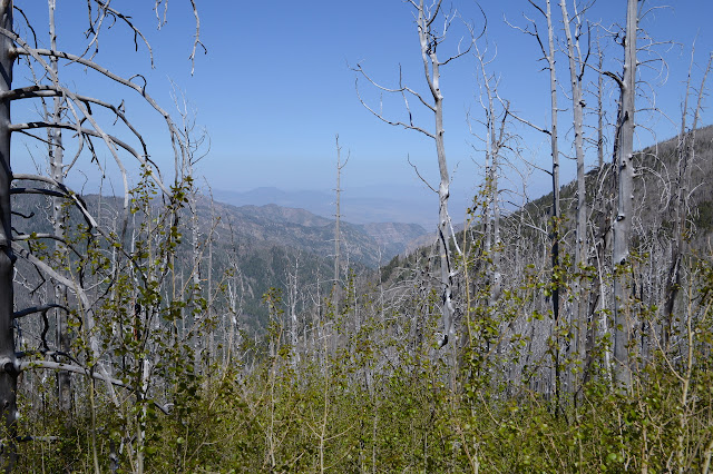
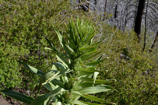
The first bit of forest doesn't look too badly burned, but that changes quickly as I find myself hiking through young aspen growing with only inches between trunks. You'd think that all this coming up from the same root system, it would try not to crowd so much that it crowds even itself significantly. At least it isn't growing in the trail like it was on Sentinel Peak. A long pink ribbon provides another clue that trail maintainers might have been recent rather than imaginary as it says, "brush out 4' - both sides of trail", rather than simply hanging as trail marker. This trail needs no markers, at least not right now.


The wind creates a wailing through the standing dead giving voice to their ghosts. A grassy section reminds me of some burned meadows in Colorado except this one has no logs to jump over and is a little less soggy. A sign below shows where to start to get to Bead Spring, but no trail is apparent to shows the way. It does indicate I am just looking in the wrong place to find the water.

What has caught my eye on the map is Mogollon Baldy, not Whitewater Baldy. It stands out on the map more and must have a good view because someone put a fire lookout on it. It is also 7 miles away as the crow goes when I am already 2 miles into the hike. There must be some lower point to the southwest to start to get to it more easily, but if I am already at Whitewater Baldy, maybe the hike isn't so bad this way. I probably put in enough water to go for it.

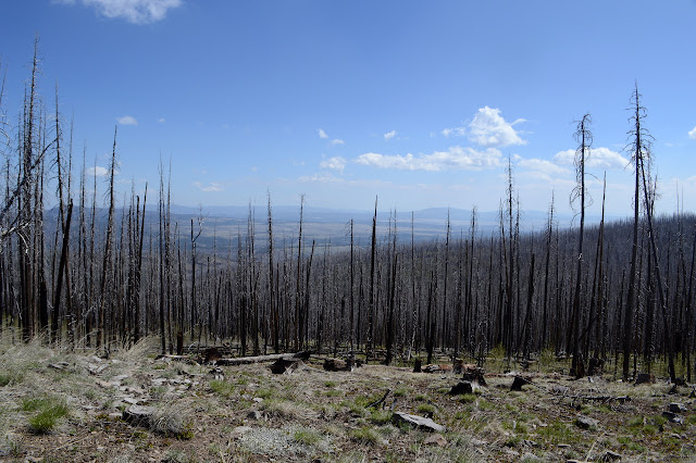
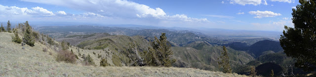
In spite of the various new spaces to find views, the best along the way to Hummingbird Saddle is still a rocky piece of ridge that peakbaggers reporting from before the fire in 2012 noted as a good view.

Hummingbird Saddle is a little island of unburned stuff. That's lucky for a little side project: see if I can find a mystery cache last found before the fire. This one requires information from the signs at the saddle, which all don't even look singed. Whitewater Trail to Hummingbird Spring looks obvious, but I hear it only gets to the spring. The Crest Trail around the mountain, and now 7 miles to Mogollon Baldy as the trail goes, is also obvious. This is my cue to start cross country up the side of the mountain. Now I finally have to start climbing over some trees, but I can pick where I go so there aren't that many. There is initially something like a use trail going up and even some cuts. Below in the trees, there is a cache of something in a blue tarp. Maybe the tools the trail workers were using. Maybe they'll be up to cut away some more trees before I get back. Snow is still here, in a narrow line climbing the north side of the mountain.

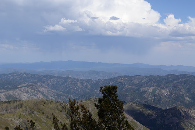
The fallen trees all line up to show which way the wind blows the hardest and that is perpendicular to my travel. Toward the top, an elk is playing hide and seek in the tree trunks before running off somewhere. The top is fairly flat but with a little slope and the peak is marked by a giant cairn with view to the south. The mystery cache also requires me to find a tree photographed among a lush, green forest and determine roughly how far it is from the cairn. I can find a good candidate already fallen, but even the rocks on the ground in the picture seem different now. I go with it. I'm not too invested in this thing as I wanted to come up here anyway.


I have the mountain to myself for a little bit, but then up pops a fellow who says he's been playing hide and seek with an elk all the way up. He has an even bigger camera than mine and has been trying to get a picture. He actually did Willow Mountain on the way and thinks he'll go for the one across the trail from Center Baldy then head back. I looked at Willow and said meh. I am looking at Center Baldy, which at least is named, and say meh. The one across the trail from it is 30 feet higher and has 300 feet prominence and is therefore nameable in the eyes of USGS, he says. USGS also has the shorter peak named Center Baldy. A technical peak. Meh. No, I want the jewel with 1000 feet of prominence and a lookout. I'm going for the big one. I'm going to just go out there and see how far I get before I admit it is time to turn around. It was only 1800 feet climb to get up to here. He points out 1000 feet to get up there and another 1000 on the way back. I say 3000 feet in 24 miles, that's practically flat! (Well, nearly 4000, but I'm obviously not counting.) Then how to get down. The obvious choice from the map is east along a nice slope in line with the fall of the trees, but as I was searching around I found a cairn on the south slope. The south slope looks uncomfortably steep on map and from the big cairn, but from this little cairn a way becomes clear. There are no other cairns to follow, but who needs that much structure? I leave him to his mountain routine and head carefully and slowly down the short and steep south side to the trail below to be greeted by the untouched obstacles that cross it.

The smooth, barkless tree trunks make excellent vaults. Unfortunately, I haven't kept up with my gymnastics and don't have any good technique for getting over them. It isn't long before I have a companion again. I say he's welcome to go around me since I'm a bit of a slow-mo, but he really isn't going that much further. He's trying to sell me on Lists of John until I point out I'm aware of the site. (I gave it a cursory glance once, then decided I already had enough places to log each hike. I already had Peakbagger. Incidentally, the Peakbagger app will log to both to save you the trouble.) We get to the junction with Holt Apache Trail where the Grand Enchantment Trail comes through and it is even flagged. Black Mountain and Sacaton Mountain, two more that caught my attention while looking at the map, are along separate trails down that.

Not far from the junction, we part again, he for his technically-a-peak which many people neglect to notice and me for my jewel no-one-anywhere-would-argue-it's-a-peak which might be too much to handle getting there and back. One thing is sure, he'll hurt less in the morning. I don't have to go far to have that jewel visible, but there is a lot of down until the West Fork Saddle when I can finally start to climb it. I wonder how far it is now. It would have taken the trail more than a mile to circle Whitewater Baldy, so from rejoining it there should be no more than 6 miles to go. Not counting back.


As I go on, there is one extra thing both irrational and irrelevant helping to push me on. Currently my longest hiking day was actually a backpacking day. Not just a backpacking day, but one with a peak to bag off trail, a little rain to deal with, trail that has faded and moved, trail that has vanished completely, and a 5 hour drive I needed to make at the end of it. Surely my longest day should be a day hiking day with the advantages that go with that. This day would beat that day. Besides, I've survived hiking to midnight before, not that that was voluntary. I would really like to get back to Hummingbird Saddle before dark.


There were supposed to be two trails along the way, one up and over Turkey Feather Mountain (could be fun) and the other down West Fork Mogollon Creek (could be stunning) but there was no sign of either as I passed. I'll have to look more closely on the way back.


The trail wraps around to a steep face for a little bit of switchbacks, one passing through a spot with really high humidity among aspen trees. Then it wraps back almost to the top with a little spur leading to the double cabin and lookout. And a much nicer peak than Whitewater Baldy. It may be just over 100 feet shorter, but it sure feels taller. The lookout has a register and I sign the line under Don't Panic. I'll stop following him now as he came from the west and I'm going north. And there's a 1901 benchmark to be my new oldest dated benchmark found. It has clearly been shoved aside to allow a 1934 benchmark to supersede it, but no one carted it off so I get to see it.

I had hoped to turn around at 4, but didn't even quite make it up by then, then I had to enjoy some time at the top. As I start down, one lookout pops out. I can't pass that up, I have questions to ask! Like, what route does she take here? Same one I did. No stock getting up that, I point out really thinking more of their food and gear than them. They can make it. They are both hard women. Nope, definitely no stock although she doesn't know yet that the trail is cleared to Hummingbird Saddle. That was the worst bit, so that's good to hear. And now I have an hour less to get back there before dark and I don't even know what the last mile of trail around the mountain is like.
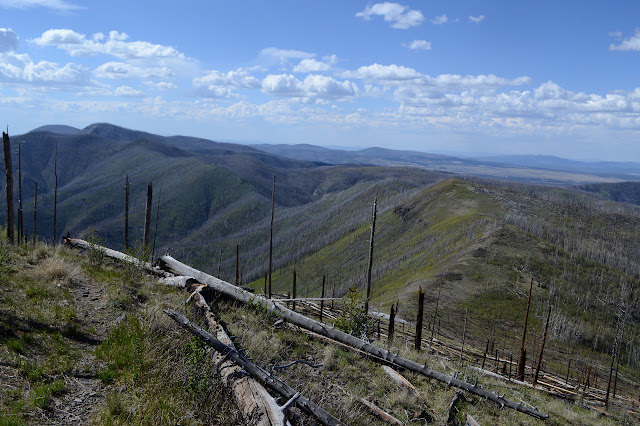
Past the little camp at West Fork Saddle and the complete lack of visible trail junction. Past the spring that is just a puddle in a box and then the much bigger spring. Past a second junction I just can't find a sign of and the flagged junction. The sky is just getting some color as I get to the worst bit I know of, that very first bit of trail leaving Whitewater Baldy. I still live in hope that the tool cache moved and there are fewer trees to jump now than there were in the morning. The trail certainly wastes no time in giving me a huge obstacle to walk around and then plenty to jump. Over and under and around. The little snow stacked narrow and high across the trail feels a little like an added insult. At least the couple of jungle gyms were restricted to the trail I'd already traveled. It gets worse and worse even as it seems to be under green trees sometimes. The trail goes a lot lower around the mountain and is more like 1.5 miles. It is shorter over the top and with all the trees might be easier too. Whitewater Baldy Trail on the map is signed as Iron Creek Trail, so that one can be found. The little track under trees every 5 feet is vanishing, so I'm not sure for how far. I finally scamper around one last tree, a green one I'd seen while checking the signs, only about 10 minutes after dark. So much for hope. Now I just hope no trees have been added to the freshly cleared trail.


I didn't make it before dark, but close enough. I walk on watching a lightning show I can't hear. Off on my right is really going wild, but when I have view tot he left, it is going off too. All without audio. I've actually seen that before at night when the far light is so easy to see but the sound does not travel as far. The really weird thing is that when the light sawn logs show just the right dimensions, I suddenly panic that my cat is sitting there. Timmy has somehow escaped the trailer and walked 4 miles of trail on his own to be sitting there waiting for me. I cannot imagine a more irrational thought, but my brain keeps going there when the logs are just right. There is a little hint of some audio with the light show as I get somewhere near Bead Spring and then suddenly thunder absolutely erupts in front of me. That might be a more irrational thought. It is actually a bunch of elk startled by my light. A few drops of rain fall as I continue, but it waits until the backs of the signs are reflecting back at me to really start to come down. That was kind. Less kind is the way it keeps going while I attempt to cook and finishes as I can hide away to eat. I guess weather should be a mixed bag. In bed by midnight. Actually seeing if I got the right information to find the mystery geocache will have to wait.
©2019 Valerie Norton
Written 19 Jun 2019
Written 19 Jun 2019
Liked this? Interesting? Click the three bars at the top left for the menu to read more or subscribe!


Comments