Flying W Mountain
Las Cruces District BLM
(map link)
I was free! Well, almost. The last hammer blow that the builder felt she couldn't quite do herself had fallen. It had been a little longer than the one, maybe two months expected and I seemed to have been kept quite busy through it all, also not expected. Inspectors came and signed off on it, but I still had a couple days to keep a small farm going while the usual farmer was gone. That is just keeping the ducks, chickens, turkeys, peacocks, cockatiels, parakeets, and guineas all got fed and chicken eggs gathered and a few things watered. The dogs have automatic feeders. This actually does give me plenty of time to do other things. It had gotten way too hot in that extra month, unfortunately. Still, I needed something for May, didn't I? And there lurks Big Hatchet, still to be climbed.
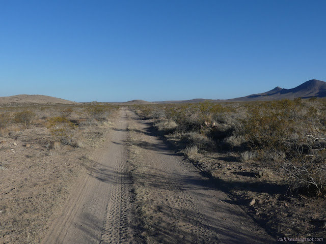
Big Hatchet will continue to lurk for me. Maybe I can get there, maybe I can't. "You've got a short wheel base, that will help." The statements about the road weren't promising. I set my sights on seeing the Cedar Mountains Wilderness Study Area instead. I had an initial plan to go up both Flying W and Cedar Mountains, but decided it's a bit long considering the high for the day will be 87°F (the coolest for the week!) and it's all cross country. I settled on just doing Flying W, which is the high point of the proposed wilderness. Cedar Mountain is both shorter and not actually in the proposed area. The trip reports on Peakbagger included some driving directions with the 2WD parking. I decided to go with the Bureau of Land Management's directions for accessing the area, which were much simpler. From NM-9, turn onto (Luna) County Road 1, park before the private property after just a few miles, hike around the private property. The satellite images seemed to show a good parking spot just past the optimal starting point. I packed up over 7 liters of water and got an early start, just before sunrise, from that good spot on top of a pipeline of some sort.

I started down along the fence thinking how nice it was that they marked the private property until realizing it was too close to the road and extends far too far south for that. I asked Caltopo where to avoid and found my way under the yet-another-range-fence at a gully of a little wash. I struck out on a path well south of the unmarked property line. I quickly came upon the ranging cows which resolved into horses, actually. They trotted off over a saddle between low hills toward the ranch.


I got past the far eastern corner of the private property and didn't have to worry about that anymore when I spotted what looks a lot like more private property. Caltopo indicates there's state land in that area, which generally means land trust. The roads to it probably make just as easy a drive and maybe the shortest hike to get this peak. I wandered northward, then aimed myself at a ridge to the right of a giant gully that would take me on a nice, looping climb up to a benchmark (mentioned by the previous peakbaggers, but not on my map) and then to the high point.
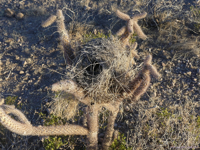


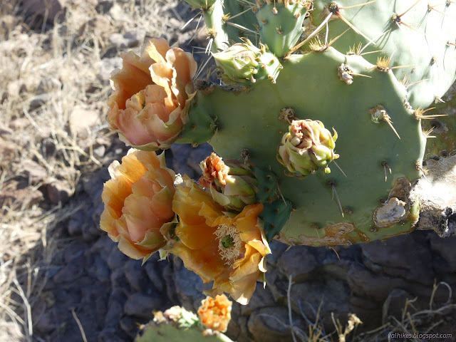
I crossed a mystery road that was only partly on my map. It seems to go from the (maybe) state land to the ranch and get used often enough to have tire tracks. Someone must know about it because the WSA boundary follows it at a short distance. I crossed into it at a bit less than the two miles BLM said and kept on aiming at the ridge. My path wasn't too straight as I was also checking cactuses for blooms. They were budding during my last hike, oh so long ago, so I was hoping for flowers now.


The slope didn't look too bad. It is steep in some spots but held together well. I could zig-zag or just climb as I liked.

It's an easy walk after the initial climbing as the views just open up.


I didn't find the benchmark at first, but doubted the peakbaggers before me would refer to a cairn as such. Some of them are, but it's very hard to tell if it's the same one that was placed in 1862 or whatever. Then I found it. Perhaps it doesn't deserve to be on current maps.

Then I moved on to the high point where I found three bottles, two of which were stuffed full of name patches. Some folks had tried to use it as a register. Likely one of them was originally brought up to be that. It wasn't really working. I thought about transferring the ones in the register to the new larger bottle so the register could be used, then decided to let it be. These folks using it for, what, a right of passage at one of the nearby bases? Boarder Patrol unit? were clearly the most frequent visitors. I do wonder why Flying W struck their fancy. It doesn't seem to be particularly near any of those. I think.


From the very start, I kept wanting to actually do the whole original plan, but had to admit that I was going in the wrong direction if I was really going to. This direction put the sun in my face at the start and left me trudging against the expected stiff wind for the afternoon. It would definitely be easier in the other direction. I would at least take a different way down and aimed myself at Rock Hole Canyon. It meant a little further on the rolling, flattened ridge, then a steep hill and a long way in the canyon.

I got down the hill carefully, but the footing was quite good in spite of the steepness. The bottom didn't quite seem like a rock hole. Not really. There were trails for me to follow along the side of the wash, probably left by cattle or the horses. It was pretty easy travel, plus I was a little out of the wind. It was blowing strongly from the west as expected.

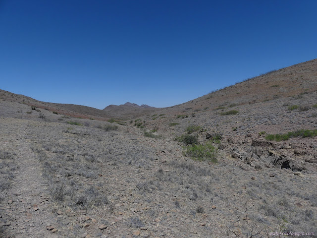


I came to a large flat area where many other smaller canyons collected into Rock Hole. It turned south and out of the hills and, well, things got flat. So much area is drained and yet it doesn't leave much of a wash?


I didn't turn with Rock Hole. I picked a ridge between two washes and started to climb toward Old Baldy instead. It would be an easy one. Hat Top looked like it would only be easy if approached correctly. Cedar looked easy too. So what if it was the wrong direction. I wanted to go!


With Old Baldy just a short climb away, I sat myself down under a large juniper out of the heat and the wind and faced the fact that I'd never get to Cedar Mountain if I went up Old Baldy and Hat Top Mountain. They really weren't much as mountains go. I could skip them easily. I figured out what my route should be, then kept on sitting there. I thought about how I'd been going slow since mile 4, which really isn't that far into a 16 miles on paper hike to be going slow. It's always longer than it looks on paper. I sat until I came to my senses and decided to turn myself around and head back out Rock Hole Canyon after all. I didn't even go the short way up Old Baldy sitting right there in front of me. Perhaps I should have, it being far enough from Flying W Mountain to give a bit of a different perspective. I would be hurting enough in the morning, but would it really add to it? I didn't let it. I did go down a canyon instead of the ridge for that little bit of a change of scenery.

Then I followed Rock Hole Canyon out until it started to get hard to follow. Really, how does it do that? Anyway, I wanted to go up and over that saddle over there. I started heading toward it, then realizing that I was getting too close to the ranch property and turned back to follow more like I had come in. Then I got to thinking that it really wasn't too close and tried again, only to be told my sense of direction really was off a bit and I was practically headed directly for the ranch itself. I relented and followed up the hill from where I'd been. My route cut much closer to the private property than before, but still missed it, at least according to Caltopo. There was still no indication on the ground of it.

And boy was it ever hot. There's no trees on the flats. There's not many in the mountains, either, such as they are. I sucked away at my fourth liter as I trudged around the imaginary lines and back to the car. I scrambled under the range fence once more, just dropping everything on the other side and skootching on my belly where there isn't too much vegetation. I wasn't going to go all the way down to the wash again. Truth be told, I'd gotten both used to and very tired of range fences. I was sure glad the air conditioner still worked as I headed back. (So does the new battery.)
*photo album*
©2022 Valerie Norton
Written 14 Jun 2022
Liked this? Interesting? Click the three bars at the top left for the menu to read more or subscribe!


Comments