Nickerson Ranch
Jedediah Smith Redwoods State Park
Click for map.We are heading for the coast and thus I am back to see some big trees in the form of coastal redwoods. There is very little parking at the Nickerson Ranch Trailhead, but we find a spot to tuck in by the side. It is practically just across the road from the large parking area for the Boy Scout Tree Trail that I hiked in February, so that is a possible parking area. Although so close, this is a little different. For starters, I cannot hear the city and we will not be hiking down toward it. The season is now dry and the potholes that somehow formed in the dirt road have vanished. Now everything around it is a uniform tan color matching the dry dirt.

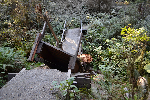
Our immediate quest is to make it out of the land of dust that rises high into the trees and coats the ferns. It is made somewhat difficult by finding that a bridge has been built just a few feet in to cross a creek and it has itself been crossed in the middle by a small tree. Well, it is at least small for the area at nearly a foot in diameter. It has smashed the bridge down into the small creek below leaving steep ends to navigate. I select a route along side trail and tree to get over the mess. Martha uses even more side trail to make her way.
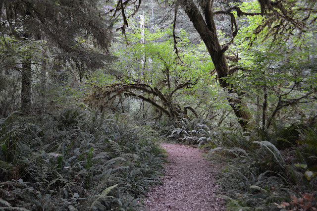
After that obstacle, everything becomes very easy. First, we get a bench with dedications on it to rest up from our ordeal. Next we get rather flat, wide trail through the trees. All the while, the dust coating is thinning out so that the forest turns from tan to green.


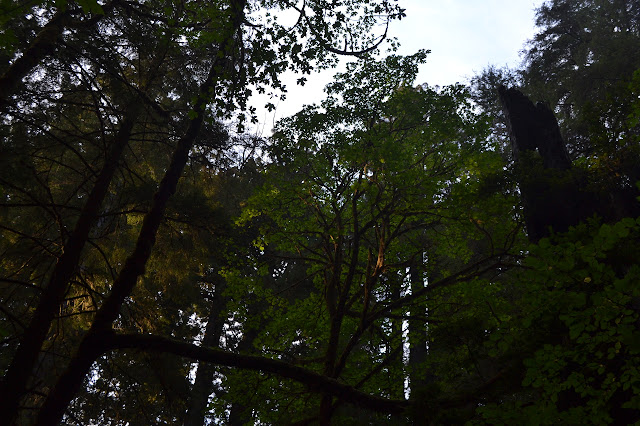
The old forest is nice and open and there definitely are a few big trees along the way. We try not to look up constantly, though. We would keep tripping if we did that. There are interesting details to be had closer at hand. Some trees have mushroom and one with blobs all over it interests me. Touching one is startling. They look like sap, but are a liquid with such low viscosity that I almost cannot feel it when in contact.


We get to a junction. My map certainly shows nothing like that, just trail looping out and back around. The trail sign at the start gave some hint. We continue outward on Nickerson Ranch to see what it gets to. It is not that long. I am in the lead as the trail thins to a few inches and starts steeply down the creek bank, and I am sure I missed a turn. Going back, there is no turn. The trail gets to a cut log way too big for the average saw someone might be carrying, then just dwindles down to an obvious use trail. We follow it down to the creek, where it splits and generally hangs out by a good watering hole.

The map seems to indicate the ranch was on the far side. There does seem to be a little trail on the other side, but not for going anywhere, just from creek play. There are some old pictures online of the ranch, including an access bridge that might have been just downstream and the Nickersons, but I have no idea what might be there now. We will not be finding out today, either, as we turn back to take the other trail back.

The redwoods thin out near the creek. The trail gets narrower going this way, too. We follow it faithfully though it requires some hopping over downed trees and pushing aside the brush, and come out with bigger trail beside a better used water hole. It is becoming clear what this trail is mostly used for: cooling off in the creek.


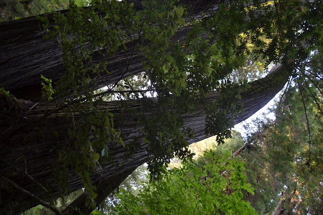
After the swimming hole, the trail is wide and easy again. This means we can get back to looking up with instances of looking around so we do not trip.


There has been some destruction along the trail. A large tree has fallen into the creek and taken a big wad of dirt out of the trail. This part of trail without a bridge seems to be bouncing back a bit better. We continue on, finding a couple more benches.


Gradually, the vegetation seems to take on something that is not exactly a pallor, but certainly a change in color in that direction. A couple more turns and we are at the road again. This side has mileage sign and a couple parking spaces. We turn to walk the dusty road back to the other trailhead. Happily, no cars come by as we do so.
©2017 Valerie Norton
Posted 7 September 2017
Liked this? Interesting? Click the three bars at the top left for the menu to read more or subscribe!


Comments