North to South: Le Conte Canyon and Dusy Basin
Kings Canyon National Park
Click for map.
DAY 1 | DAY 2 | DAY 3 | DAY 4 | DAY 5 | DAY 6 | DAY 7
The rain stopped halfway through the night, and, eventually, so did the dripping through the ceiling. My bag and myself even dried out a little and certainly managed to get a bit more comfortable. It is a testament to just how bad my sleep has been that this probably was the best so far. My fellow soggy hikers have a weather report for the next few days that is uninspiring and seems to lack sun for today. They head off anyway, but I take a long while to get collected again. The appearance of the sun changes things. I quicken up to try not to miss more minutes of bright sunshiny day only to stumble over the lack of any fuel for my stove. I can remember remembering to grab it and stuff it in and taking it out and setting it by the bear canister in the night, but now it is nowhere to be found. Cold breakfast it is. Creatine really does not dissolve well in cold water, but such is life. After wasting way too much sunlight, I am packed up and ready to repeat the last half mile of yesterday and get down to Helen Lake once more.

Stopping by my abandoned campsite, there is a little bottle of fuel exactly where I put it after supper except it is now on its side. What a dreadful bit of litter that would be. Packed away where it is supposed to be, I am assured of hot meals in the near future. Crossing a creek on the snow, an older path has failed and there is a deep hole right to the water along it. I step carefully as I go. The next crossing is pouring out of the icy lake and crossing the trail, somehow obvious under the flow, swiftly. Cold feet are in my more immediate future.

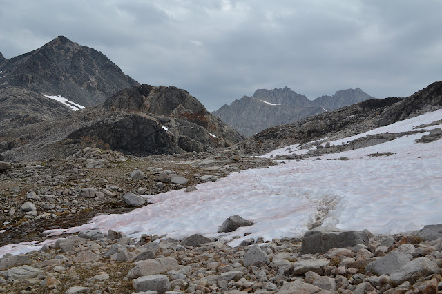
The pain starts immediately as I step into the ice water. The flow is swift enough to require care for everything except that pain, and this is just the first, highest crossing. It feels like little ice crystals are forming in my skin as I step out. Perhaps neoprene socks are not required, but they sure are nice. Wish I brought mine. Heading down some more, there is quite a lot of snow walking on ephemeral but well established tracks. They weave over the river flowing along an uncertain path underneath. One guy coming up says to "just follow the lemming path." There is something a little too on-the-nose about his statement. We keep following these paths expecting them to hold simply because others have managed it before us. We keep jumping into these crossings expecting to get to the other side simply because we do not see any signs of bad outcomes so far.


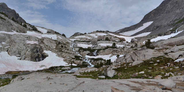
It certainly is pretty to come down Le Conte Canyon with its string of lakes and waterfalls filling them.


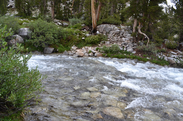
Although the river is still growing, there are still a couple of crossings. The people coming up warn me that although many are taking a snow bridge over the next one above the next lake, it is starting to look like it is ready to drop someone through. The water has been getting distinctly warmer with each lower crossing. What a difference a little potential energy converted into kinetic energy and then heat makes. I give the snow bridge little notice as I investigate the crossing. At some point the rocks were set out like a road along the trail under the water with tall ones lining each side. The water is swift, but stepping along the stones at the side keeps me out of most of it. The crossing is long and my feet hurt from the cold by the end of it even if it is no longer at the edge of freezing.

The following crossing is something else, but people are coming the other way, it must be possible. Lemmings. We really are lemmings. At least a few of them actually took a different crossing nearer to the lake, but it is unclear from my perspective where or how they navigate the other side of the river for the quarter mile or so. I lean heavily on my poles as I cross, becoming a four legged creature and never moving more than one at a time as I go. Once across, I am very certain that whatever comes up ahead, I will not be going back across that.
Happily, it is the last of the river crossings. From here, I can just wander down the canyon gawking at the waterfalls and meadows.


Oh, and there are the avalanche remains. I can gawk at that too. There really is a lot of evidence of recent avalanches as I get lower in the canyon. It is hard to avoid bits of broken tree in photographs, but they certainly are not pretty.


A bit of flat and a drop over and over again, the trail descends. The trees change and thicken and as they are thick enough to provide good shelter from it, the rain begins lightly.


Finally coming to a junction, it is time to leave the PCT, but first I head the other way to check out the Le Conte Ranger Station. This one looks like a fancy, modern take on a log cabin. It seems to be occupied by a ranger and a couple of hikers with many things scattered about to dry. The tent on the line in the rain is just getting soggier, but the stuff on the large covered porch may be getting better. My curiosity about what sort of station is out here, I head up the other way to the tune of a couple distant rumbles as the light rain continues.


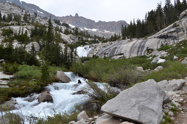
Although the river crossings are done, there are still a few spots to wet my feet again. The map shows two crossings of the creek out of Dusy Basin, just above a tributary that significantly increases its size to the torrent sheeting down the amazing rock face below. The lower is actually two crossings, and the second part is another delightful over the knee and swift crossing obscured by white water. It becomes even more delightful as I commit my weight to a foot and find I was not sufficiently careful in placing it. The rock under it starts to roll, bringing my mind suddenly and sharply to the subject of balance. Slowly and carefully, I regain a spot for my other foot and retreat from the rolling rock before more carefully progressing across.

The upper crossing fills me with dread as I approach. The waters are combined for it and the lines on the map are so close to each other, it is clearly not a place to ever put a crossing. The switchbacks shorten as I get higher, staying by the water and getting pushed in by a cliff above. I start to plot cross country routes that do not involve the first crossing so will not require the second crossing. It looks reasonable enough on the other side as I climb. The deer I end up sort of chasing upward probably thinks it would be better if I was over there, too.

It may be getting heavily misted by the cascading water beside it, but the bridge across the creek is a very nice sight to see just as my dread reaches a crescendo.

It is a little more climbing to get to the next bench above and a good place to be looking for a campsite.


As the trail flattens out, it starts to braid. All the pieces seem to get to the same place, so it just creates options. Lakes and puddles dot the place. Mosquitoes are a little less than on the small bench below, but still a bit more than desirable.


The terrain above looks likely to have a campsite and I go wandering upward to find it. There is a nice spot, well off the trail and tucked beside a tree. Eating my (hot, oh happy evening) supper, others pass by below, apparently not noticing me and my camp. It is good, except my DEET seems to have run out already and my head net did not get included. My larger net for sleeping under did, so I just have to sort it into a head net that I can even eat under.
Continue reading day 7 ⇒
©2017 Valerie Norton
Posted 29 August 2017
Liked this? Interesting? Click the three bars at the top left for the menu to read more or subscribe!


Comments