Lava Cast Forest
Newberry National Volcanic Monument
Deschutes National Forest
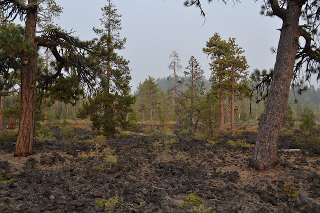
Click for map.After driving down the road most of the day, it was time to stop by something interesting. Unfortunately, it was also very smoky from nearby fires. It did get better as we got higher, but those distant fires were still feeling a little too close. It is good gravel road that only sometimes turns into a washboard all the way up to the lot, which requires a fee of those without a pass. The first part is wide and handicapped accessible. We head out on the paved route into the smoke.

We wander for a short bit past trees living upon the lava flow. Perhaps it is an older flow than the 6-7 thousand year old one we are looking for, but the change is not obvious as the forest opens up. There are interesting details to the lava, but there still are no tree casts.
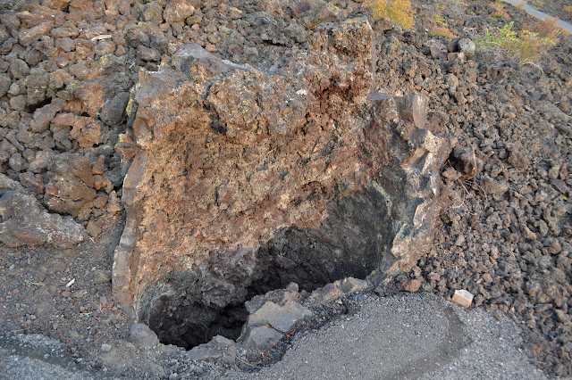
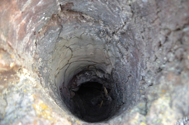
A sign points out that the casts are more accurately called molds, then goes on to the more interesting information that the roots of these trees can still be found in the dirt below the lava flow. Nearby, there is a hole in the lava that goes down quite far. Once we have an idea what to look for, there are a few others around to see.

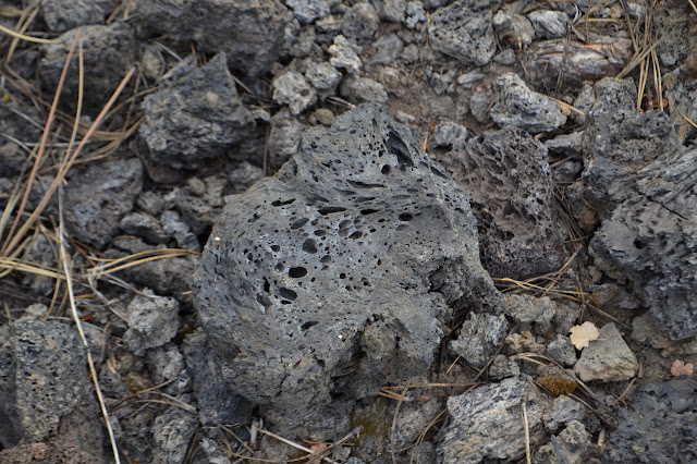
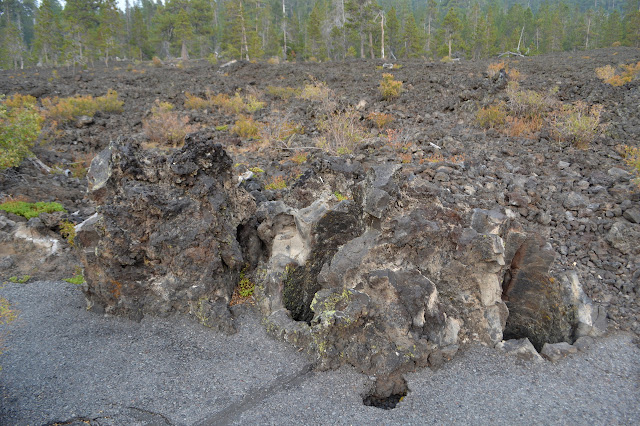
The first molds show some distinctive characteristics. Lava come in from one side and stacked up higher against the tree than it did flowing across the ground. The inside is extremely rough, much more than one would expect bark to be, but a perfect process conforming to the outside surface of the tree would be unexpected. The top edge is suddenly smooth and a few rocks have gotten in so that we cannot see down to the ground below and perhaps the roots. They will not get to explaining these details until the very last sign. The top has broken off and the pieces below are very likely the broken rock. Visitors, who tend to think that rock is solid and unchanging, at least on the order of their own lives and certainly on the order of their own visit, have a tendency to climb all over and down into these to pose for pictures causing the breakage. These rocks are quite delicate. They probably should put this sign a little earlier along the path.


One cluster of three small trunks next to the trail shows something odd. The one on the far left was leaning over as the lava solidified and a section that was along the upper side of the lean became very smooth rock. It looks like a piece of a mud flat, but it is a seamless piece of rock.
The attention of the interpretive signs turns to the living plants as we make our way to the further portions of the loop.


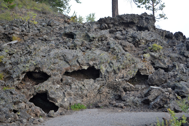
The accessible portion of the trail ends at a break covered by a bit of wood. It looks like something that could easily be fixed for further accessibility, but the trail turns narrow and has some steep downhill spots shortly after. There are long, horizontal holes in the lava, although when I carefully peek in, I find they are not continuous. The signs turn again to the molds to say that these trees were pushed over and formed a log jam here to make the stacked holes.

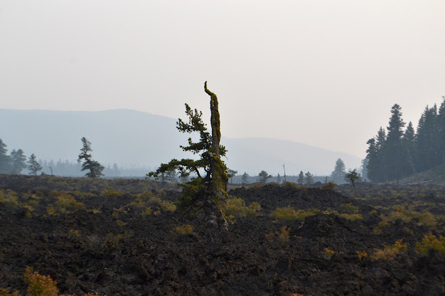
One sign points out an island of survivor trees across the way. Today, it is just a smoky mass with pointy tops from the distant fires. A trail a little way back on the road advertised hiking into it in a mile. We will probably be turning attention to trying to get out of the smoke instead of hiking it.


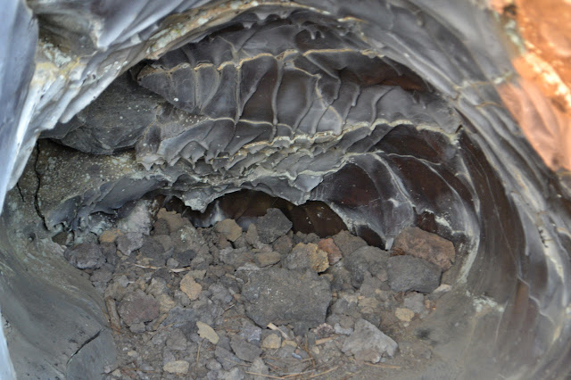
Then there is another section of the log jam to explore. The trees built up quite high along here. I check the upper surfaces, and many of these also have the very smooth section of solidified lava. It is mostly at the top, but sometimes it slides down the sides almost to underneath. There are fins and other structures in the smooth as well, reminiscent of limestone caves.


There is one more vertical cast and then the sign concerning the destruction of the molds by visitors. It shows an old photograph with a pair next to a cast that reaches higher than they stand. One is leaning on it and the other is climbing in, showing exactly what not to do. Then we are dumped back out into the parking lot.
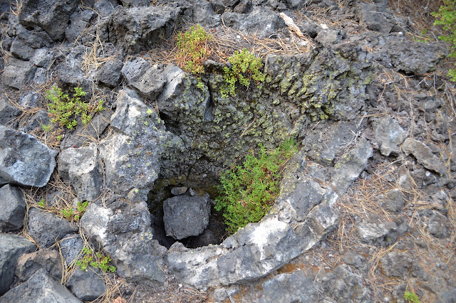
*photo album*
©2017 Valerie Norton
Posted 6 September 2017
Liked this? Interesting? Click the three bars at the top left for the menu to read more or subscribe!


Comments