Garnet Peak
Cleveland National Forest
Click for map.
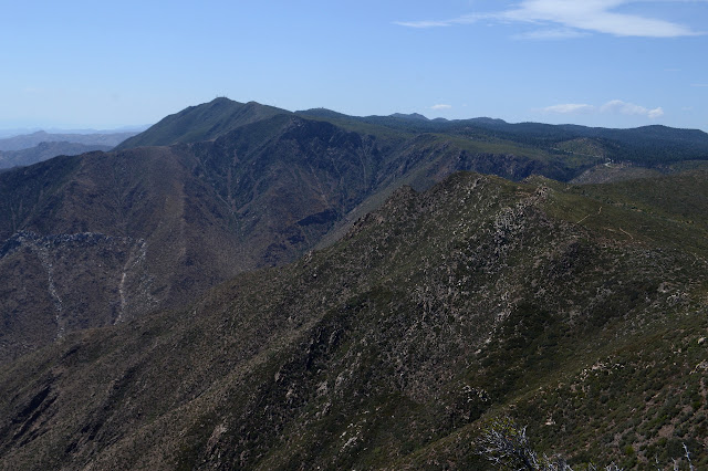
Garnet Peak, not to be confused with Garnet Mountain, is sandwiched between the two hikes yesterday and is the rather peak looking thing in the near distance of both of them. It is the last of the Hundred Peaks Section listed peaks for this trip and has its own trail up, but approaching via the Pacific Crest Trail gives me a few PeakBagger bumps to grab on the way. Also, I suspect Penny Pines, a place where water is available, to be easier to find. It does have a sign, but it is far enough off the road to miss in the dark. The paved pullout is just south of a big orange snow gate and cattle guard, so that can provide a landmark to find it, too. There is no indication of where the water is, but two trails head off marked as PCT. I grab the north one since I want to head north from here. It is just the longer route to actually join the PCT on the other side of a low hill.

At the junction, there is a sign to indicate water is along the shorter route back. Not too far past the junction, there is an old fuel break and the first peak a short way off in roughly that direction. The down side is marked restoration area, but up is fine. I go for it, but it only goes a little way up to a little flat. Except for the beer bottles, it does not look like many people come this way. No trail has formed, but the brush is easy enough to walk through on up to the top. The PCT is following me upward about 200 feet to my right. Maybe I did not need to leave it quite so early.

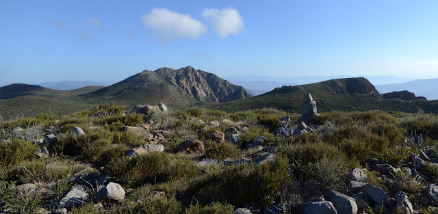
The top is a nice view spot easily obtained. Nested cans next to a rock man contain a map printed off Caltopo of the local area. The back has one entry from a few months ago, so I add my name and refresh my memory of the possible approaches to the other bumps. I have seen no other cans, so suspect that this might have been an old register cleaned out by the Cedar Fire. A bit odd that it took nearly 15 years for someone to drop something new into it.
Obeying a sudden whim to be completist about this little section of trail, I follow the route down the way I came up and climb again along the trail. The vegetation along the side gets quite thick and would not be fun to try to get through. There is probably a perfectly fine route up once a little way past the peak, but by this time I am thinking about other things. At one viewpoint along the way, a very distinctive cut from a wide trail or road is visible climbing up the side of the canyon. Perhaps part of the old mail route the signs along the road mention? There are no interpretive signs along here. A long spur trail leads off to a second viewpoint of the canyon that really sticks out into the canyon and I clamber out to the end of it, too.

There was no need to review anything for the approach of the second PeakBagger bump. There is a huge trail that leads off the side of the PCT and up it with a second trail heading out to a viewpoint. There is another register on this one, but it has an actual notebook with lots of names inside.

It would probably be easy to make a way down from the viewpoint to the side of the peak and I am surprised there is not a stronger trail doing just that. My completist whim holds, and I go back to where I left the trail and even tag my previous footprint before heading on. After a slight climb, there is a junction marked Garnet Peak on one side and Sunrise Highway on the other. Time for the main event. I turn to climb the steeper and rather eroded trail.


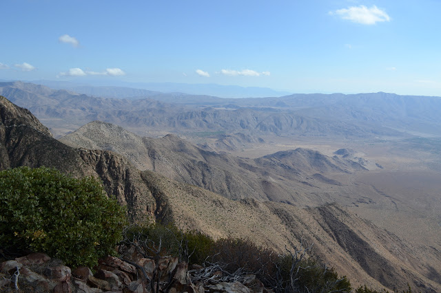
The trail climbs around one rocky point then gets a bit rocky itself with a thought of getting to a class 2 climb, then suddenly I am at the top. This one has a much larger register full of full books. The view is a bit more clear than yesterday and this peak feels a bit more prominent and isolated. Really, that is what being on a peak is all about: prominence and isolation. Down on the next bump is a blue rock that is some memorial left by Hercules or a helicopter. People seem to be obsessed with leaving memorials around here.

There is quite a lot of trail down the far side of the mountain. I poke around toward the mysterious blue rock, then once finding what it is, I return to the peak to poke around it for a benchmark. There is only a hole with a deeper central hole. I can not even come up with that much for possible reference marks. So much for benchmarks. So far on this trip, I have only found a miniature one on Monument.


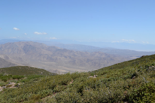
After a while and a short visit by a trail runner, I head down and pass the trail runner coming back up. He does not have enough stuff with him to have forgotten something at the top, just two soft water bottles and a phone. Near the junction is a small group of women chatting and climbing. I keep to the peak past the junction. The other side of a saddle is my last PeakBagger bump. The direct route is blocked by high shrubbery. I might try pressing through it, but I think I saw some open routes along the southeast side. I drop down a little and try again, then a little more so that I am actually where I was seeing routes and try again. Someone has been filling the gaps with cuttings from trail work. I think that is just mean as I press through a larger gap and carry a couple cuttings a little further along. Past that, it is an open climb if a little bit winding. I am willing to wind a little if it means not so much pushing. In short order, I am at the top.

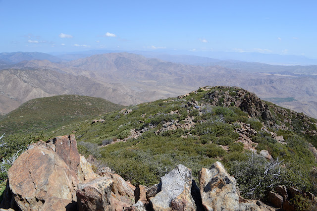
Following my trail back down is simple enough and I even find a large slot to walk through to get back to the trail. I just had to wiggle a little bit further to the side and there was a clear route. I take the peak trail down to the road. It is just as flat and easy as it looked from afar, though it does hold the surprise of one poodledog bush growing at the side. It turns into an old road and comes out next to a large parking area where long metal posts block any automobile travel along it. Stickers on the middle bar spelling out "Garnet Peak Trail" are the only sign to tell people where they are. None of the people I saw is parked here.


Penny Pines is just over the hill from the peak trail and there is generally shoulder to walk on to get to it. There is not much trail, so people must not do this as a loop much, either. I do get to find a slightly run over benchmark on the way. Once back to the car, I explore just a little bit down the trail on the far side of the highway to even find the water, which runs as promised. There are lots of people parked here, including a horse trailer, but they are on the other trail. It is barely afternoon and I am ready for what will turn into a ridiculously long trip home.
©2018 Valerie Norton
Posted 31 July 2018
Liked this? Interesting? Click the three bars at the top left for the menu to read more or subscribe!


Comments