South Fork Trail on Trinity River
Six Rivers National Forest
Click for map.
When I went out to see the not-really-world's-largest tanoak, South Fork was there for a backup plan. Now I'm finally getting out to see it. I wasn't sure how far I would get, but thought there was hope I might get past the ford with the rather dry winter the area has had. The road in is mostly paved and frequently narrow, sometimes for long stretches. Signs are missing and one or two driveways try to look like road, but mostly staying left at the branching works. Of actual forest roads, there are two places for river access on the right along the way and then a final loop which is less rough and steep on the right side. There is plenty of parking for a dozen vehicles and even a dispersed camping site for all who make the correct guesses to get there. The trail itsel is not signed, but there is a large sign board for information across from it to help one find it. It is a little less well signed than I expected for a named trailhead shown on the forest visitor map. I started down the dirt track not entirely certain I was heading the right way.

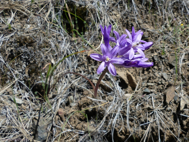
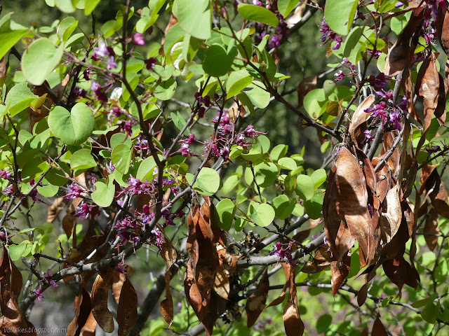
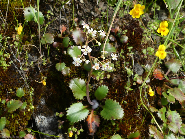
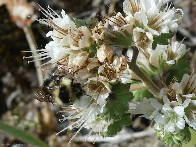
It's spring, so I was expecting flowers. I got plenty of the tiniest mariposa lilies and irises to start off. A good start! Also, plenty of poison oak everywhere. It was mostly off the trail, which makes me think this trail probably gets plenty of use even if it is trying to be a little obscure.
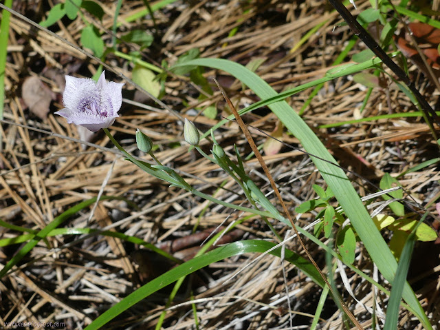

The first bit of the trail was lots of trees, a little view although not of the river, and general easy travel. And lots of flowers: big flowers, little flowers, flowering trees.


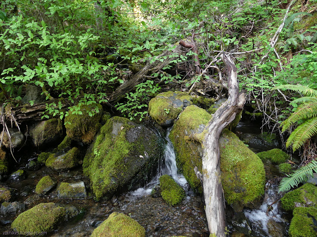
I'd heard water at the start, but the trail didn't get close to Surprise Creek. I heard it again for Coon Creek, which gets a crossing. A frog went swimming fast from the crossing area as I got near. On the way back, I stopped well away from it and watched it while fumbling with the camera, but after a moment and long before I was ready it had scampered again. That frog did not want its picture taken. I also spotted the stripe of a little racer dashing under leaves. The snakes wouldn't be still for me either. Even lizards were just a quick bit of movement. Only the snails were sufficiently slow.


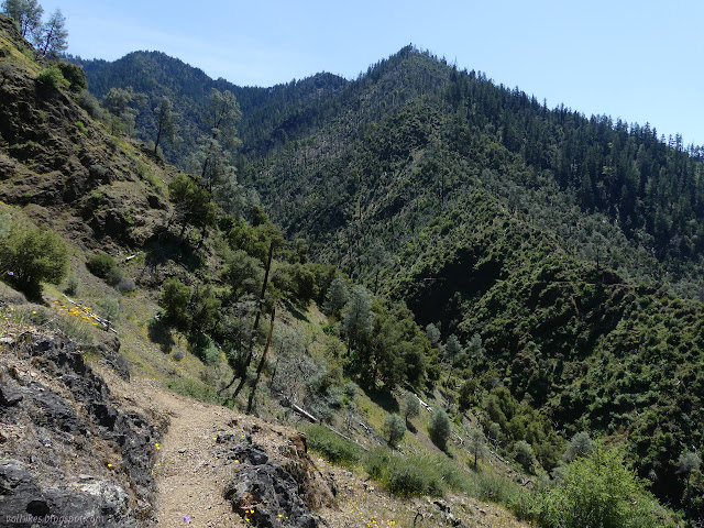
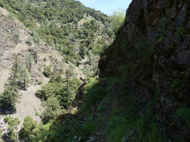
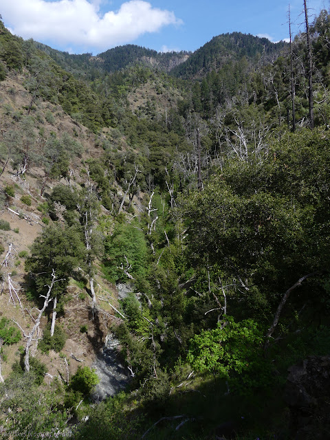
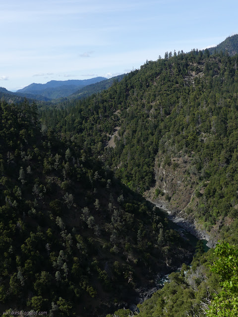
It took a bit, but I finally saw the river far below. It was first through the trees, then finally expansive views. It didn't look small as I rushed across the bridge in the car and it didn't look small looking hundreds of feet down on it. Even though the trail goes upstream, it starts out so high up that it actually loses about 200 feet from start to finish.


I had spotted Hells Half Acre Creek on the map and wondered what it might hold. In Santa Barbara, that name is attached to an area of rocky outcrops. The creek has steep sides and the fin of land splitting it from the river for a while on the far side looks volcanic. A small wash was distinctly discolored and when I got to the creek, it was too. I dipped my hand fully expecting it to be abnormally warm, but it wasn't. I still wouldn't be surprised to find out there's some hot springs up there somewhere. Maybe that's why there seem to be two or three trails climbing the ridge lines around it.

It took a moment to find the trail on the far side. It was a little further upstream, but I had been watching the cut on the far side drop, so knew about where it should be. There were more clues to help too. I thought it wasn't too hard to spot, but on the way back, I met other hikers who first turned downstream to find that trail, then walked past it once I directed them the other way.

The south facing slopes are rather steep, but the north facing ones are carved right into the rock. I could see this being a hard trail to pass along with too great a fear of heights. I certainly found a step or two worrying. What little I could find about the trail indicated that some of the trail was too narrow and high to safely use stock and this part around Devils Half Acre Creek might be one of the spots that makes it so.


The trail splits just short of arriving at the river. I found signs at the split, but they can no longer be read easily. There was one still nailed to a tree and one on the ground. The one on the ground seemed to have a road designation almost faded to nothing. 6N03B? I drove in on 5N03, but the 6 is clearer than the 3. Maintenance was most obviously missing on the turn to the right. Since I had seen sawdust at a number of logs along the way, I took this as a sign and continued on. It hadn't been maintained in that direction either. I found the old footings for a bridge and that I had strayed from the trail on the current map. New hypothesis: left is the trail to the bridge and right is the trail to the ford.

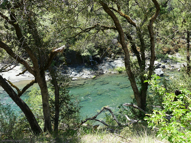

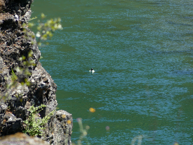
I stopped for lunch at the long gone bridge eventually noticing that there are cables partly buried in the banks on the far side. I watched a floating bit of white trash resolve into a common merganser. It paddled along until hitting a little rapid in the one iffy part of what is probably the ford. It seemed to suddenly relax for the short ride then started to push again.
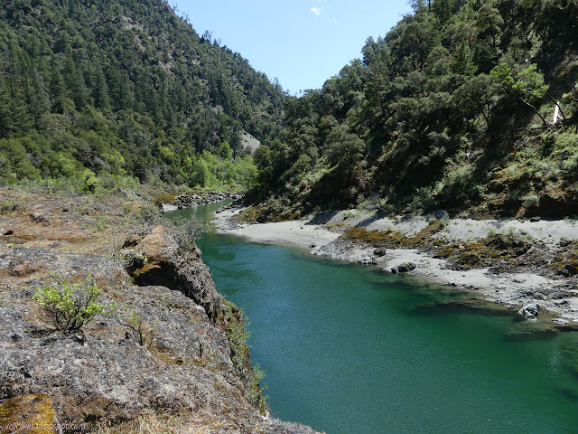
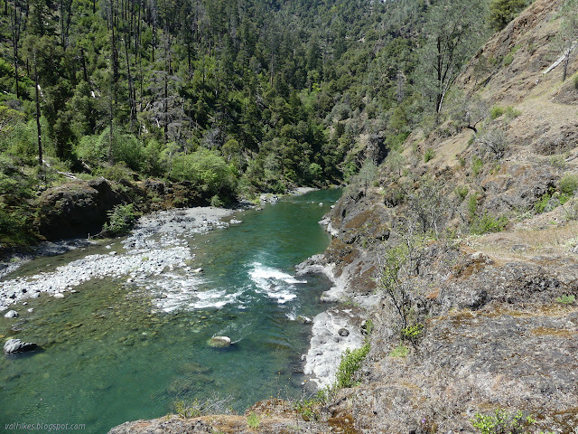
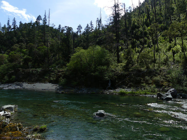
I was thinking I'd go further than the ford if it didn't look bad in this early season. I still hadn't seen anything that looked like a regularly used trail down to the river. There is a bit of a cliff right where the bridge crossed. There is a little trail continuing past it. I followed it to find a camp site and a bit more trail to an area where scrambling down to the river wouldn't be too hard. There's more candidates for a fording area, too, and they might be better. I just don't know how one would get to the trail up on the hill. There is more beach on the far side and it looked like a pair of people might have slogged through the sand sometime recently. Maybe that is a good option for the crossing.


I decided to go and check out the other trail instead of actually trying the scramble down to the river. Besides being bushy and log covered, it had significant animal trail continuing downstream when it turned up again. There was another camp site and then I wasn't sure where to go. I just found more scrambling routes down to the river and the easier ones still left cliffs and deep water between the ford and the scramble. Some of the rock getting to the ford did look a little like it might have been chipped away for a trail, but the river has long ruined it. Ultimately, I never even got down to the river to think about trying the ford and seeing a little more trail because my turn around time had passed.
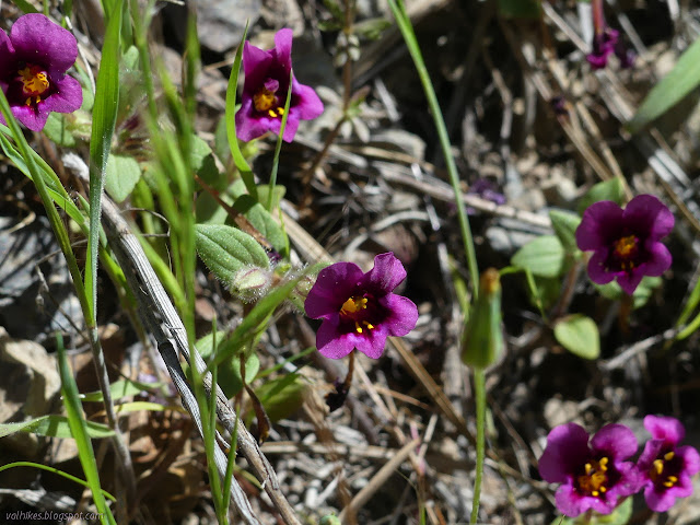
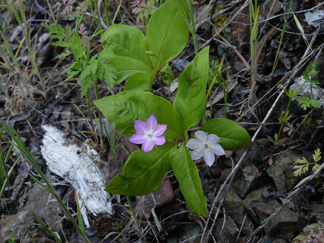
Heading back, I noticed a large metal square tacked to a tree. I went to see what it was and found the southeast corner of a mining claim. Maybe that's what the trail is for? It still seems to be approximately where the trail on the Forest Service map is marked. Maybe an older map would help to sort it out. Continuing on my way back, I paid a bit more attention to some of the plants I had skipped on the way out.

It wasn't quite so hot going up the sunny side of the canyon from Hells Half Acre Creek. A cool afternoon wind had kicked up, although it wasn't constant enough for my liking. Clouds moved over the sun with good timing to give me shade as I climbed, which was quite nice.


The map shows a shorter route back to the parking area, but I could not figure out where it actually was. It used to be road, but where it should meet the trail has a lot of downed trees. So I went back the long way again and had a chance to check the little spur trail to Surprise Creek. I thought I saw it on the way up and it turned out to be one bend closer to the trailhead than it is shown on the map, so I'm glad I did. Of course, I wasn't sure I was finding the trail or some use trail, but after ducking through a little unmaintained feet, I found a wooden "trail" sign nailed to a tree. It is clear enough all the way down to the creek and there is use trail up the other side. I found a fence up there and decided to leave the field beyond it alone. It may be inholding or it may just be range land.
It was still barely evening when I got back to the lot, so I decided to go exploring for the other trail up. As an old road, it should be easy enough. I found it at the end of the loop just before the road turns up the hill. It had been blocked with earth but with an easy walking width left to the side. There is very little trail beaten into the old road bed. It quickly gets to a washed out crossing of Coon Creek. I had to squeeze past a fallen tree to continue up the other side and soon it became clear that it is bear that make what path there is. The trail passes under low branches even when there is space beside and then there is bear tunnel.


I was already tired from the miles on trail, so pushing through the brush trying to find where the trail went was quickly getting to me. I called it a day and squeezed my way back down again.

©2020 Valerie Norton
Written 2 May 2020
Liked this? Interesting? Click the three bars at the top left for the menu to read more or subscribe!


Comments