Henderson Gulch and Ryan Creek
McKay Community Forest
(Map link.)
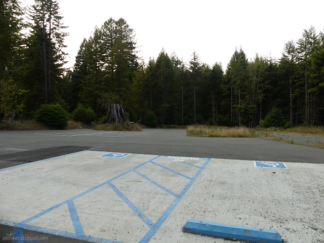
I headed down to the actual, official parking lot toward the middle of the McKay Community Forest for another visit only to find that it is currently locked up tight, which makes it much harder to find legal parking in the area. I should have reviewed the map prior to arriving, or at least brought it along. As it was, I headed south along the road, then turned east where there will be fully accessible trail eventually. I expect that means it will be paved, but for now it is more like the "improved access trail" that will be further out, wide and flat.

I found a bit of trail heading off to the right and decided to go for it. I wanted to get down to Ryan Creek and from there... take route I hadn't taken before. It was a nebulous goal, but definitely furthered by taking the nice winding trail that dropped, maybe a little shallowly, in that direction. Along the way, I noticed what I took for an old skid trail, but was probably the original route of the road. A lot of work has gone into replacing the steep, water rutted drop with a much nicer trail.


At the bottom, it hooks into another trail that looked like a more major route down from somewhere, and that ran into things that looked familiar. I set about making different turns soon after, crossing a small creek that was not, as it happens, Ryan Creek.


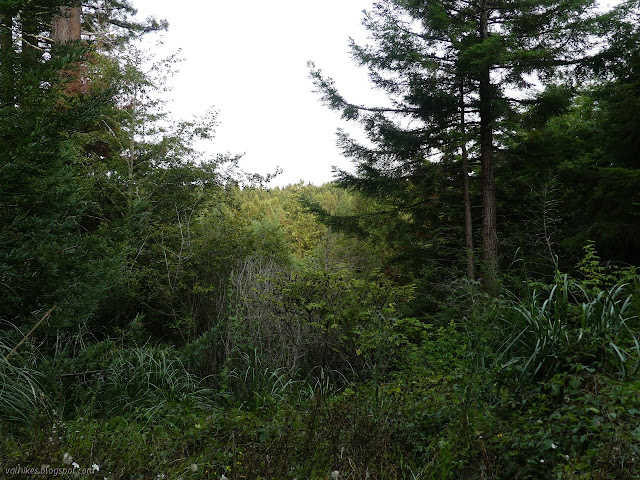
I got onto some trail along the left side of the creek. There were loads of banana slugs foolishly sliding along it, making quite the obstacle coarse, before it took a sudden and decisive turn upward. I followed it until the character changed to scruffy, new forest full of pampas grass on the high flat.


That didn't seem like it would be hanging out with the creek, so I decided it wasn't what I wanted in a trail and turned back the way I'd come. Admittedly, the steep bit wasn't what I was wanting either. I crossed some water and got headed along the right side of the creek for a while.


I got to looking at my track on the map and found that I had traveled quite a bit south. This seemed downright odd because I was traveling downhill with the sun at my back. The creek flows north. I should be traveling north. It was getting to be time to turn around. I decided to try a nearby creek crossing and look around the other side.

There's roads on the far side with plenty of evidence of foot and bicycle travel with occasional vehicles. I wandered a way up a side road that was blocked to vehicle traffic with a break to walk through. Another creek flowed far down the side of it.

What I did have of map suggested it would go up a while and stop. Heavy use makes me think it actually connects with things. I mostly had time to go back the way I'd come, though, so that's what I did. I was still feeling quite turned around, but I can retrace steps easily enough. I crossed back over and made my way back on the narrow trail instead of the wide road. It might have been more downhill in the return direction. It's so close to level, it's hard to tell. I did take an excursion up a road that made a much nicer climb that probably connects with my first excursion upward.

I made more excursions as I retraced my steps. At the bottom of the climb, I wandered along the other trail a short way. Had I brought a map or just felt I had a little more time, I could have known that this is meant to connect with the rest quite easily. (It might not yet, though.) Poking around needs to be given plenty of time even if the distances aren't likely to be all that long.

When I got to the top, I wandered again in a small excursion. This time, I was on what will be the loop at the end of the fully accessible trail.

Then I stuck to the main trail all the way back to the parking lot. There's many trails marked along the way in the trees. Eventually, there will even be a "bike skills park" in that area.

Looking more closely at my route, I see that the creek had turned more east than south so that the afternoon sun was at my back although I was headed south. The rest is perception and I've found a few trails that are so gentle that it feels downhill both ways to me. It does roll slightly as it goes, but the overall feel of it is still downhill both ways. I want to make more explorations of the forest, but definitely need to be more organized about it.
*photo album*
©2021 Valerie Norton
Written 4 Sep 2021
Liked this? Interesting? Click the three bars at the top left for the menu to read more or subscribe!


Comments