Trinidad Beaches
Trinidad Coastal Land Trust

(map link)
I finally got the roughly 2.5 months backlog of hikes down to something reasonable, and after just a bit over 2 months of solid writing. (Yes, it takes me as long to write up a hike as it did to hike it.) Between all that writing and a general feeling of saturation of the local area, I wasted a lot of lovely November days not going anywhere interesting and got into a December when it was harder to find a halfway nice day. I decided to use this particular window of good weather to go out and see what the big tides were doing in Trinidad. The king tide already passed, but the high would still be over 8 feet. So, while the rest of the country was popping their pipes in an extended freeze, I went off for a day at the beach. The temperature was pleasant, the wind drifting about when it did anything at all, and the fog probably wouldn't cooperate. It's been around and Trinidad is good at gathering it.
Houda Point
I started off at Houda Point while it was still a couple hours until high tide. It was just normally high so far, around 6 feet. What had looked like clearing had clouded up again and that's just the way it was.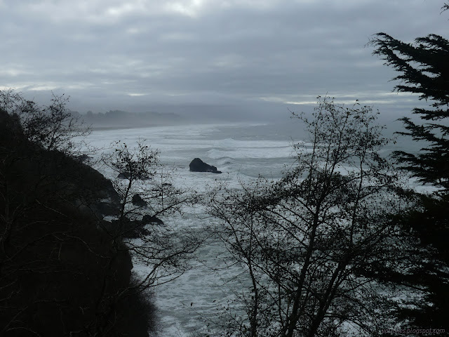

There's a short trail here out along the point. Steps are steep as they drop to a saddle where trails, more steep steps, go off to what is usually beach. There was a little sand left. At low tide, you can walk all the way around the point. High tide leaves it a little splashy. There's also a little high point to look out from.

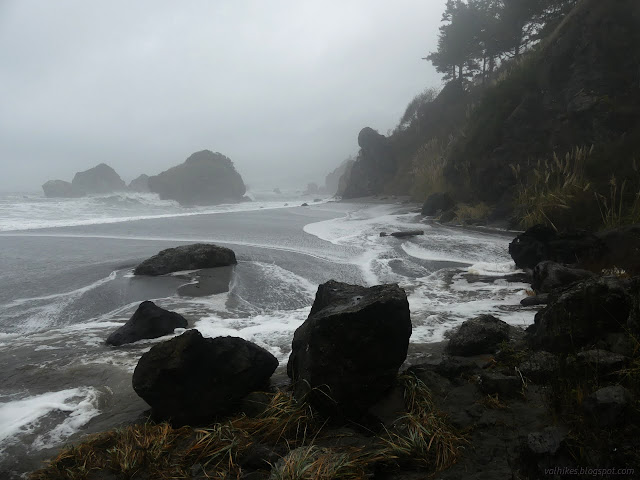
After the saddle and the high point, there's still a little more trail going most the way down to what is currently water but can be sand. This gives the best view back to the splashing along the cliffs to the south.


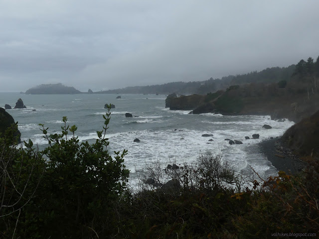
Splashes are always fun, but there weren't a lot of big ones going on. Just a general splashiness that worked its way along the rocks. I headed back up and walked down the road to Tepona Point. The road alternates between paved and unpaved sections and this area is mostly unpaved.
Tepona Point
Tepona Point gives a much more "point" experience. The trail is smaller and has no trails down. There are other ways to use to the beach that don't scrape away what little rock is left.

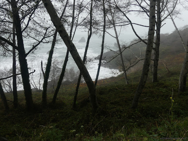
Luffenholtz Beach
I continued the little bit more to Luffenholtz Beach. There are stairs down. They deliver one to the beach with a creek flowing only a few feet away. Most of the beach is on the other side of the creek. I wandered down as far as the creek, but not all the way to the beach. The waves weren't coming all the way up the beach for the most part. After a while, one would come up and top a hill of sand allowing it to flow down into the end of the creek. Sometimes it still sank into the sand too quickly to get there.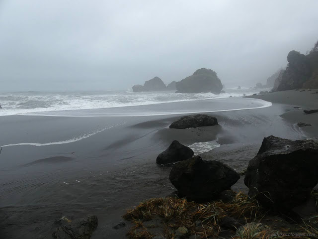

I headed back to the car to head off to the other side of Trinidad, but found one more stop to see a beach I'd not been to before.
Baker Beach
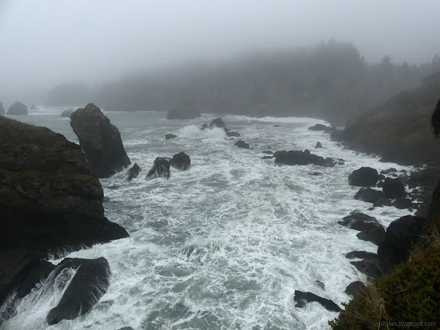
The sign at the top of the trail earnestly warns that this is a clothing optional beach. The trail wiggles along in one direction not loosing elevation nearly as fast as the others do. I got there and found none of the promised nudity. There was still beach, some of it even marked with numerous footprints. This was pretty impressive as the tide was now up to the 8.2 feet high.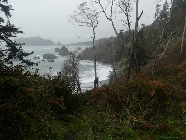


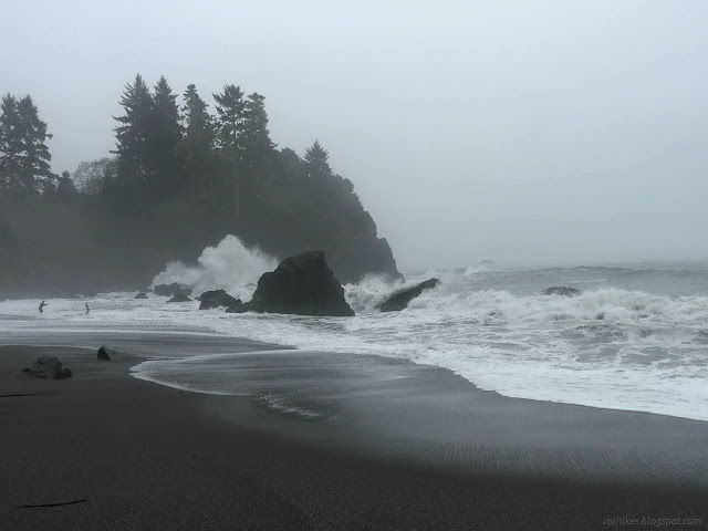
The bit of sand with footprints was already occupied. I timed some movements and went further along the beach to where a former tree provided a good seat. I even had a nice footrest a few inches above the sand. I was sure this would leave me well situated for the waves coming. Most didn't get near and there was another large log trapped on a rock below to lessen the power of any water coming my way. It twisted back and forth around its rock and one wave washed right up that beach and over my foot anyway. The swells were increasing.


I watched the show a little longer, then headed back. The tide was going out, if only very slowly, and I was still headed to the other side of Trinidad for one more stop.
*Humboldt album*
©2022,2023 Valerie Norton
Written 3 Jan 2023
Liked this? Interesting? Click the three bars at the top left for the menu to read more or subscribe!


Comments