Posts

Fey Slough Wildlife Area

Image
California Fish and Wildlife Click for map. This little spot is so close to the highway, I have actually noticed it while zooming past, tucked in opposite of the car dealerships. There was heavy traffic leaving the dealerships as I arrived, but no one at the trail. Plenty of information signs at the trailhead. So I stopped at the information signs to find out what was up. The important one was a large map showing areas closed to entry, areas closed to hunting, and areas where hunting is allowed. I had actually found out it is a hunting area prior to stopping by. "Hunting is only allowed in the hunting areas," it says. It goes on to clarify, "No exceptions." It can be important to clarify. "Hunt days are Saturday, Sunday and Wednesdays ONLY." Good thing for me it's Tuesday. "No holidays except if they fall on one of those days." It certainly seemed pretty clear, but I expect it's really important to clarify. Lots more rules as...

PALCO Marsh Trail and Hikshari' Trail

Image
Eureka City Trails Click for map. I headed to the end of Del Norte for the rest of the Eureka Waterfront Trail to discover that there is a park and fishing pier there too. It's a happening place. There's a little loop trail through the park, which I did not take, but I did head out onto the fishing pier a little way. I discovered quite a lot of old pier or something like that surrounding it. The pier is built on the end of a jetty and had a few fishermen fishing from it. I disturbed the gull on the lamp. Industrial works to the north on the far side of the bay and loads of old pylons on this side. Looking south is into the bright sun over the reflecting water, but there's a bit more pylons to see. I headed back to the other side of the parking lot where there is one of many signs detailing the trail and a bicycle repair station complete with tools on cables and a pump. This particular sign details the Waterfront Trail to the south and the PALCO Marsh Trail tha...

Eureka Waterfront Trail

Image
Eureka City Trails Click for map. The Waterfront Trail is only 6.5 miles, so I suppose I could wander it in a day, but I decided to split it up and check out the northern part first, getting to where it starts following road a bit too closely for a bit too long, which would be my time to turn around. That is the bit that goes past the marina, so perhaps it wouldn't be so bad? I skipped it anyway. I parked at the end of Y Street where there is one of many access points. The back of the Blue Ox Millworks catches the eye immediately. It looks to have been built in an ad hoc manner and keeping it up must be a nightmare, but there it is. For now. The end of Y Street where it becomes bike path that intersects with the Waterfront Trail. The organic nature of the building around the Blue Ox Millworks (in blue) is not yet apparent from here. I turned right to walk along the abandoned tracks toward the short end of the trail instead of left to get a better look at the building. ...

Aldergrove Marsh

Image
Arcata City Park Click for map. Aldergrove Marsh isn't exactly a park and gets a special call out along with the Arcata Community Forest and Arcata Marsh when the city lists its open spaces. It is the smallest of these areas and only has trail along one side which might be as much as a quarter mile long. The rest of the area is marsh, so not all that inviting for stepping out. The rules of the place are on the side of the trail with parking. The alder (which are probably ash) have all lost their leaves, but the birds that are a star attraction for coming were still hiding away somewhere and singing. I didn't see them. At first I didn't even see marsh, but it quickly became clear that the area really is quite soggy. First a little puddle on the road side of the trail.

Carlson Park

Image
Arcata City Park Click for map. This is Arcata's largest city park outside of one with sports fields and Redwood Park (on the edge of Arcata Community Forest) at 19.1 acres. It's biggest boast is Mad River Access, but I neglected to bring a boat. (Probably because I haven't got one, but I've eyed a few.) I found parking to be difficult. All the surrounding streets are marked with "no parking" signs leaving just a bit of the gravel end of the road for both parking and turning around. After about two car lengths, there is a post, then the neighbor's gate, then no parking. Entry to Carlson Park. Signs tell the rules and indicate the direction to go for the trail. Since I didn't have a boat, I probably wouldn't be spending hours at the park, so I made do. A sign just past the gate points left for hiker trail, but the right looked more used, so I went that way. Even without a boat, I wanted to get to the river, and in a short time, I had. T...

Elk River Sandspit

Image
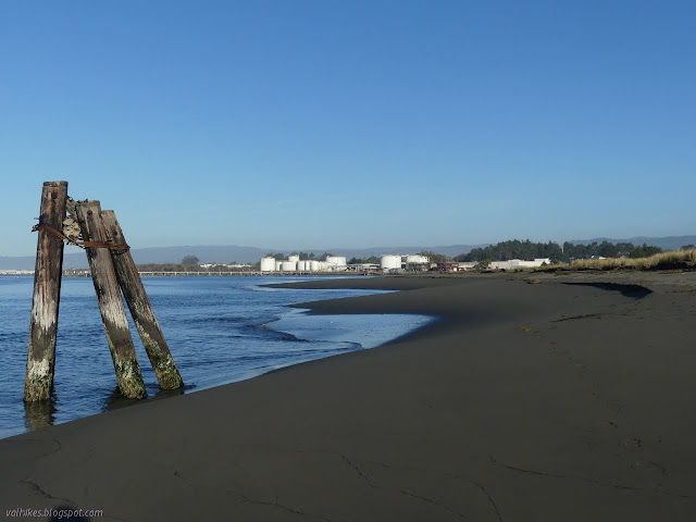
Elk River City Wildlife Area Click for map. I will get to the Waterfront Trail eventually, but the spit of land by the Elk River got my desire for this afternoon. It is quite the curiosity to me. I have been known to wonder why the rivers generally love chugging north along the coast befire finally breaking out into the ocean. I saw one sign ( was it at the Mad River Bluffs? ) with an explanation for why the rivers do this, but I'm not sure it applies to a river that exits into the bay. Anyway, I didn't believe it completely. I wasn't entirely sure how you get out there, but there was a geocache on it and it suggested starting at the (former) park and ride. I knew where that was, so I parked and got out and found myself on the wrong side of the river. Looking out from the raised area of the parking over the grassy flats to water and then some trees that look suspiciously like the ones on the North Jetty. I followed a sign claiming there was bike trail in the so...

Chah-GAH-Cho Trail

Image
McKinleyville Land Trust Click for map. I've decided I should be more complete about the local trails. I'd seen a sign for one in McKinleyville and did a little research to find it is on the local land trust's first property. The parcel is just 9.5 acres with a grid of trails, so I stopped by in the early evening on my way past. I didn't see the sign once I was looking for it, so got there after a minor run around. Parking is very easy and the area itself is well signed. The start of the trail to access the property. I followed the access trail from the parking to the property itself. The bulk of the land is sparsely covered in trees with grasslands north between it and the parking and thick trees to the south on some private land. A sign explains the name of the area and that it is transitioning back from cleared ranch land to native forest and grasslands. It adds a few Wiyot words for common items in the area. (The Wiyot were the people who lived here at ...

Samoa Beach and Dunes

Image
Arcata BLM Click for map. I've just been getting around the neighborhood loop, sometimes with a bit of a spur, and not really enough of that. I needed to get out and do something fresh and new even if it is something small and just the other side of something old . I didn't get out to them until the afternoon, but even the short visit served as a nice reminder of what the various dunes have to offer. At first glance, that's a wide, sandy path to the beach over low hills covered in invasive plants. There is more, so much more. A couple went up the path to watch the waves. The grasses may or may not be native, the sagebrush is local, but the ice plant came from South Africa. The waves are rolling in in layers as usual. There's people on the beach just where it starts to get misty. I had decided to make a search for the nearby multicache , so I went over to its first stop by the pedestrian underpass. It seemed rather splendid in fresh paint that had some pic...