PALCO Marsh Trail and Hikshari' Trail
Eureka City Trails
Click for map.
I headed to the end of Del Norte for the rest of the Eureka Waterfront Trail to discover that there is a park and fishing pier there too. It's a happening place. There's a little loop trail through the park, which I did not take, but I did head out onto the fishing pier a little way. I discovered quite a lot of old pier or something like that surrounding it.

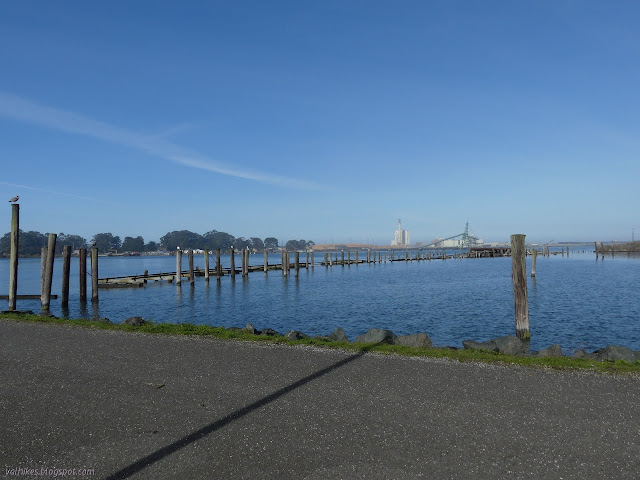
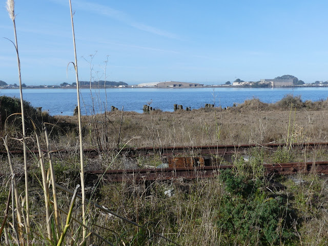
I headed back to the other side of the parking lot where there is one of many signs detailing the trail and a bicycle repair station complete with tools on cables and a pump. This particular sign details the Waterfront Trail to the south and the PALCO Marsh Trail that parallels it for a half mile. There's a few indications it wants to be called the Eureka Marsh now and at least as far back as 2002, but the name change does not seem to be taking. The trail is obvious as the paved bike path heading north and, a little less obvious on the other side of the train tracks past a bit of fencing, heading south. I found more distraction to starting within the bit of fencing where a great egret was deciding how best to swallow down the rodent it had captured. It wasn't as quick with it as they usually are with fish.


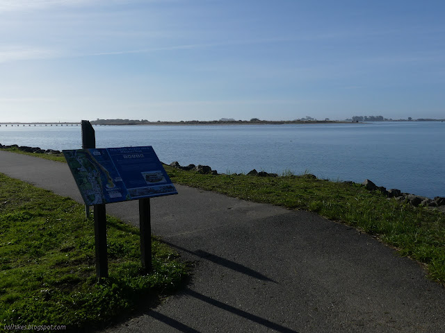
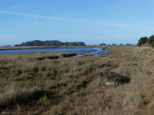
So I finally got started once the gopher vanished and the egret took off to the edge of a nearby bit of water. When the trails split, I went left onto the gravel PALCO Marsh Trail where there are benches and picnic tables and interpretive signs.

The marsh was land caught behind the railroad berm and separate from the tides that had washed it before the rails were laid. For a long time it caught storm water, including storm surge waves, and dried out in the summer, making a very different environment. Now it has been connected to the tides again through culverts, basically. Well, at least one. The single one I found along the half mile of trail was very noticeable by the volume of water moving into the marsh area in the rising tide. The signs talk about how it breaths twice a day now, but surely it wasn't quite so concentrated to one channel before.


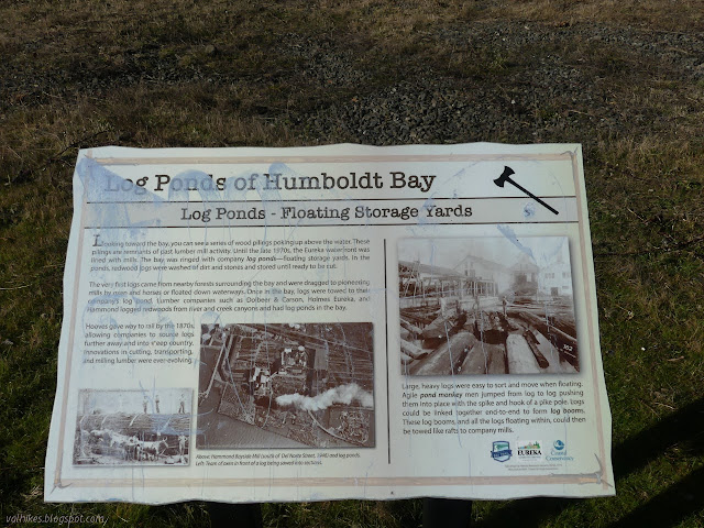
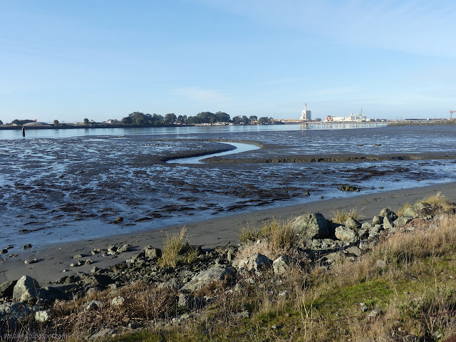
Trail at the far end turns to follow further around the marsh with the potential to circle it. I connected back to the Waterfront Trail and promptly found a sign to tell me about those pylons out in the water. They were not part of some elaborate pier system but part of the lumber yards that once lined the bay. They would stick the trees out there, floating in the salt water. I wondered if salt water would not be thought damaging, but they have a picture of the Hammond Bayside Mill in 1946 with buildings in the middle of platforms and in one corner, the logs jumbled up in the bay waters. It was "south of Del Norte Street" which means it could be the stuff visible from the sign or what I noticed south from the pier.

The trail leaves the side of the bay for a moment and signs about Homeland Security responding to threats and intrusions and some Chevron branding made it clear what I was looking at. I decided to get past the tanks marked with a big 4 on the red of their hazard diamonds quickly. On the far side, I passed a sign signifying the start of the Hikshari' Trail, the southern end of the Waterfront Trail.
There are some more extensive signs by the parking, but I did not find out what the pipes that cross the Elk River and the spit were. I followed a small trail down to the beach, but did not find much to go much further.

I did find out what the strange, tall building was. I had also seen this from the sandspit. It is a training platform for the local firefighters made of shipping containers. That helps explain why it looks boarded up, but not quite abandoned. The firefighters even came by to demonstrate it as they went up to the top and lowered one of their number down a hole in the top. Then the road ends with some parking and the trail got a bit wilder. I was offered an official alternate route closer to the beach and took it since paved still isn't all that wild.


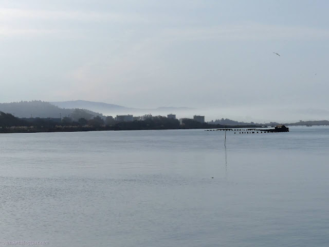
The trail looped back to the paved path and back to the interpretive signs. A big theme is the sandspit on the far side and how much bigger it is today (which is 2009 for the sign) than it was in 1860. They say the change in the waves when the rock jetties solidified the bay opening has caused it to grow substantially. (If left to its own devices, Humboldt Bay does not always have an entrance at all.)
I found myself once more at the sign marking the south end of the Hikshari' Trail, so turned back. There are some rather distinct trails following near the beach, so I followed them back to where the official loop of extra trail was.


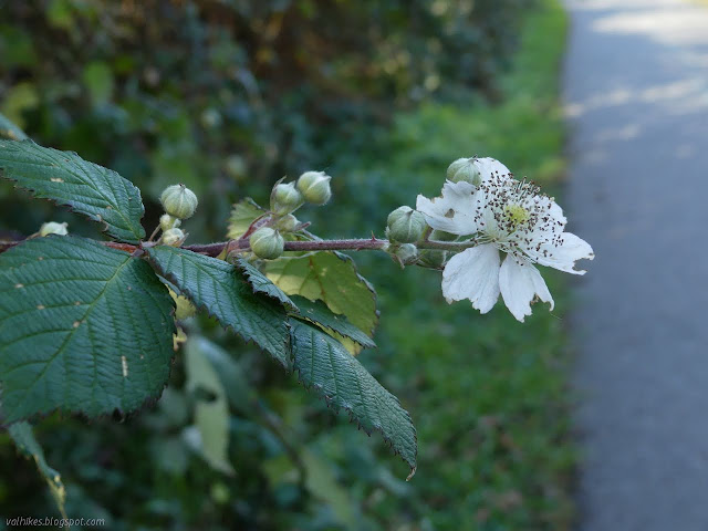
I returned to the paved path to find I had missed a bit lined with blackberries. Some of them might even be the native sort. All of them are covered in thorns and fruitless, so I didn't interact with them as I headed north.
I kept on northward noting a lot more mud exposed along the way. The firefighters seemed about done as I passed but the oil tanker was still churning away at some pumps.


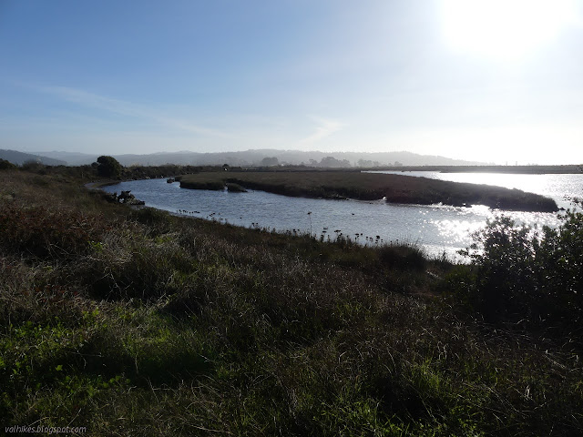
I made a diversion across the channel between the Waterfront Trail and the PALCO Marsh Trail to check on the water flow. The flow had reversed but the roar was continuing. I crossed back. Crossing like that hadn't been an option earlier when the channel also was full of water, but was down to a trickle then.

Maybe I should have given that mile in the middle of the trail a chance. I looked at it, but then decided to use the time remaining in the day to check out a small trail by the highway instead.
©2020 Valerie Norton
Written 3 Jan 2021
Liked this? Interesting? Click the three bars at the top left for the menu to read more or subscribe!


Comments