Samoa Beach and Dunes

Arcata BLM


Click for map.


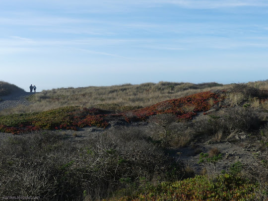
I've just been getting around the neighborhood loop, sometimes with a bit of a spur, and not really enough of that. I needed to get out and do something fresh and new even if it is something small and just the other side of something old. I didn't get out to them until the afternoon, but even the short visit served as a nice reminder of what the various dunes have to offer. At first glance, that's a wide, sandy path to the beach over low hills covered in invasive plants. There is more, so much more.

couple on a wide, sandy path looking out next to grasses and ice plant
A couple went up the path to watch the waves. The grasses may or may not be native, the sagebrush is local, but the ice plant came from South Africa.

beach covered in footprints with layers of waves rolling in
The waves are rolling in in layers as usual. There's people on the beach just where it starts to get misty.


I had decided to make a search for the nearby multicache, so I went over to its first stop by the pedestrian underpass. It seemed rather splendid in fresh paint that had some picturesque art, but was mostly boring tags. I continued along the rest of the nearby stops, which left me out in the lesser trod areas further from the ocean once I signed the log at the final stop and started to explore. I made my way along the paths that presented themselves toward the trees.

edge of land with trees coming up from far below
The trees are actually at least twice as tall as they look from a distance because they live in a gap just past where the land drops away quickly.


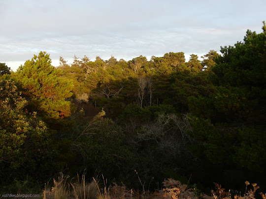
The trees were down the very long and steep edge that gave me the impression of a creek, but on the spit, it seems unlikely. There was no water visible in the sandy bottom. I decided not to step over the edge and instead wandered along the side and across some sand traps to an even more impressive line of trees.

bushes rising to the edge where the tree tops start
Along the edge where the bushes are shaped up to the top where the tree tops start.


tree tops above
Up a sandy hill (with little sand verbena) to more tree tops over the side.

dunes to ocean
More of the sand dunes out to the ocean.


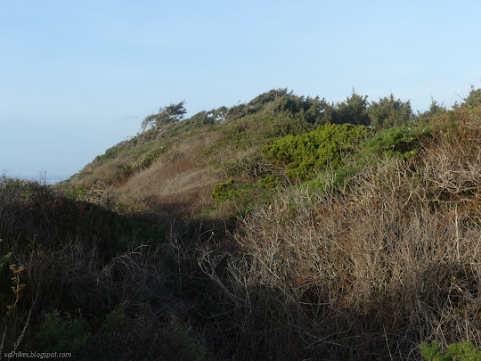
The trails in the area far from the ocean have a tendency to go strongly along, then suddenly stop. I met a lovely patch of increasingly tall blackberries on one and other random stops before I found myself once more among trees.

little mushrooms sprouting from sagebrush
The mushrooms have returned after a brief rest in the dry months. These were on a former sagebrush.


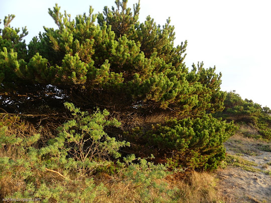
The trees were taller and the slope shallower, so I continued along under them. I spotted other trails back away from the ocean, but tended to crossing low space.

lichen dotted trunks with trees further back and bushes between
Following trail beneath the trees.

standing tall and somewhat broken
Shore pines standing tall, at least they look so from this angle. They're still down in the ditch with the rest.


Once again, the trail just came to an end. I did meet trail coming in from the road side and going out toward the ocean on the way, so I decided to follow the one back toward the ocean. It ended too. I was feeling the lateness of the day and really wanted to get to the beach for that variety of experience. I also wanted to get back to the parking, which I'd neglected to note if included a gate (it doesn't) or when parking was legal (5AM to 10PM, so lots of time). I decided to march out across the ice plant winding around the blackberries. The blackberries threatened slightly until I got to the main trail through the dunes paralleling the beach.

gentle fall and rise of land
The dip of the land among the sand hills.

pines at the edge of the sand and dip
The short ones are also shore pines (Pinus contorta var. contorta), very close relatives of Sierra lodgepole pines (Pinus contorta var. murrayana).

ice plant for ages
Looking across the dunes covered in ice plant, I was pretty certain I could get to better used trails without getting stuck by blackberries.

ice plant in patches with dune grass on much of the sand dunes instead
The ice plant doesn't seem to be winning quite so decisively closer to the ocean.


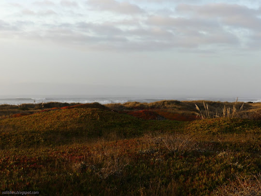
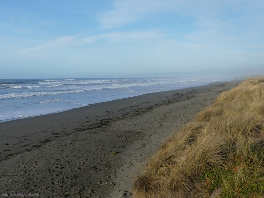
From the main path, I found a nice trail to the beach. I could see no one to the north, but there were a few people waiting for the sunset to the south. I started south.

sand and footprints and waves
A little bit of north from the edge of the dunes.

south with a bright yellow blob
Looking south includes an eye full of sun.

foam rolling over itself behind birds
The birds rush in.

foam spattered flats show when the waves retreat
And then the birds rush out again.


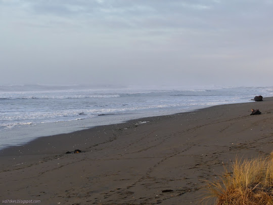
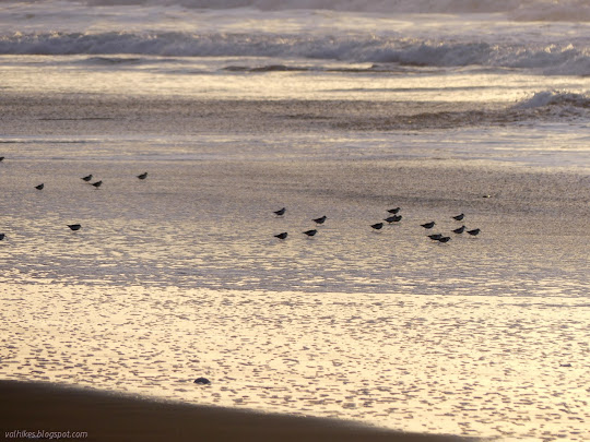
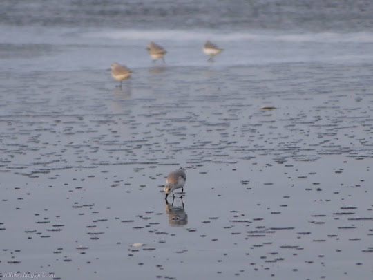
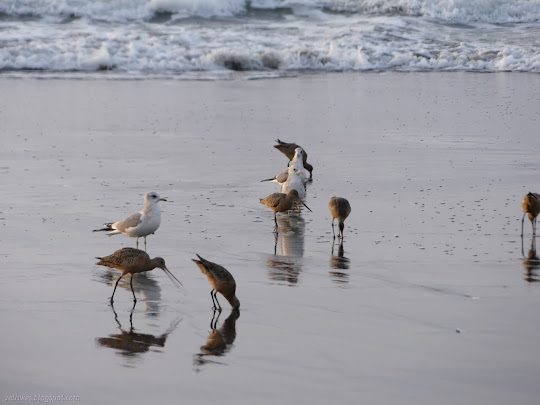
I stuck to a meander to watch the antics of the little shore birds.

birds with beaks in the sand
All the running around is in service of getting the sand crabs just below the surface.

little birds a little taller than the foam rolling in
The foam rolls over itself and the feeding birds are ready to run once more.

tiny birds facing off the waves
Out to face the waves again.

a couple birds finishing flight
Sometimes running just isn't fast enough.

beach cleared of some prints
Following people back toward the parking as the sun nears setting.

pulling up some food
One left while the others run off after the surf.

in flight in front of the sun
The little sanderlings took off into the sunset.

brown birds landing
The godwits arrived for more foraging antics.

gulls among godwits
Feeding among the gulls did carry the danger of one trying for a steal, which it did.


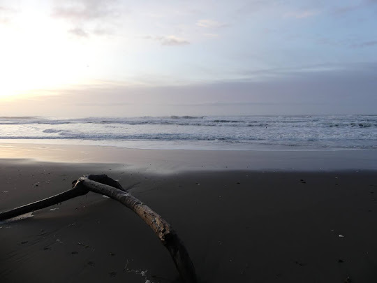
The path coming in from the parking lot was sufficiently large that I knew I was passing it as I did. I still had some time to hang out on the beach and I was parked at the other end anyway. I made my way up a much smaller trail a little further south.

person in the surf
The incoming waves didn't look so big, but maybe that was for a lack of scale. About a quarter from the right is a small black spot which is head and shoulders of the one person who decided to play in the surf.


©2020 Valerie Norton
Written 20 Dec 2020


Liked this? Interesting? Click the three bars at the top left for the menu to read more or subscribe!


Comments

follow by email

popular posts:

Jennie Lakes: Belle Canyon and Rowell Meadow

Mount Lassic

Lost Coast: Cooskie Creek Route

If the Map's Wrong, Fix It!