Posts

equipment list

Image
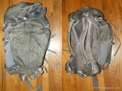
Back in July, I mentioned I took off backpacking into the West Elk Wilderness with a 36 pound pack . Since I had about 10-11 pounds of food and water, that left about 25 pounds of gear, which seemed like a lot. Really, it shouldn't be too hard to be at a 20 pound base weight and much smaller weights are not too outrageous. I didn't have time to analyze it then, but I do have time now. So, here is a gear list which will show where it is and where it could be. Weights in bold were in the pack. So, what's in the pack and why does it weight that much? What could it weight and leave me still happy to be out hiking? Big 3/4 backpack The pack is a Gregory Jade 63 from when Gregory decided they were going to reduce the weight of their packs a lot. I've got a 50L pack from just before they cut the weight which comes in over 4 pounds and carries a lot more weight more comfortably. This one is fairly straight and tends to slip down. However, it does come in at 1650g...

Arcata Ridge Trail

Image
Arcata Community Forest ( map link ) I got back to Arcata just in time to participate in a volunteer work day on the long awaited last segment of the Arcata Ridge Trail. It was a little closer to finished than the work solicitation email seemed to imply. In fact, there was a city worker along for this one who had placed a couple signs in the ground before we got there and the trail was officially open! It's also a little steeper than originally designed and a bunch of crushed rock got vibrated into place at the bottom to try to mitigate the worst of it on that work day. I came back a couple days later to finally, truly, hike it end to end. Not like that last time . There's still projects waiting to happen, like replacing these narrow steep steps that are meant to give a worker access to a water tank and have been pressed into service as main entry to the Sunny Brae part of the Arcata Community Forest So up the steps and past the signs with maps and rules and even a b...

Gray Falls

Image
Six Rivers National Forest ( map link ) It was a geocache that brought this spot to my attention. I didn't find it or anything, but sometimes there's more important things to a geocache than being there. Well, for me who is a hiker who geocaches rather than a geocacher who hikes, anyway. (I might be part of a very small minority.) There's also a Redwood EdVentures Quest to bring people here. I didn't have signal or the PDF nor are there any brochures provided, so couldn't do it. The map on it would have been nice since neither the Forest Service topos nor OpenStreetMap had any information on the trails. (Another on my list of things that need editing on OSM. At least that's one that can be fixed.) There's signs out on CA-299 for Gray Falls to help find this spot. Take the right fork on gravel too narrow for any attempt at passing 0.5 miles to the picnic area with tables and a toilet and a small trail system. Kiosk under the tall trees at the picni...

Hat Creek Rim, Hat Creek, and Subway Cave loop

Image
Lassen National Forest ( map link ) I had a hike planned with more miles than hours of daylight, which requires getting an early start. I know, some people just walk fast, but that's incompatible with taking way too many photographs, checking out all the flowers, trying to catch all the birds and lizards and everyone else out on the trail. So I got up in the dark and got moving before the sunrise. I had second thoughts about getting going quite so early, and ultimately started exactly 5 minutes late to get out to the edge of Hat Creek Rim for the best of the dawning light. Trailhead on the Pacific Crest Trail (PCT) a quarter mile north of the Hat Creek Overlook The area burned in the Hat Creek Complex in 2009 and there's hints that there was once a much larger forest here. There's a lot less burn and a bit more recovery to look at than on the last hike along the Bizz Johnson . It's still a bit, well, scrubby. Leaves the view clearer. Trail through the old ...

Bizz Johnson NRT — Devils Corral to Goumaz

Image
Lassen National Forest ( map link ) I enjoyed my time on the Bizz Johnson National Recreation Trail yesterday so much, that I decided to try the other direction. It's the same easy railroad grade until it gets to the crossing of CA-36. The train went right across this highway that didn't even exist when the tracks were built, but the people get the only piece of this trail that is not considered accessible as it drops down to cross under the bridge, then climb back up to the railroad grade above, both at greater than 3% grade. Gate upon arriving at the CA-36 right-of-way. Trail drops downward to the left. The actual old grade has already gone to the right. Looking up to the CA-36 bridge over Susan River (and the moon below it) The railroad bridge and the old Lassen Highway bridge Trail gets back on grade just before the biggest bridge over the Susan River. It comes with a lovely interpretive sign about the bridge that includes a lot of pictures. The railroad b...

Bizz Johnson NRT and Southside Trail Loop

Image
Eagle Lake Field Office BLM ( map link ) The Bizz Johnson National Recreation Trail is a rails to trails project following the Fernley and Lassen Branch Line of the Southern Pacific Railroad. It travels 25.4 miles from the Susanville station to the Mason station on old railroad grade, then continues on county roads (modified grade) to the Westwood station. It would be a pretty easy thing to through hike. (There's even bus service to make a one way hike or bike easy.) I was interested in the segment between Susanville and Devils Corral (named for sounds the wind makes in the rocks, supposedly) where both tunnels and many of the 12 bridges (11 from the railroad days) are found. Additionally, there is the Southside Trail, which gives a secondary route for a little different experience along this section. There are multiple connectors between these two trails, so a number of loops are possible. Small train stop themed information kiosk at the Devils Corral Trailhead The tra...

Water Canyon and Sonoma Peak

Image
Humboldt River Field Office BLM ( map link ) The Water Canyon Recreation Area is tucked away in one of the canyons of the Sonoma Mountains that happens to to flow with water year round. It's not a very big stream, but was one of the main sources of water for Winnemucca when the city was young. Today, it hosts free camping at designated sites, roads for off highway vehicles, and hiking. I went to the very end of the road and got lucky to find the last site empty. Mine! (For up to three nights, which is the maximum stay.) I decided to head out hiking on a combination of ATV trail and cross country. First up to an old mine, then the little bit more to the ridge to walk around the edge and back down the other side. There's a couple different options for coming down that other side. I let the canyon get a little bit of light before starting out. My future route down and the information kiosk on the far side of the turn around and parking at the end of the good road in Water...

Hennen Canyon: Ruby Dome

Image
Humboldt-Toiyabe National Forest ( map link ) DAY 1  |  DAY 2 The morning wasn't nearly as cold as I expected it to be. I packed up my gear, that which was needed to hike in my pack and that needed for camping into my liner bag. I crossed back over the dam and found a spot to tuck it away among some bushes and a log. Sunlight touches the peaks over Griswold Lake I found the trail again and started climbing. There were a few more sites people use for camping up that way. I'd been hoping for morning sun when I made my location choice. While the light is approaching where I camped, it still isn't there or anywhere else near Griswold Lake There was a little bit of hope involved in finding the trail climbing again, but once it was climbing it was easy to follow until things got rocky. It was also steep. Once in the rocks, there's choices. I ended up climbing a bit I wasn't sure I'd be comfortable going down. It was something to worry about later. ...