Posts

Etna: Etna Mountain, Meeks Meadow, and Paynes Lake

Image
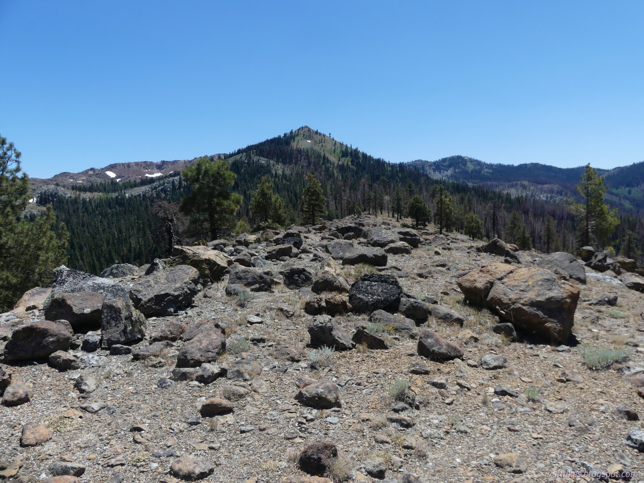
Klamath National Forest (red lines, map link ) DAY 1  |  DAY 2  |  DAY 3 My plan for day 2 was simply to continue along the Meeks Meadow Trail exploring the nearby lakes, then a short way further south on the PCT to Paynes Lake. Since I'd already done the first 2 miles to get to Ruffey Lake, I had plenty of time to head up Etna Mountain, also on my list of desirable excursions. Here comes the sun, almost to camp. See the tent in the rocks? I expected Etna Mountain would be a common local hike. The mountain isn't super high, but it stands out from the main ridge so that it'll have a grand view. It's only 3 miles from the major trailhead on Etna Summit to the top of the mountain, so very doable even in a half day. The first 1.5 miles is on the PCT, 0.5 miles on Meeks Meadow Trail, and the final 1 mile is cross country, but it wouldn't feel that way if it was regularly traveled. Turns out, it isn't regularly traveled. Checking Peakbagger, I found it ...

Etna: Ruffey Lake

Image
Klamath National Forest (green line, map link ) DAY 1  |  DAY 2  |  DAY 3 I got a nice warm solar shower and a day in Etna getting my batteries charged (my solar panel is attached to my trailer and I didn't bring it along) and a little time on the internet. Then I headed up to Etna Summit with an overnight plan for a little more time in the Russian Wilderness. Unfortunately, spending the night anywhere around there wasn't very attractive. Fortunately, I still had plenty of afternoon to bump my plans to three days starting with the short hike to Ruffey Lake. It's about 1.5 miles on Pacific Crest Trail and another 0.5 miles on well used side trail. Heading south from the large parking area just south of Etna Summit, a road leads down the the PCT leads upward. West from Etna Summit across some of that vast parking area. We have more grand peaks to the south! East toward Etna from Etna Summit. After three miles, this is private logging land. The tra...

Russian: Pacific Crest Trail

Image
Klamath National Forest (blue line, map link ) DAY 1  |  DAY 2  |  DAY 3 After the "easy" day that included pushing myself up a very steep hill for over 1000 feet to a big boulder strewn peak, I was looking forward to an actual easy day. Just 7 miles back down along the nearly clear (one tree down) Pacific Crest Trail. I didn't even go ahead and wander down some random amount of PCT north prior to going south. First I hung around camp a bit watching the newts. They were thick in the lake where the sun would get to them first. There's 10 of the at least 14 newts counted in the nearby shallows. And horror of horror, they were surrounded by foam. All the rain the day before had kicked up bubbles that hadn't gone away. You only need a freezer bag to be your bucket to be able to take water away and be safer with soap use. It doesn't have to be this way! Little orange toes! (The whole underside is bright orange.)

Russian: Bingham Lake and Russian Peak

Image
Klamath National Forest (orangey lines, map link ) DAY 1  |  DAY 2  |  DAY 3 Day 2, my planned easy day! Just 4 miles around from Waterdog Lake to Bingham Lake near the Pacific Crest Trail. The only complication is that there's no official trail up from the PCT to the lake, but the contours are slightly less close than the ones where a trail does go. Also, the PCT through hiker I chatted with the day before relayed reports (on FarOut) that there was a scramble trail up to it. So not that big a complication. Looking down to the unnamed lake just above Lower Russian Lake. But I couldn't leave it just at that. I had developed a couple "little" excursions over the course of the previous day. The first was a result of checking for geocaches. I found two. One was just under half a mile from Waterdog Lake and the other was along the official trail to Bingham Lake. The latter wasn't so interesting, but the former promises a view of both Lower Russian Lake ...

Russian: Siphon Lake, Russian Lake, and Waterdog Lake

Image
Klamath National Forest (reder lines, map link ) DAY 1  |  DAY 2  |  DAY 3 Well, I didn't go to Etna. With the Russian Wilderness so close at hand, I couldn't leave it unvisited. It isn't very big and sits back from any major road and has a distinct lack of obvious trail loops, so the how wasn't entirely clear. I decided that the premier entry would be via the Pacific Crest Trail from Carter Meadows Summit. I slid right back into the exact same parking spot I had before among the burned trees, but this time turned my attention to the greener side of Cecilville Road. (There isn't parking on the far side until the second crossing of the PCT and Carter Jack Road a mile up the trail. It's a low standard road and I decided not to risk it although it doesn't look that bad.) What a difference a direction can make. The PCT quickly gets lost in the green pines just right of center on the far side of Cecilville Road. I didn't have much planned and ...

Boulder Loop: Pacific Crest Trail

Image
Shasta-Trinity National Forest Klamath National Forest (purple line, map link ) DAY 1  |  DAY 2  |  DAY 3  |  DAY 4  |  DAY 5  |  DAY 6 Morning and I had to start finding the trail again. This turned out to be harder than expected. I couldn't see the trail I'd been on the evening before. I had to relearn what little clues I was using to find it. All the questionable trail was getting to me even if most of it had worked out. Little vegetative cobras occupy the meadow. (Or California pitcher plants.) But I knew some specific spots the trail passes and it should get easier to find once out of the meadow and, well, it was. Mostly. Eagle Creek and the benches. More of the north and east side of the canyon around Eagle Creek. I found a few obviously used camp sites as I made my way up the hill. Each had easy water access while all but one wasn't actually on the water. None had quite so nice a view as where I stayed.

Boulder Loop: Mill Creek Lake, Washbasin Lake, and Big Marshy Lake

Image
Klamath National Forest Shasta-Trinity National Forest (blue lines, map link ) DAY 1  |  DAY 2  |  DAY 3  |  DAY 4  |  DAY 5  |  DAY 6 Before leaving East Boulder Lake, I had an excursion planned to see Mill Creek Lake and Washbasin Lake. Morning sunlight alights on the far peaks of the Russian Wilderness. So I took off on the trail below my camp. As long as it was near the lake, it had lots of footprints. As I started climbing, every one of them vanished. I got distracted trying to find the "real" trail after a long fallen 4 foot thick tree on an early switchback before just getting on with the rest of the turns. The lake slowly lit up as I climbed, but I stayed in shade almost to the top. A mundane start going over the top. But it improves quickly. Trail is good down to the edge of the meadow, then nothing. The map suggested continuing along the rocks above the meadow, but there's not trail there either. I ju...

Boulder Loop: Middle Boulder Lake, Cement Banks, and East Boulder Lake

Image
Klamath National Forest (green lines, map link ) DAY 1  |  DAY 2  |  DAY 3  |  DAY 4  |  DAY 5  |  DAY 6 Morning at Telephone Lake. It's a funky looking thing. Perhaps the two lobes look a bit like a telephone receiver with enough foreshortening? I would run into clues for another reason to call it Telephone Lake later. The water is significantly below the rim and below the high water mark. Telephone Lake The nicer view of Telephone Lake. The rocks at the back glowed nicely in the sunset, but I didn't have my camera with me as I watched it. I took off down the trail. It's all rather badly burned. Hoofprints marked where the equestrian went. I got upset at how much milling and messing up the trail he did until noticing that the milling prints are the two toed ones of cows. Cows are trying to lead hikers on this trail astray at a few strategic points. The horse prints managed not to be lured and neither was I. Makin...