Eclipse: Strawberry Basin
Malheur National Forest
Click for map.
DAY 1 | eclipse | DAY 2
Around about noon and finally getting underway, it does not take long to tuck away everything into my pack back at camp and then keep on going down the mountain. One turn and we are dropping down into new areas. The map shows many springs in this area, but the first few are not visible to me. Just past an old cabin, there is a little water and it grows a bit as it pours downward through flower filled meadows.


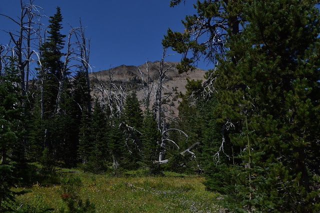

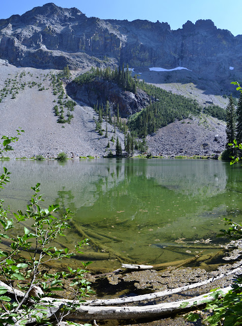
The land starts to drop away and we get a view of Strawberry Lake below. There is no view of Little Strawberry Lake that I notice. We will have to take the spur to go and see that.

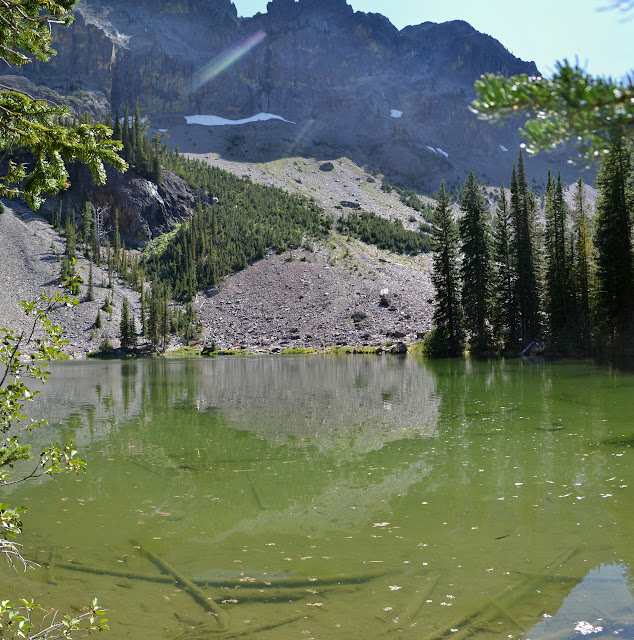
We can hear the waterfall as we reach a junction. It takes some reminding that we do not have to go up any of the stuff we have just gone down, but Martha agrees to go check out Little Strawberry Lake. It is a little bit of up beside a nice creek flowing well, and then a little more up to get over to a second branch of the drainage where the outflow seems a little more stagnant. The lake has a few swimmers and a lot of campers who do not appear to be leaving today and even a group coming in for the night.

My attempt to find a place to photograph the lake takes me out to the meadow at the end. It is a wide open space and quite nice as itself, but no good for afternoon pictures toward the lake. Heading back along the edge, we rest a bit with snacks. I watch the fish from logs beside the lake. They are very numerous, if not all that large, and have the loveliest bright red fins.

We eventually head out again, stopping along the larger creek for water.
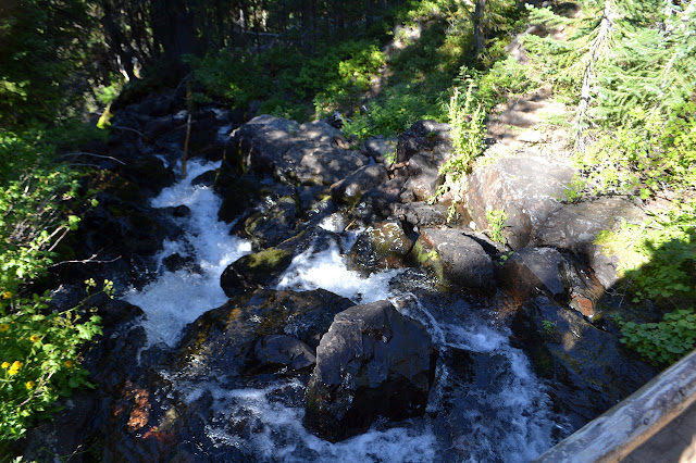
Back at the main trail, there is a bridge to cross the creek. It once had a handrail on the waterfall side, but half of that is now sitting in the creek thinking about going over in the next really big rain. Some quick turns downhill bring us from hearing the waterfall to seeing it. It is actually quite nice. We are two minutes late to the meed point, but Jeff saw fit to enjoy the waterfall a little longer waiting for us.
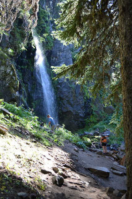
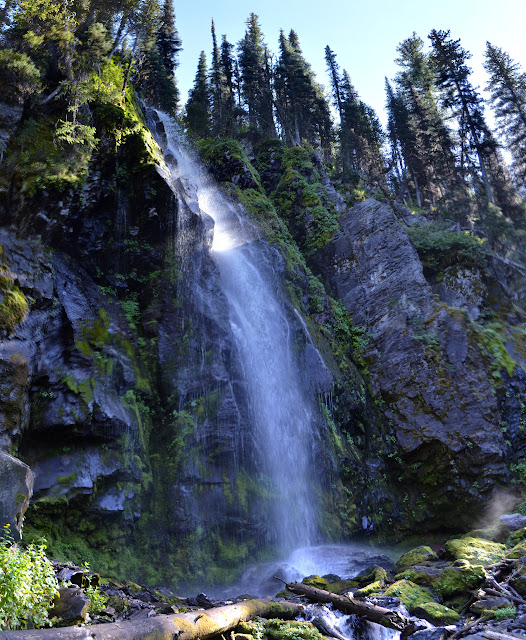
Part of the waterfall is blocked from the viewpoint from the trail, so what can one do but cross over to see it better? The rocks look like they have areas where the moss has been cleaned off by previous crossings. A few steps in these spots shows them to be remarkably deceptive rocks. They are so slick I cannot find any grip at all on them with my shoes. Crossing ends up with some slightly wet feet, but would likely have resulted in a fall if I had trusted my feet to a rock.

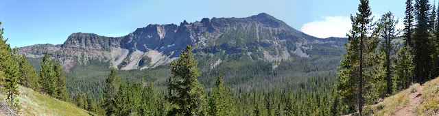
In a while, we head off down the trail. The trail has grown significantly. This must be very well used by the people in Prairie City. Who can blame them when it is two miles to a lovely waterfall? We are surrounded by thick, young looking forest as we head down to Strawberry Lake.

Trail gets a little confusing down by Strawberry Lake. There should be trail on both sides, but there also seems to be two branches of it following the short way past the lake. We drop down to a better view of it and to stop by the lake shore. I cannot find any fish in this one.

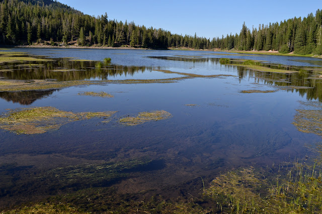
Turning around on the shore, it is suddenly glaringly obvious that this is actually the lake bed. When it is full, it comes right up to the edge of the trees where there is a ring of erosion. The lake is at least 6 feet low today and there are many campers taking advantage of this to find a site. Disturbingly, one of them is unable to look at the low lake and the way every tree has some brown needles and figure out there might be a reason for the campfire ban. It is a warm afternoon and they have a big campfire going.

We follow along the lower trail around the edge of the lake. This goes along just inside the trees where the lake would be lapping away in better years.

Stopping by the water at the other end, it looks like a common camping area. There are swimmers again, although neither lake looks like that is usual. We stop by the edge again and there still seem to be no fish. A few do jump. It is not as pretty on this side at this hour, so we head off again.

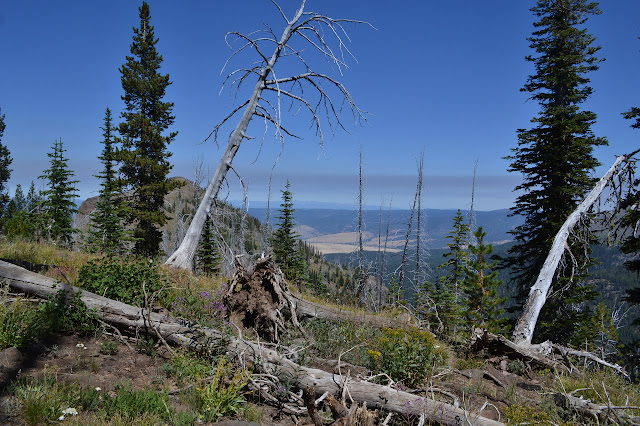
The trail heads out past the outflow. It sits dry and quiet under a collection of fallen trees that have made their way through the lake. Had we gone for the loop to see Slide Lake and High Lake, there are two marked trails for us to take. This is again twice as many as expected from just looking at the map. I am sure they connect up there somewhere, possibly even before the trail does split on the map. We just have to go down, so we take the small wiggles down beside the creek. Eventually, it does find some water to flow with.

I was expecting the worst when coming to a wilderness that usually would not see much traffic, but the crowds surprised me. I expected to see trash everywhere from people who are not common wilderness users, but there was only the sort of thing that escapes pockets and even that was picked up by someone else almost as quickly as it landed. There was one extra trail across a meadow, but for the most part the meadows were not trampled. While there were swimmers in the lakes, I was not seeing suds. Apparently this crowd knew that "biodegradable" does not mean safe to put in lakes and streams.
Crowds may be an annoyance on their own, but they really are something that just must be accepted for some places. For example, there are people who will tell you there are other places just as good as Yosemite, but there is honestly nothing at all quite the same as the 3000 foot natural cathedral you find yourself standing in when on the valley floor. It is accessible and well known, so it comes with crowds. To enjoy it, you must be able to look past those crowds and still see the nature. Interesting places to take in the spectacle exist up along the rim of the valley and, again, the accessible and well known places are full of people. There are plenty of inaccessible or unknown spots that might offer viewpoints without crowds, but it would be unreasonable to expect Glacier Point to be deserted.
I had an amazing experience, but it did seem to come with 200 of my closest new found friends. But I wanted a place accessible by trails to view it and so I started at Wilderness.net because that is an easy way to find that sort of thing. Plenty of trails exist outside the wilderness, it just takes a little more effort to find them. Many people went out from there to find an isolated spot for viewing, but I wanted "the best" and there are a number of reasons to think that that is where I went and so I had to share. While it is only accessible by trail, it is not a particularly hard one. There are at least three ways to the peak that can be done in a day before looking into cross country routes. And it is actually a nice spot. I overheard at least three people exclaiming they wanted to come again while one of those out from Portland said this was his third visit. His first time was a year or two before the big fire 30 years ago and it was the place he thought of for this.
And so I try not to complain about crowds. They do come with advantages. A couple of them hauled up telescopes so we could all look at the sunspots. Even more had binoculars that were suitable for that. It certainly makes it easier when they do not trash the place. In the moment of standing in the shadow of the moon looking out at distant country side lit by mid morning sunlight, it is really easy to look past the crowds and just see the beauty of nature around me. Crowds are what they are.
But wowie zowie, there sure are a lot of cars down at the trailhead as we leave. The lot, which is surprisingly large, is still crowded and so are the road sides. A lot of people are not leaving today. Many just do not want to face the traffic today and many want to see the place they came to visit. With all these cars and the cars on the other road, we must have only seen a small fraction of the crowd this wilderness absorbed for the weekend.
©2017 Valerie Norton
Posted 5 September 2017
Liked this? Interesting? Click the three bars at the top left for the menu to read more or subscribe!


Comments