Goddard Campground and Picnic Area, ruins on Camino Cielo
Los Padres National Forest
Click for map.
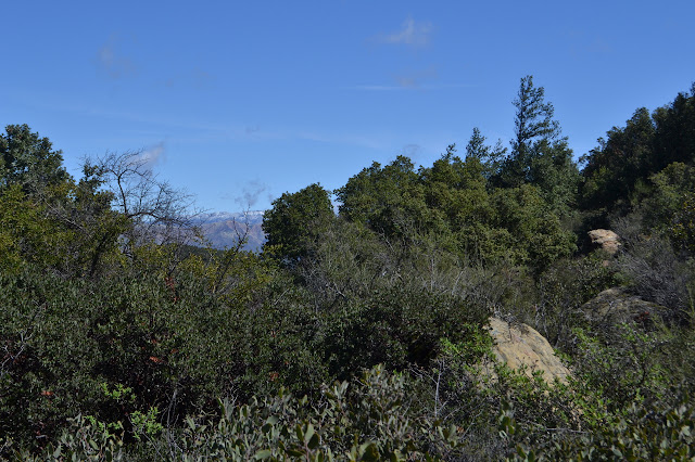
Something about the air on Wednesday just seemed to scream out to me, "You must come to the mountains!" Yet, as I looked to the Santa Ynez Mountains themselves, they were entirely crowned in clouds. The stunning air over everything else did not quite extend high enough. After another evening of rain, the morning air again seemed to shout of what a grand time it would be at the top of that ridge, but this time the ridge line supported it. Outside of my plans, but inside of what was possible, it took a little time to convince me, but I finally relented to the arguments and took to the mountains for some small explorations I have meant to do. The first is a pair of barricades across long decayed road, both of which have "no motor vehicles" signs and a break in the middle for walkers to pass. There is no indication of where walkers may pass to as I pull into the turn out next to the barricade, but there is a narrow and distinct path through the thick vegetation. Walkers certainly get somewhere.

The hole through the brush is a narrow rectangle and seems to be a doorway into a new place. On the other side, the old road is obvious for a bit, but has been buried under a large amount of cut brush. A clear path continues on the very edge. There are glimpses of a snow covered cliffy mountain partly obscured by a grassy bump to the north. Big Pine and West Big Pine behind Little Pine. I try to get a better view of them, but it seems like this whole section of the mountain just wants to look at the ocean.
Ahead, the old road plunges back into thick vegetation. It is difficult to discern as it reaches the top of the hill and whatever it was that was here before. Most recently, that was the Goddard Picnic Area. Before that, it was some sort of Buddhist retreat built by Dwight Goddard, who seems to have gone off as a missionary to China but found something he liked better there. The first and most obvious indication of anything is a water tank, but look a little harder and there is more. The path comes to a low concrete wall that is vanishing into the forest litter. It traces out a rectangle the size of a large room. Behind the tank is a larger wall, and scattered about are more small concrete foundations. A row of lilies still grow where the gardens were and there are rock walls that must also have been part of the gardens. Other flowers that commonly mark old cabin sites sprawl across here and there is even a thing that looks like an old well, although probably decorative.
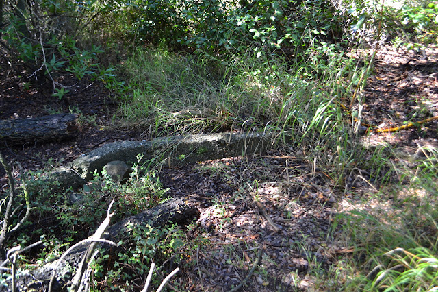

I follow a bit of trail down under a pair of odd cedar trees that no doubt were also planted. Past them, the old road becomes apparent again as it meets an old cut traveling to east and west. Young bay trees and madrones fill in the hillside and make it somewhat dark. To the east, the road becomes a thin field of poison oak, so I turn back and look to west. Someone has been maintaining the road a little bit this way. Cuts from bay trees join the iron trash that is scattered down the hill side. Most of it is food cans, but there are a couple pieces that look to be from a kitchen stove.

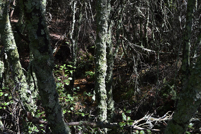
I figure the road west might lead back to my start and follow it. The road west does not go far. Trail following it curls around to the right and mostly stops at another pile of metal that used to be something more interesting. There is track crossing a tiny creek, running with the recent rains, and plunging into the brush on the other side until whoever was cutting it got tired of it. Besides some lovely madrones adorned with moss and lichen, there is not much offered by this trail.


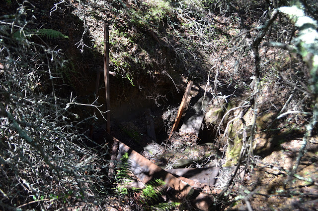
Returning across the little stream, there does seem to be some mystery just past the pile of iron parts that I noted previously. There is a giant hole with a wooden cover collapsed down into it. A couple I beams and some pipe also stick up out of it. Mining? Water? Neither seems likely for the area. I head up where the road seems to go but the current trail does not. As I continue, it seems more and more likely that there really is no old road there, just a shelf of earth. It certainly is not going to get me back to the car, so I return the way I came.
Once at the junction again, I wonder again what the road east might go to and decide to wade through the poison oak after all. I can stay to places where it is only thigh high, which should keep it mostly on my clothes and not on me. The road is distinct as it curves around and into a thicket. No one has been maintaining the route in this direction the way they have for the other direction. I could try to push through or perhaps find a way around, but I suspect there would be some minor trail doing just that if there was something to be seen where the road goes. I have waded through the poison oak for nothing and now have to return through it.

I head back to the car, but not to it because the next stop is a similar barricade a very short way down the road. Behind it is the old Goddard Campground. It sounds like it was just a few loosely organized sites in its day. Now it is a rope swing and well carved rock.


There is not much view from the camp, even from up on the rock. Oak trees have not been turning out to be as strong as we like to think after years of drought, so I do not feel any need to test the swing by it. I try to poke off into whatever areas it may have stretched before, but there is noting of note. Instead, I head a little way further down the road.


The day is an amazing one for being up on Camino Cielo. I do just barely miss one more known ruin of the area (whoops) before looking to see what one of the many trails down the south side does. It heads down to a large rock jutting out of the ground and keeps on going along a steep and very strongly established route. Maybe one day I should make a systematic search of what can be found here. Today, I am being a little more shallow, so do not continue far down it.


I head up past the car in one more bid to find a good view of the snow covered Big Pines, but this comes with little reward before climbing in and heading off to the Playground.

©2018 Valerie Norton
Posted 20 Mar 2018
Liked this? Interesting? Click the three bars at the top left for the menu to read more or subscribe!


Comments