Posts

Burro Mountain

Image
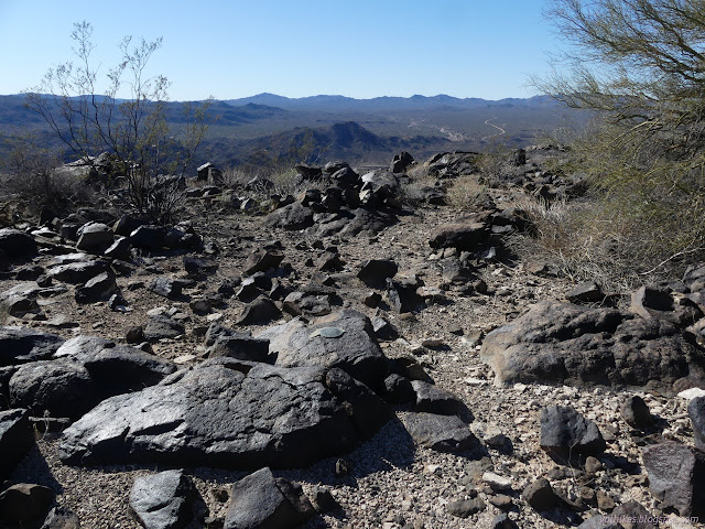
Kingman Field Office BLM (map link) I decided I would head up the peak south of my most excellent camp, thus needing no driving at all. I decided on a long, winding route following what I suspect is the old version of Signal Road, then wandering through mining areas, past a dip and up a long ridge until the final steep climb to the top. I picked out a more direct return route that had a bit more walking on the current road. Along the way, I had a variety of benchmarks I might find: section corners, road markers, and a triangulation station at the top. The Sonoran Desert certainly is taller than the Great Basin Desert. The view out over a couple section corners to where the sunsets happen from my camp. The day's ultimate goal, Burro Mountain, rises to the south past a ridge. The old road heads down from my camp area. The first hidden spot is the impassible spot for my little car. The first benchmark was within a quarter mile of my start and turned out to be quite ea...
Signal Mountain

Image
Kingman Field Office BLM (map link) I have to admit, I was a little concerned what the state of the roads would be as I drove along them, but Signal Road does happen to be a maintained one. It still gets a little rough when it passes the washes, but for now it was fine in the little car. It is maintained from US-93 to Alamo Road, another maintained road. After exploring to the west end, where I found a well used camping area, I decided to visit Signal, the vanished town that someone had helpfully signed, and the mining works that supported it. The sign did make it look like this was the private property north/west of the road, but it is actually south/east. I found more camping and a couple of groups there as I walked over to the mine. The road into Signal with Signal Mountain behind it. The tracks would indicate it's a very popular place. If pulling metal out of the ground, it seems the common practice was to contribute metal back to the ground. Mine dump with mine in ...

White Cliffs Wagon Trail

Image
Kingman Regional Park (map link) The second geocache I needed to finish off the "challenge" on at Geocaching.com was somewhere within the small and multi-looped trail system of White Cliffs Wagon Trail which is a regional park near the edge of Kingman. Where, exactly, I wasn't sure since my map wasn't up to date with that trail system. I should have photographed the beautiful trail map at the parking area, but I figured it couldn't be that hard to locate. First up, though, was the old wagon road. Along with the map, there is some history. The sign says the Board of Supervisors were petitioned to blast the road due to the 2 foot deep ruts. That would have been something to see. They are very obvious, but not quite like that, now. Parking, information and history, map, and even water for humans and dogs at the trailhead. The deep ruts in the sandstone left by the wagons. Since the techniques of driving wagons through seemingly impossible terrain have b...

Fortification Hill

Image
Lake Mead National Recreation Area (map link) The folks at Geocaching.com like to have "challenges" from time to time. Usually, they just assign points to types of caches and if you get enough points, you get a souvenir. (There's a place on your profile to find these. It's not something meaningful.) Sometimes they get a little more intricate, like the one they had running when covid hit, Wonders of the World . In this one, they assigned "wonders" to geocaches randomly. There were two levels. You needed to find one each of the "modern wonders" to get the first souvenir. Then it was on to the "ancient wonders". When covid hit, the deadline became indefinite and then two more levels were added: "natural wonders" and "solar system wonders". I got through the first three levels by ignoring it until I found I had one to find, then making an effort to find that one. It took over a year to get through the third level si...

Liberty Bell Arch and Arizona (Ringbolt) Hot Spring

Image
Lake Mead National Recreation Area (map link) Even with a hike in, a well known hot spring is likely to have too many people around. Still, it looked like a good hike and I decided to go for it. There's more than just the hot spring. There's the arch, the view points, the adventure on the not-quite-trail parts, the petroglyphs, and the rest of the hike. Access is mostly easy on a piece of the old highway, but it is a left turn across the interstate when going south. There are no bathrooms (and no timed entry or fees) at the trailhead. There is also a "scenic bridge" that looks like typical depression era highway bridge work to me. I've been over many of them and stopped at a few. I even hiked miles to one of them . I was probably over this one once, shortly after going over the Hoover Dam. The trail starts at the edge of the wash the old US-93 bridge spanned. The trail drops down into the wash and under the modern I-11 bridge, which has some picturesqu...

Corkscrew Peak

Image
Death Valley National Park (map link) (Not all of Death Valley National Park requires a fee, but this is within the old monument area where a fee is required.) There is no official trail up Corkscrew Peak, but it is sufficiently striking looking that someone decided it needed a roadside sign. I parked beside the sign where I found one of the many thin trails that converge onto a well worn use trail that climbs to the top. It's almost as good as an official trail. I was being promised morning weather including a chance of snow. I could believe it the day before as I explored Rhyolite under thick clouds, but I did the morning trail finding under an arc of solid blue. A very visible use trail going off to Corkscrew Peak in the distance. A couple puffs of cloud appearing over the top of Telescope Peak, far across the huge valley. The route drops into a wide wash where I could see remnants of trails from previous years. They all go the same place, into a short canyon with ...

Rhyolite ghost town and Ladd Mountain

Image
Rhyolite Historic Area, Tonopah BLM (map link) From Walker Lake, I took off south wanting to be set up to climb Corkscrew Peak. That gave me the whole afternoon to check out Rhyolite before finding somewhere to camp. The area itself is day use only, but there's a lot of surrounding Bureau of Land Management (BLM) lands, so that isn't terribly hard. I started out at the cemetery (south from the area shown on the map above), where there is a geocache. It's a nice one that requires one to find information on the gravestones to get the location of the hide outside the actual cemetery but nearby. It seemed like an excellent way to do such a thing. None of the original markers from when it was a town can be read (or, often, found) now, but a few people have been giving more modern markers. The Bullfrog-Rhyolite Cemetery is fairly blank, but not empty. The monument in the middle is a general one set in 1959. Most the graves are only marked by the heaped rocks now. Th...

Copper Canyon

Image
Walker Lake Recreation Area, Stillwater BLM (map link) Peak bagging is a bit of a go to for me when looking for a hike in an area without any trails. I especially wanted to go up Mount Grant, the county high point. I expect it requires permission even if one does not try to obtain the key to drive up. Bald Mountain also looked like it could be an excellent hike. There's a canyon west of Sportsmans Beach Campground that looks interesting. What I settled on, partly because I had pulled in forward and didn't want to move the car, was Copper Canyon, directly west of Tamarack Beach. A stub of road gets to it and there is a benchmark far up it implying there was more road once. It could be hiding something. I thought I might turn from the main canyon to pass by a spring, and then make a loop up through some mining history on old pack trails. First, I struck out cross country to the mouth of the canyon, stopping for quick searches for benchmarks, one near the old highway and one...