Fortification Hill
Lake Mead National Recreation Area
(map link)
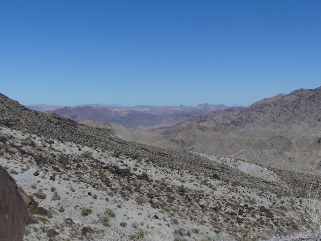
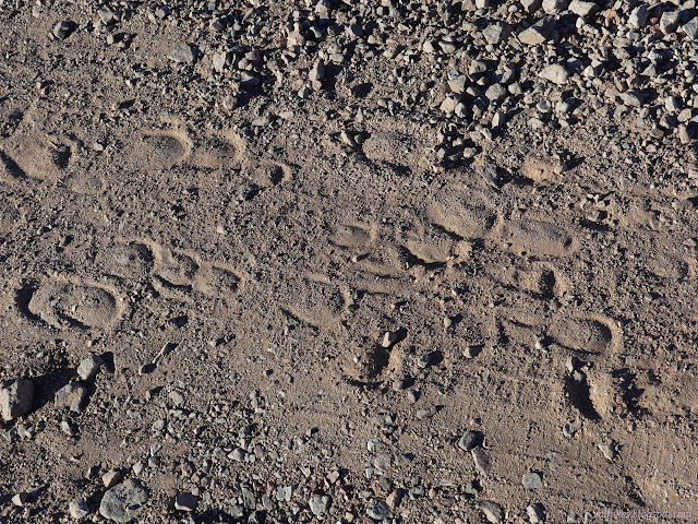
The folks at Geocaching.com like to have "challenges" from time to time. Usually, they just assign points to types of caches and if you get enough points, you get a souvenir. (There's a place on your profile to find these. It's not something meaningful.) Sometimes they get a little more intricate, like the one they had running when covid hit, Wonders of the World. In this one, they assigned "wonders" to geocaches randomly. There were two levels. You needed to find one each of the "modern wonders" to get the first souvenir. Then it was on to the "ancient wonders". When covid hit, the deadline became indefinite and then two more levels were added: "natural wonders" and "solar system wonders". I got through the first three levels by ignoring it until I found I had one to find, then making an effort to find that one. It took over a year to get through the third level since I was doing so very little finding of geocaches. I checked where I was on the fourth and last level and found there were 2 to go and a deadline had quietly been added only a few days away. I settled in with the map and found a lot I could stop by and do in some why-am-I-stopping-here? place, then I found a pair that might actually be interesting. The first was at the top of Fortification Hill. It kindly described the route up, which is a trail. OpenStreetMap kindly verified that there's a trail there, right near the end of a 4x4 road that does happen to be the Kingman Wash. The trail itself is only 2 miles long, the road to it 2.7 miles. I could still do it. The road in to that actually recommends a 4x4, but is maintained and I had no problem getting the Scion (without the trailer attached) to the bathroom marking the intersection. I got everything out and set to chugging up the wash, the easy part except that the surface is all energy sucking sand and gravel. There were plenty of tire tracks going up the road, but the only recent tracks were a line of burros (or perhaps horses) making their way up.

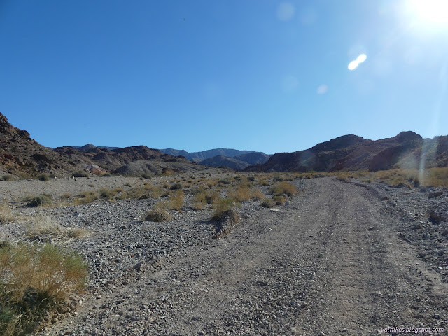
Travel is only allowed on designated routes, but the sign for the road if far enough along that it is out of sight from the intersection. After exactly a mile, I came to a pair of signs, one designating the local hunting area (no target shooting) and the other designating where it was illegal to have a loaded weapon (definitely no target shooting). Someone had unloaded their weapon in the quickest way possible at the sign. Of course.

I thought I would have to pick out a faint track to find my trail, but there was actually an official sign indicating not just trail, but scenic trail. There are two routes marked on my map, but rocks along the trail strongly suggested I wanted to take the one following the ridge instead of the one up more wash. As this was true, I let them lead me on to the real work in getting up to the top of this "hill".


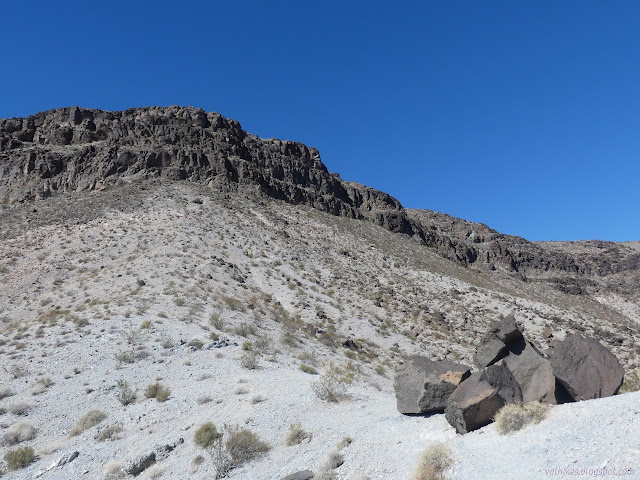
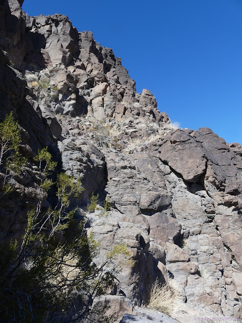
The trail rolls a little, but it really doesn't have much extra elevation gain. A cluster of dark rocks broken from the top marks the start of it getting particularly steep in a fairly direct run to the bottom of the cliffs.
When I got to the bottom of the cliffs, the trail stopped going up. It turned right although there was a little trail going left. That's the way the survey crew went, according to the reach written up for the benchmark, and there's probably been a few people having a go at it since then. They had a short vertical climb up some crumbling rock.

I came to a spot with a lot of cairns marking the way up and a scramble of a trail trying to go down and around even more rock instead. It was also a vertical climb, but the rock didn't seem to be crumbling. There were a lot of big hand holds, so I went for it, but it was rather unexpected after seeing a sign at the bottom. It was just barely far enough to call class 3, continuous hands and feet. I didn't actually put my poles away for it.
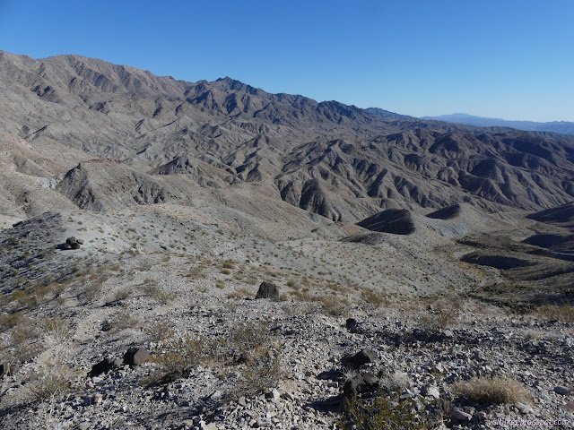
After one last bit of steep walking, I was on the top and on easy street once more as far as the trail was concerned. It heads off across the mesa top, dropping a little at first, then climbing to the peak.
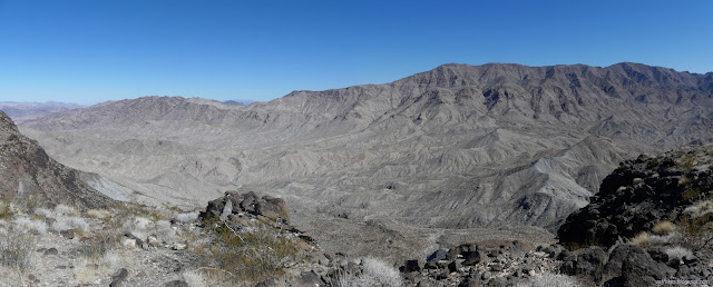
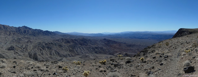


I found the walk along the top to be extremely pleasant.


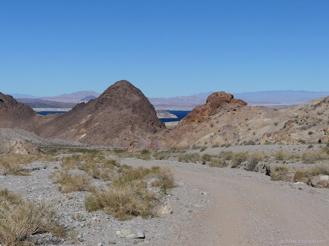
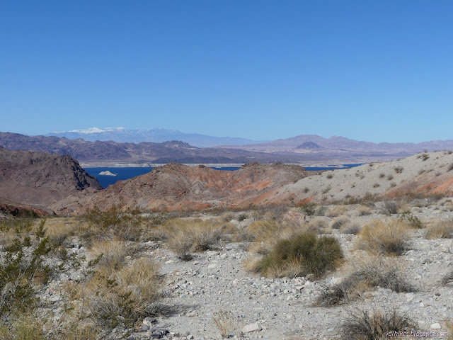
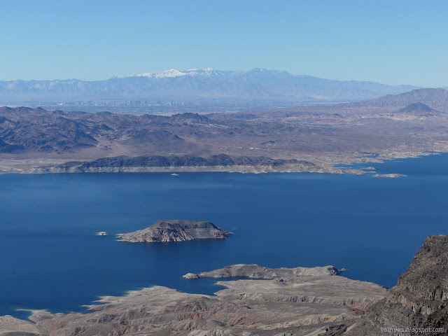
I spent a while enjoying the top where quite a lot, but definitely not all, of Lake Mead stretched out below. It is distinctly white below the high water mark. Yes, I could see my car from there.


Unfortunately, I wasn't yet to the geocache that was the goal of the whole operation. I had to scramble through the rocks and sparse growth another quarter of a mile to get that before heading back the way I'd come. I didn't put my poles away on the way down the cliff either, although I had been expecting I would.
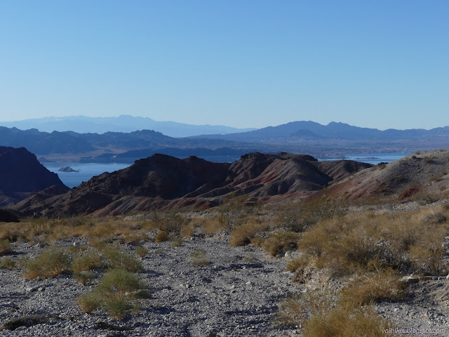
I had thought that I would take the wash route down. The trail is rather obvious where it splits and it goes steeply down from there. There is a switchback, but it has been cut enough that it is hard to get across from one part to the other. Once in the wash, there was little trail to follow. Of course, following the wash gets you there. There were a few really big steps down to do that. Although there was no extra elevation, it was a less pleasant route.

No one had come up the road while I was on the mountain and the prints on top were still just me and the burros. There had been a lot of helicopter traffic, especially in morning and afternoon. It must be a regular canyon for sightseeing tours. There were a bunch of airplanes a bit higher, too.
I tried following the burro trails instead of the road in a couple of the big turns. It was a little shorter, but not any better or easier or faster. I just had to chug down the road again, mostly. It was prettier than expected down in the wide wash. The best bit is still at the top.
*photo album*
©2022 Valerie Norton
Written 29 Mar 2022
Liked this? Interesting? Click the three bars at the top left for the menu to read more or subscribe!


Comments