Burro Mountain
Kingman Field Office BLM

(map link)
I decided I would head up the peak south of my most excellent camp, thus needing no driving at all. I decided on a long, winding route following what I suspect is the old version of Signal Road, then wandering through mining areas, past a dip and up a long ridge until the final steep climb to the top. I picked out a more direct return route that had a bit more walking on the current road. Along the way, I had a variety of benchmarks I might find: section corners, road markers, and a triangulation station at the top.


The first benchmark was within a quarter mile of my start and turned out to be quite easy to find. There was a witness post to help out. As soon as I got past thinking it must be somewhere by the bottom of the post and looked at the rock as high up as the sign, I actually did find it.

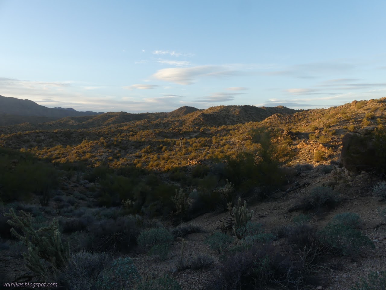
The published reach from when this benchmark actually states that it is along a "T road" leading to a mine, which suggests my instinct about it being the old road is wrong. On the other hand, it was written 17 years after the placement. There's plenty of mining that didn't get on the map. I continued on this rough track of a road finding unexpectedly good views along the way.


I got in the vicinity of the next benchmark, just a few feet past where I wanted to cut up to the main road once more, and could only find a few huge rocks. They seemed a little overly large for it, but once I went ahead and climbed the biggest, there it was.


Then onward to the short climb up to the main road. It was a simple stroll on animal paths to get there. Then I wandered the road a little longer than expected. I saw something like it was once a road where I was expecting one, but went on to what is definitely a road now. I could have taken the other, it really was an old track, but it all got to the same place. From where they meet, there is a spur to the right and more road to the left. I ended up taking both because, well, I chose wrong at first. This rose up from old mining activity to recent mining with a view.


I had a wash to traverse prior to the mesa, but it is small so near the saddle. I followed road down to powerline road, then cut across to more powerline road, and then started to climb, briefly by the road. There were good burro trails to follow heading up and across the mesa.


I got to walking along the top. More burro trails made this walk super easy. It is always surprising how much easier walking across the terrain is with even the simplest of trail.


I came to the slope, narrowly less steep than the other slopes, and looked up to find a cactus garden. But of course. There were trails up through this too, so even though they were a little close for comfort, the cactus did not bite when passed with care. It was a little steeper than expected, but the ground held nicely to walking.


I picked out a low spot to go climbing up to the road and then picked a ridge to get to it hoping it wasn't too bad. There are rock bands that look like they could be difficult. The going down was as slow as the up. At first, I had burro trails, but after navigating one rock band, I only had thin goat trails for a while.


Then I was once more on the powerline road. The actual power lines were across the way and looking rather inaccessible with the wash in between. Here, it was a much more involved problem to cross it. Getting down was accomplished by finding the right tributary. Then I walked upstream a while past something I figured I could make work to something that was almost a walk up. If I'd just followed teh road a little further up, I'd have been able to just cross with it.

Once out, I climbed. This was easy enough with more burro trails. I tended to the left since that seemed to be the lower spot. It wasn't needed.
At the top, it looked like an even easier route than the one up. I picked out three landmarks anyway and was glad I did. As soon as I started down, the view of the land ahead vanished and without the landmark based plan, I'd have gotten into some rougher country. Eventually I came to a jeep road below the main road and followed that the last few feet up.

Then I just chugged my way the couple miles to the right mile marker and the jeep road I was camped on. It was a little late for the last of the monuments, the section corners, which were just off to the side of camp. These were marked oddly on the map with one given the dotted triangle of a triangulation station while the other was the traditional red plus. I stopped by them in the morning before leaving. I got the usual one first.


I headed off in the direction of the second corner and soon found it. It was an earlier placement and had a different interpretation of the way the sections met.


*photo album*
©2022 Valerie Norton
Written 12 Apr 2022
Liked this? Interesting? Click the three bars at the top left for the menu to read more or subscribe!


Comments