Liberty Bell Arch and Arizona (Ringbolt) Hot Spring
Lake Mead National Recreation Area
(map link)
Even with a hike in, a well known hot spring is likely to have too many people around. Still, it looked like a good hike and I decided to go for it. There's more than just the hot spring. There's the arch, the view points, the adventure on the not-quite-trail parts, the petroglyphs, and the rest of the hike. Access is mostly easy on a piece of the old highway, but it is a left turn across the interstate when going south. There are no bathrooms (and no timed entry or fees) at the trailhead. There is also a "scenic bridge" that looks like typical depression era highway bridge work to me. I've been over many of them and stopped at a few. I even hiked miles to one of them. I was probably over this one once, shortly after going over the Hoover Dam.


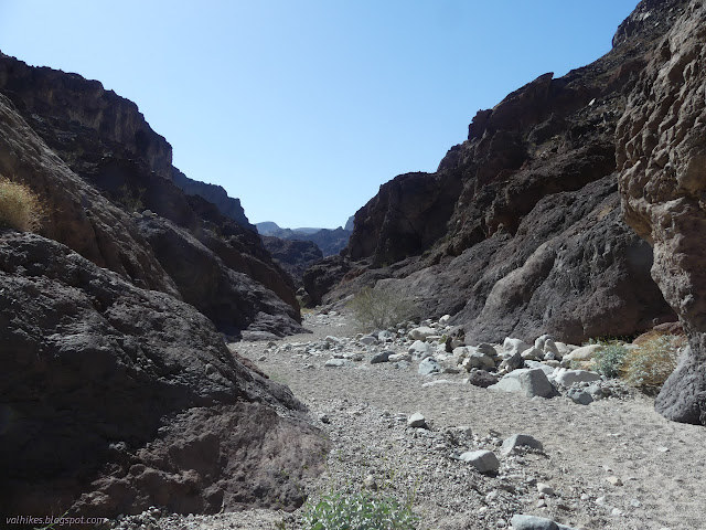
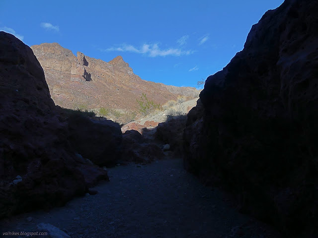
I took note of the map on the information sign, especially where it warned that the trail was many and unclear as it crossed from one wash to the other near the river below (but not, it noted, on the banks). I failed to notice the statement about a 20 foot ladder west of the hot spring. I headed down into the wash, under the bridge, and past a multitude of greeting signs full of rules, where there are also multiple trails and nothing clearly official. The trail is in the wash, so follow the wash into White Rock Canyon.


There was a sign on the left side of the wide wash noting where to turn to cross over to Hot Spring Canyon. On the far side, there was an old road clearly getting used as trail with no signs. This likely goes to a second parking area that is a dirt turnout on the side of I-11. A bit further, there was a sign up on the right for Liberty Bell Arch. I took that one and started climbing.


Nothing mentioned the mining history I would be passing, but it was very obvious as I did. There's pieces of a tram and lots of old cans and various other pieces of infrastructure and trash. That certainly helps explain some of the more road like character of the trail in places.
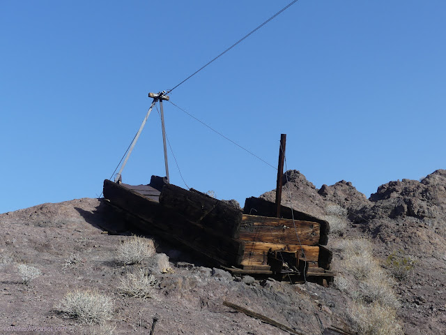
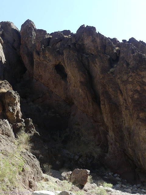
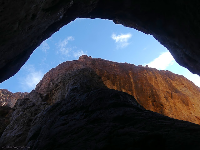
Trails went every which way including getting closer to the mine workings as they dropped off the hill. I picked a way and found reasons to go other ways and eventually to the same place as everything else. I kept going wondering where this arch might be as it should be quite close. Eventually the trail got around to an angle where the arch was visible.

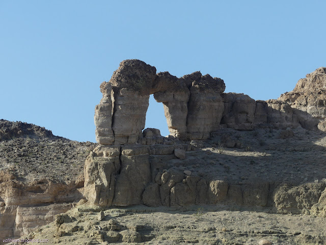
The trail keeps going and so did my plans. I wanted to see the Colorado River from the overlook. That meant climbing up and around the side of the arch. There was a use trail that approached the arch itself, which wasn't all that near to the trail. I didn't diverge from my goal at the overlook.
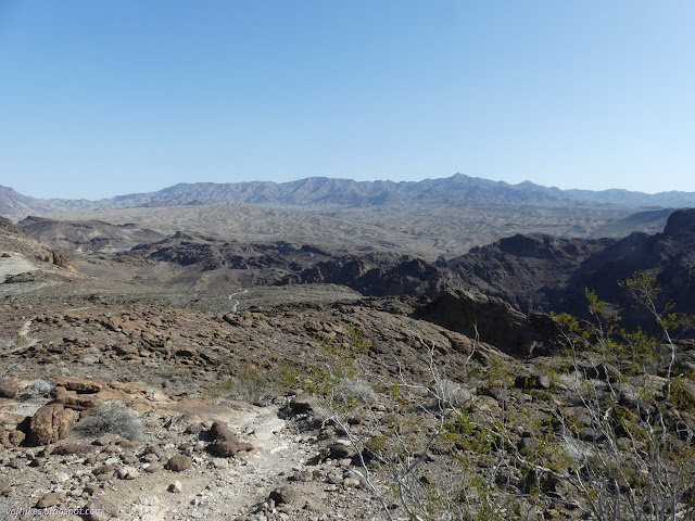

I was not quite so single minded on my way down. I had noticed that Peakbagger had a "Liberty Bell Peak" marked. At first I assumed it was the peak next to the arch, but I finally noticed that it was the slightly higher peak right next to the trail... and although I'd already let go of a few feet of elevation, I turnd back and started up it. It was a quick and fairly easy climb to sit at the top and look out once more. The river was gone from view, but other things were better.

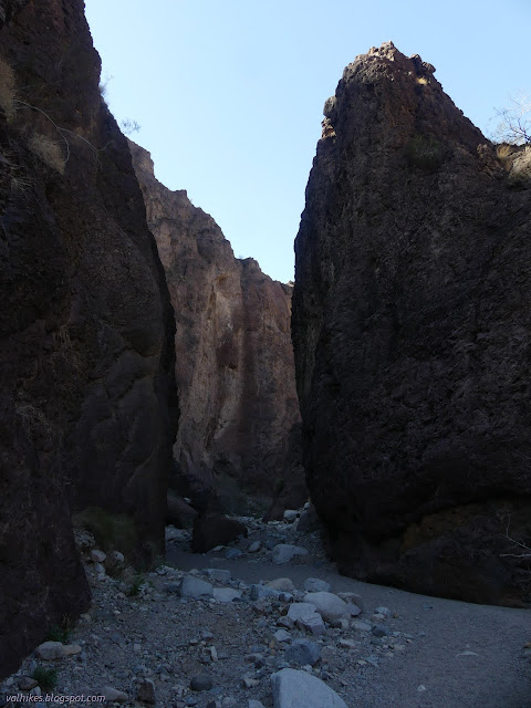
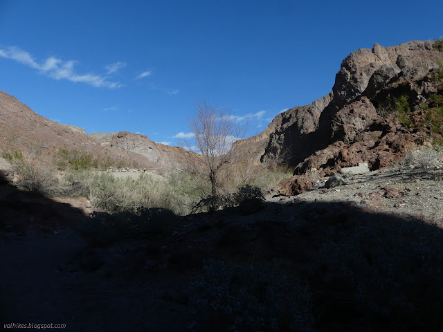
(Yes, that's a different Xero shoe. They're Mesa Trail, which look more delicate than the Terraflex, but are a lot more breathable. This day was expected to be a bit hot and almost certainly involve wading through deep water, so breathable is best. The Terraflex are one of my warmer shoes.) Finished playing on the little mountain top, I headed back along the trail and started once more down along White Rock Canyon. It gets taller and taller and twists tightly as it drops toward the river.


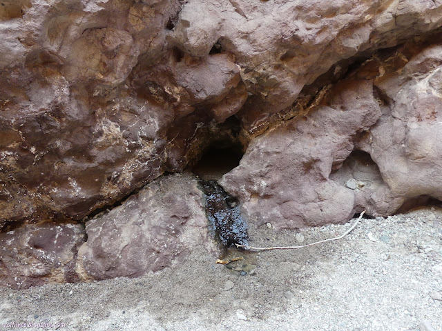
Near the end, there are a few water seeps near the bottom of the walls. They are decorated with once dissolved solids and none were very large or warm. Nothing did more than drip.
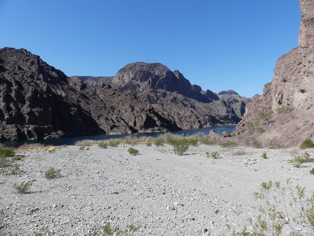
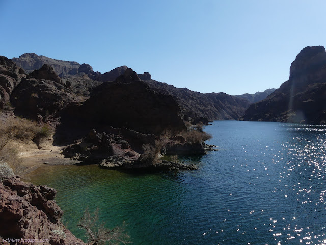
A little further, I found the gravel beach at the edge of the river. It is a bit more lake than river here, though at the bottom of the dam. There's another dam further on. People have very much enjoyed damming this river. The beach has clearly been a camping spot for many over the years.
Trails started early on climbing up and around the rocks to the left, so I did too. I was a bit early. There was a sign further down to suggest a route of travel. It does indeed tend to stay away from the edge, but sometimes does so by being high rather than far. The route is entirely not clear and while there are probably enough signs to point the way, a few have gotten free and are placed badly now. In particular, there is a spot where the route goes through a cleft in the rock that looked much worse than it was from a distance, so was not my first or second try in getting through the area. Plenty of others have tried the other routes and pounded in good trails, too.

Eventually, I found myself looking down over a canyon with water rapidly vanishing into the gravel bottom. There is a little climbing involved in getting down, but not much. Less if one takes the route going down canyon. I picked out a way over the rocks and down and then stuck with it. It was time to get rid of my socks, but first I went out to the river once more. That area is even more used for camping and there are a pair of toilets. There were also campers who came guided via the river.

Then I turned to head up. The barefoot shoes did feel fine without any socks on, or at least as fine as usual and the gravel is fairly soft to walk on. There were also a couple small scrambles through tumbling water.

There was a sign warning about brain eating amoebas that might be lurking in the hot water, then a small tub made of sandbags that wasn't all that warm, then I met the ladder. It is metal and chained in place and, according to one local soaker in the pools above, gets washed away every few years in a big rain. It was also directly in the path of the waterfall it climbs.

I tested the weatherproofing of my camera as I slowly, carefully climbed that worrisome ladder. I really wished they'd mentioned it. (But it is marked on the map at the top, so they did.) I clung to it even as I pushed myself gleefully from it and the edge. Then I came to the pools. They are built up of more sand bags. I got a smile and a nod when asking how deep they were from a soaker who had some English, but not enough for such intricate questions. I just had to wade in and test it myself, then carried my pack through it because it was nearly waist deep in spots. Surprisingly, there were no nudists. They came later.

The water felt good on muscles that were getting quite a bit of hiking in the past few days. I decided to let them soak a while. I wasn't sure how long that should be because I wasn't sure of the time. The phone, with signal from Nevada, said one thing and the GPS, knowing it was in Arizona, said another.
After about an hour, I started up the canyon once more. The hot water soak had no lasting happy effects on my muscles, so good thing they weren't that bad. The canyon dries up very quickly above the pools. There were lots of impacted camp sites in the canyon once it opened up enough to fit a tent.
I got my socks back on when my shoes seemed mostly dry. It didn't take all that long on their own. I expect the socks themselves would have taken much longer.

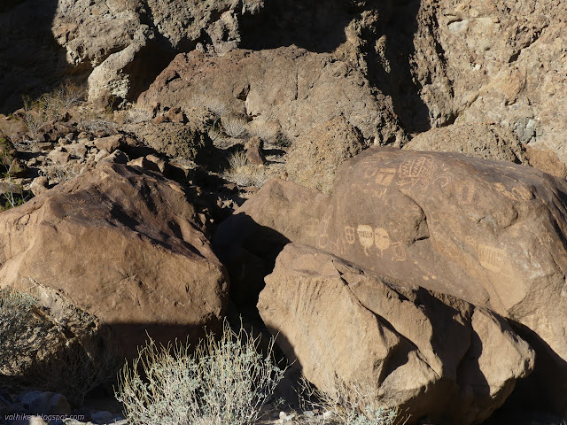
The trail leaves the canyon, but I had an old virtual geocache that promised there would be petroglyphs and a second trail if I stayed in the canyon. It even gave coordinates for one rock with petroglyphs, then asked that I find more on my own.
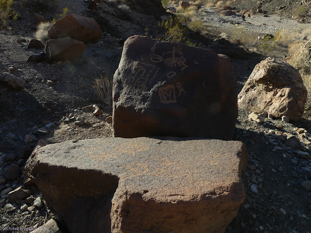
Unfortunately, people had felt the need to add to the petroglyphs in the canyon, which probably explains why the trail heads off before them. I found a few others that were showing desert varnish on the pecked areas.
The geocache also described the rest of the alternate trail including a set of climbs. The last one didn't sound like something I could really do. Maybe it was as easy as indicated. I didn't take the chance and backtracked to the junction and started up and over to White Rock Canyon via the current route. It was getting late anyway.


The second trail was obvious as it rejoined near to White Rock Canyon. There were lots of extra trails as I got very close to the canyon. People had walked the bluffs as well as the wash. I took what seemed official. It worked out, but likely all of them work out. I finished with darkness falling.
*photo album*
©2022 Valerie Norton
Written 28 Mar 2022
Liked this? Interesting? Click the three bars at the top left for the menu to read more or subscribe!


Comments