McCord Trail and Cathedral Rock
Coronado National Forest
(map link)
Finding myself in New Mexico and what do I do? Head over to Arizona to hike. I've actually hiked quite a lot of the trails around Cave Creek, but I found one I had not done. AllTrails (which is very sparse across the boot heel) is where I found it mentioned that it is inappropriate to park at Cave Creek Ranch where the trail starts and I should park at the visitor center. From memory, the visitor center has a gate on the lot and it very much gets locked when the place is not open. However, there's also a little parking directly across it and, if you are desperate, maybe some to be had beside the fence in front of it. I was on the lookout for closer parking on the way in, but then pulled in across from the building as planned. It wasn't open yet, but I did pass the person who would get to that in 20 minutes. I had about half a mile to the trailhead. Signs along the road into the ranch indicated you might be able to park there for $5 after all. They have a suspension bridge over the creek for hikers, but it was such an odd thing to walk that I decided to take the ford on the return. There was only a thin film of water running over it anyway. I passed a group of guided bird watchers and followed the road through to a small sign indicating the trail to finally get started.
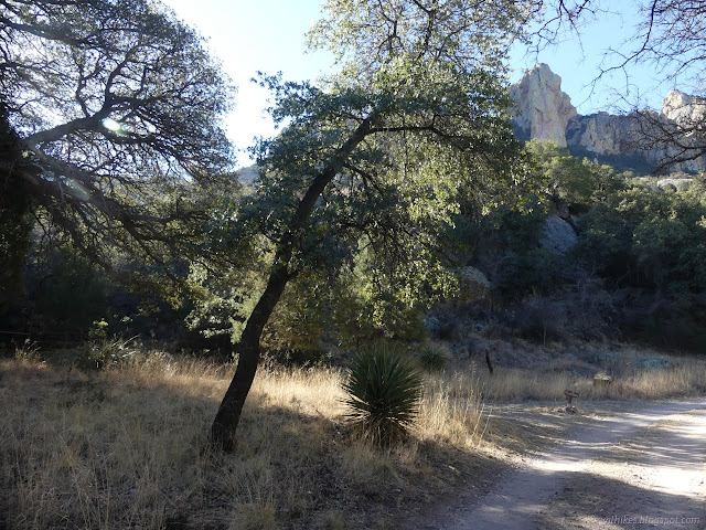
The trail passes through a fence with no means for horses to go through, which I found a little odd next to a "ranch". I didn't actually see evidence of horses along the way either, but I guess horses aren't required. I started up the distinct trail passing a couple of extra trails along the way. One might be the Portal Trail which goes around the mountain and could be used to make a loop with McCord. I wasn't concerned with that yet. I was going up. A second sign identified the area as "Spifford's Bird Sanctuary", which may or may not be an official thing.

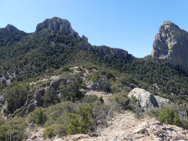
I came to a trail junction marked with a cairn and no claim as to which way I should go. Consulting the map, the right fork is a short spur to... um... well, it's not very far and I sort of remembered there was some reason to take it, so I turned onto it. It looked for all the world like a climbers' trail to the rocks above. It was usually obvious, but had quite a few cairns making sure. Admittedly, there were sometimes a couple extra trails.

When I spotted the antiquities sign and then the pictographs, I remembered why I had wanted to take the spur. I was promised petroglyphs along it! Since I had not found them, I continued along the trail which increasingly looked to be a climbers' trail. I got off it a few times and then it was game trail, then I'd find it again, or some other trail. There was definitely more than one that had been marked and one had had recent working removing a few branches. I did not find any more antiquities as I worked up to the cliffs above.

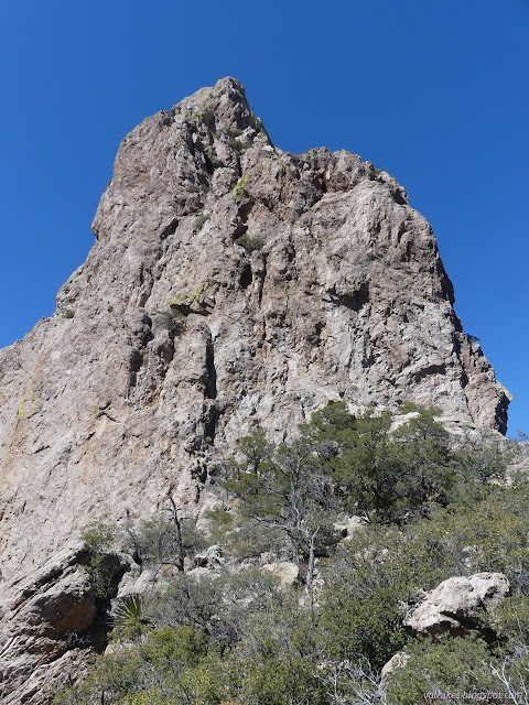
Footing got difficult as I got into some loose rocks that had been breaking off the cliffs above. A sensible human would turn back by then, but I had gotten determined to get to the bottom of those rocks. I took a little more care, but kept going. There was a reappearance of cairns in a spot where boulders and vegetation reduced the possible paths apparent to one and those were the last I saw for a while. The trail was clear again until it split with a couple branches going off to the bottom of a window. While cool, I decided I might not be ready to climb into it on my own.


I hadn't actually got to a base of a cliff, though, and there was more trail, so I kept going up. The dirt turned to rock slabs, but I picked out a ledge of less sloped rock and kept working my way up. After a little bit of that, I turned around and realized I really didn't want to go back down that way. Well, if there was a way through going up on the rocks, if I could make it to the (marked as difficult to see) trail to Cathedral Rock could be found, if it could be followed back to McCord Trail, and if McCord still goes through, I wouldn't have to go back down those rocks. They seemed to be ordered from least likely to most likely, so I turned back up and started working on the first if.

With a little bit of work, the rocks ran out and I found myself on an easy going ridge. It had more rocks along the top which looked like they could be annoying to go over. I went around the first one, then got up onto the top only to see that there really is no trouble at all just walking along. The first if was taken care of.
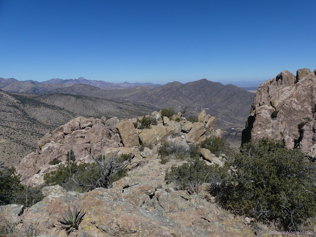

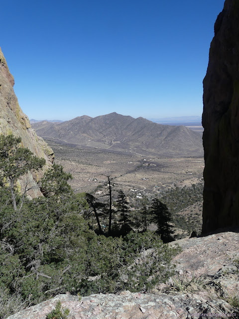
I was able to spot the trail to cathedral peak along the hillside in a couple places up ahead, so the second if looked pretty promising. I came to a spot that could, with a little imagination, be a trail, then decided to go a little further before settling for that. I hadn't crossed it yet according to the map. Indeed, just a couple yards further, there was a much nicer trail with cairns every 30 feet. The second if was settled. I was so close to the end that I turned and followed it to the base of Cathedral Rock.

When I finished with the view of Cave Creek, I turned around and got to working on the next if. The trail did have a few spots to challenge navigation a little. Erosion at a currently dry stream had forced it to climb briefly, then it drops down in the rocky bed to the old trail. Near the McCord Trail, it has several turns that could be missed as it drops a bit then climbs back up and I'm rather suspicious there's nothing specifically that it is trying to get around. There are even a number of faint possible trails that don't do this. It just seems like an extra bit of wandering that has been frozen in by suitable cairns.


That if resolved itself as I ran into the well trod switchback of the McCord trail next to a large cairn marking the junction. At that point I had a choice. I was wanting to go all the way to Hummingbird Spring. From there, I might just keep on going around to Portal Trail to finish a loop. That would mean missing a viewpoint just below me on the trail. Deciding I would go to the spring and come back, I left the viewpoint for later and climbed the short way to McCord Saddle.


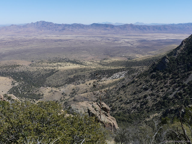
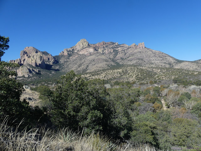
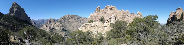
Unfortunately, as clear as the trail was coming up, I couldn't find anything that looked like trail for very long going down the other side. I also couldn't find anything looking like a spot with a spring below. There did seem to be a little bit of trail going up to the top of Castle Rock. (The trail is on the left side of the panorama above.) I decided it was time to work on the last if, stopping first by the viewpoint, which is a short spur off the main trail.

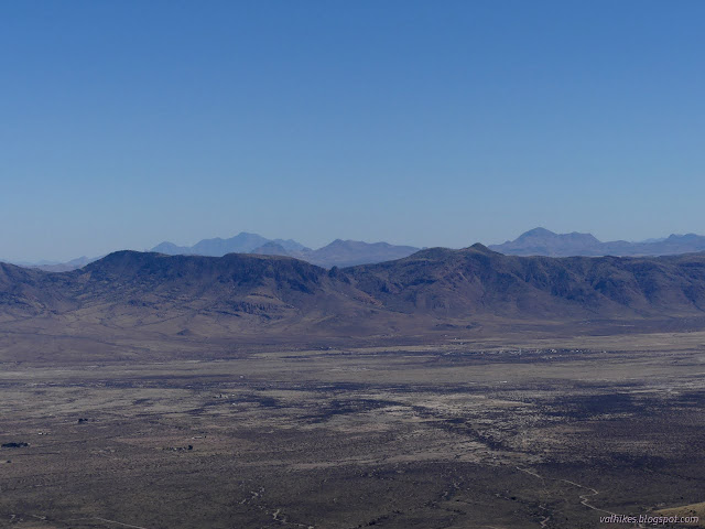
The saddle itself didn't have such a great overlook, so I walked around the big rocks to where the valley was laid out, mostly, below me.

Then I headed down the trail some more and it became abundantly clear why there was no allowance made for a horse to come through the gate. The trail is steep and full of loose rocks and randomly narrow and altogether not suitable for horses. Perhaps not for people either. I took some spots particularly carefully and others particularly quickly.

I made it back down and out the fence without incident, but I did almost slip on the mossy ford crossing Cave Creek. Then I continued the extra half mile back to the car. The visitor center lot was already locked again by the time I returned. It is closing at 3PM these days. I was glad I hadn't tried to park inside.

It felt good to get in a hike that was not only off trail and into the unknown, but a bit of proper adventure.
*photo album*
©2022 Valerie Norton
Written 22 Apr 2022
Liked this? Interesting? Click the three bars at the top left for the menu to read more or subscribe!


Comments