Coyote Hills and Coyote Peak along the Continental Divide Trail
Las Cruces District BLM
(map link)
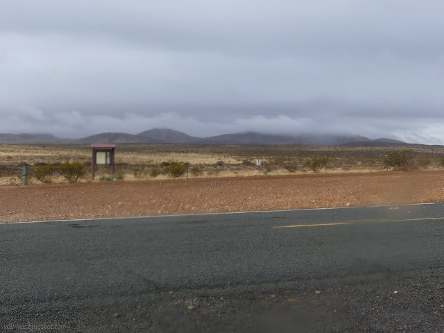
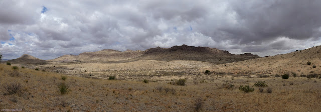
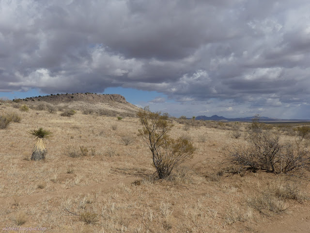
I picked out Coyote Peak, the high point of the Coyote Hills as best as I can tell. It sits very near to the actual divide and near to the Continental Divide Trail. It would be shorter from the north, but I decided it would be more interesting from the south. This was entirely due to gut feeling while meditating upon the USGS map of the area. It looked a little like rough land until I noticed that the major contours were 100 feet, which makes the minor contours only 20 feet. There's a lot of detail. I was able to make an earlier start than the previous hike via the all paved approach to the trailhead. I could easily spot the CDT by the information kiosk on the south side of NM-9 and parked trying not to block the Border Patrol roads. (Apparently they need a lot of dirt roads running parallel to perfectly good highways. I can't explain this.)
I downloaded the demo version of the CDT on Guthook (calling itself FarOut now) since I've never looked at it before and everyone keeps going on about it. It covers the trail from the monument at Crazy Cook to Lordsburg as well as a secondary trail from Columbus to Deming. It's about what I thought. It spoon feeds you your next water source and you can get reports from the other users about that. I could see how the caches got filled and dwindled away. Many reports on filled tire troughs until I fell off the current (still early) season and found the October southbounders reporting empty troughs and full tanks. As expected, the greatest value in the area is the content provided by other users.

I crossed the road and found the trail, confirming it with the help of my offline OpenStreetMap. I kept failing to get a location mark on the FarOut thing because I kept trying by turning on tracking and I didn't want to give it all the permissions it needed for that. Typical new program teething problems. I was getting pretty upset with it wanting me to make tracks by the time I finally found, hours later, the simple button right on the map to turn on location.

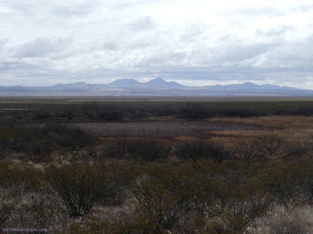
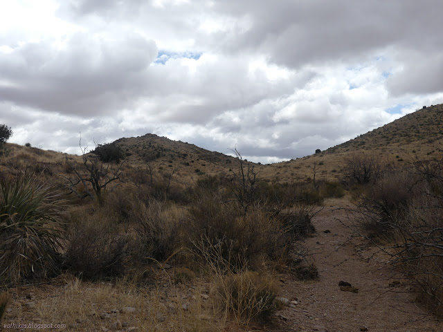
Meanwhile, the 10% chance of a measly amount (0.1 inch) of rain was manifesting well and making my west side soggy. It didn't bode well for the 10% chance of thunder in the afternoon. I resolved to try to make some reasonable time. The first two miles just gets to the hills. The trail meets a road (which connects easily to South Wells), then turns off it just to come back to it again. Notes left by hikers in the FarOut app indicated a few are rather enthusiastic about just walking the road. I expect the trail parts exists because builders are enthusiastic about it one day following very little road. Feeling support for the builders' viewpoint, I walked the trail as best I could when I could. Some places are obvious and some places have too many cow path choices that look just as likely.

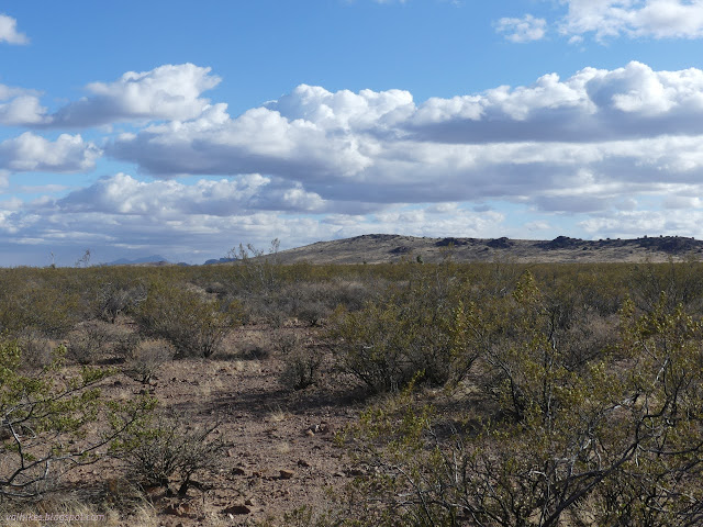
The rain didn't last and by the time I was getting to the hills, I was getting some chunks of blue sky. Across the valley, it was still dark, and a strong wind was blowing.


Once back on the road, there's a gradual climb with no difficulty finding the route. That certainly gives the road one advantage.

I ran into the day's through hiker beside one of the tire cattle troughs along the way. He went for the water in the tire even though there was a metal tank one could climb. It did look alright even if rapidly filling with green. If it was dangerous algae like that warned about in Redwood Creek, it wouldn't be any good for the cattle either. I didn't actually need water, but I still wanted to climb the metal tank. It couldn't exactly be called safe as only one side of the ladder is attached still. More interesting was a floating circle of wasp nest with three huge insects resting on it. I scrambled for my camera, lens cap off, let it turn on, try to get secured enough to use it... the little mat slowly drifted from directly below the opening to a place too dark and far to photograph. No big green and yellow maybe wasps to add to my iNaturalist collection. I chatted with the fellow gathering water. He didn't seem to quite grasp that I was not also through hiking with my 28L pack cinched down as far as it goes. I came here for here! Then I started to stress about getting up and down the little peak before the 10% chance on thunder and took off.

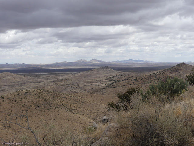
Then I arrived at a crossing of the Great Divide. It isn't marked. Water flows east to the Atlantic and west to the... except wait a minute. Peakbagger shows the drainages for some of the peaks and I'd noticed that in this area that is Animas Valley or Chihuahua Basins, part of "Worldwide Internal Drainage". The water from Coyote Peak doesn't get to either ocean. The divide actually comes north along the Animas Mountains to South Pyramid, then shoots east and swings along south through this area. There's a second divide shown on maps over by Deming (where the secondary trail on FarOut (and other sources) is found). Here, water drains east to the Pacific and west to the Guzmán Basin. By the time the trail crosses again, it is the more traditional configuration, but not here.
The road ran into the New Coyote Tank and the trail actually quit it just short of the end on the off chance that gets filled with some water, like in monsoon season. People aren't taking that bit of trail, though, so it's hard to see and hard to spot the turn across the north side of the tank if you do go with it. I tried to catch the trail while climbing north out of the tank and missed it. The other hiker skipped the first turn and caught the second and since he timed it for while I was wandering the wrong way slightly, he made a helpful signpost to point out the rest of the signs.

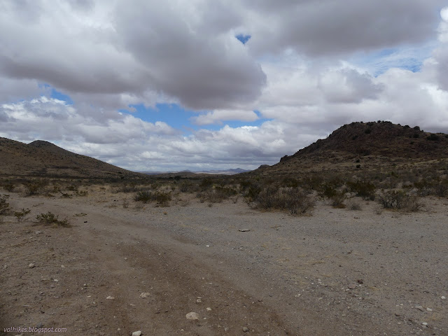
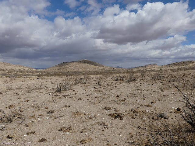
It was really time for me to take off from the trail anyway. I struck off west, navigating small but steep edged washes on my way to the outflow from New Coyote Tank. I found a nice cow trail into the next drainage, then worked my way up it until I realized I should have just crossed it and started climbing. I had picked out the wrong peak to climb.

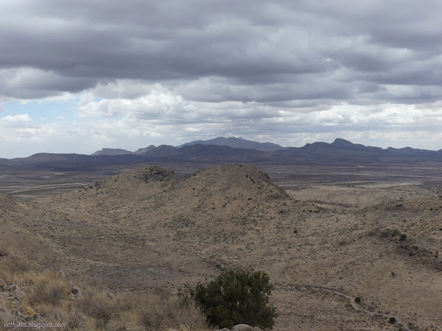
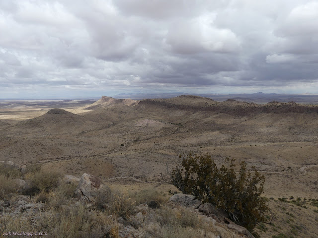
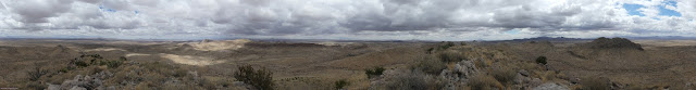
I worked my way north and upward and across a gully. The wind hadn't stopped blowing and as I came around the north side, I got a bit blasted and retreated back out of it. There were only about 400 feet to climb to the top. Cow paths come and go on the way and it gets steeper toward the top, but it is not too bad.

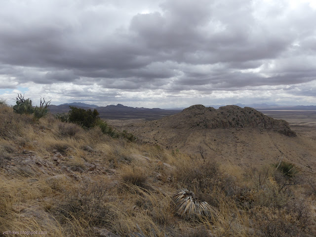
The wind wasn't too terrible at the top and I spent a little bit of time up there.
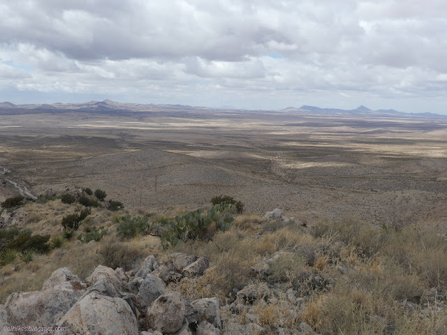

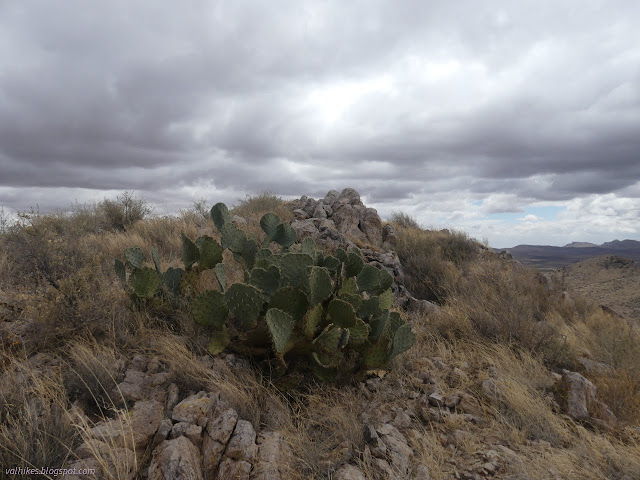
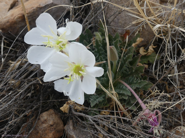
I headed down the way I'd come up. The chance of thunder hadn't yet manifest as anything and I took a little more time to observe the plants.
Once down off the mountain, I followed the wash up to the little dam that makes the tank. There was an easy cow trail up and over it. It was much better travel than the little bit of trail and the small, steep gullies to navigate back to the wash.

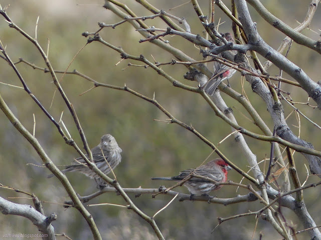
There was no thunder after all. Skies cleared to bright and blue with puffy clouds instead. I stopped by the metal tank to check for the wasps, but they were far from the opening once more. I had to settle for bird watching instead of insect watching.

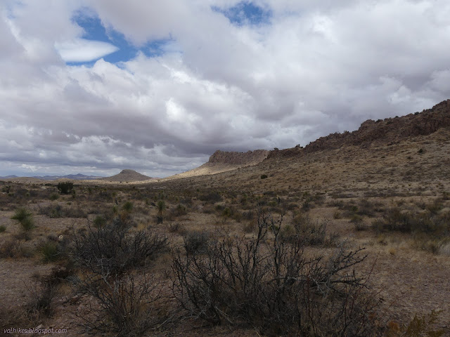
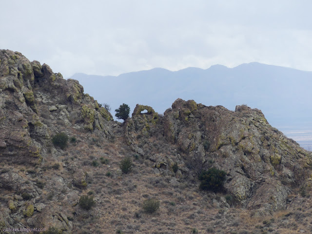
I was feeling good about my time and started eyeing the peak with the Vista benchmark on it. Checked Caltopo only to find that it is mostly private property. So I stuck to the trail as best I could. When it wasn't road, I kept having to readjust the path I was following to align with the signs even on this second pass.


I almost let this day's hike go when it started pouring down rain on me. That poor hiker said he'd practically dumped everything into his pack and booked it when the rain started. I'm glad I didn't. Some random peaks can be such a delight.
*photo album*
©2022 Valerie Norton
Written 15 May 2022
Liked this? Interesting? Click the three bars at the top left for the menu to read more or subscribe!


Comments