San Rafael: Big Cone Spruce and Cachuma Mountain
Los Padres National Forest
DAY 1 | DAY 2 | DAY 3 | DAY 4 | DAY 5 |
Click for map.
I awoke in the dark to mist on my face. The night had been clear with bright stars shining where I could see through the leaves, but had turned dark. My light showed more mist coming down. It was raining. I could see quite a bit of water on my quilt already. It had been raining for a while. I looked around for some rocks to hold down the emergency blanket again and saw a blanket of white developing. It was actually snowing. The breezes of the evening had died to nothing and it was the most peaceful moment looking out on that fluff dropping down. And then I had to get up and deal with it. The emergency blanket is a lot easier to deploy a second time, so I got it open, got some rocks to hold it down, and tucked in underneath my rain coat to sleep the rest of the night away and get up to a blanket of white.

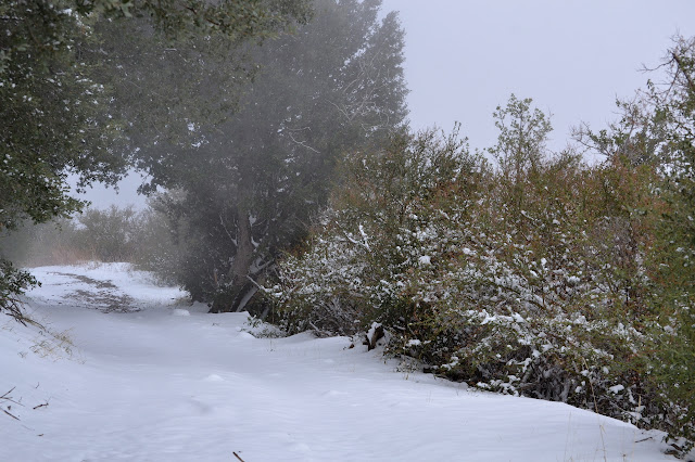
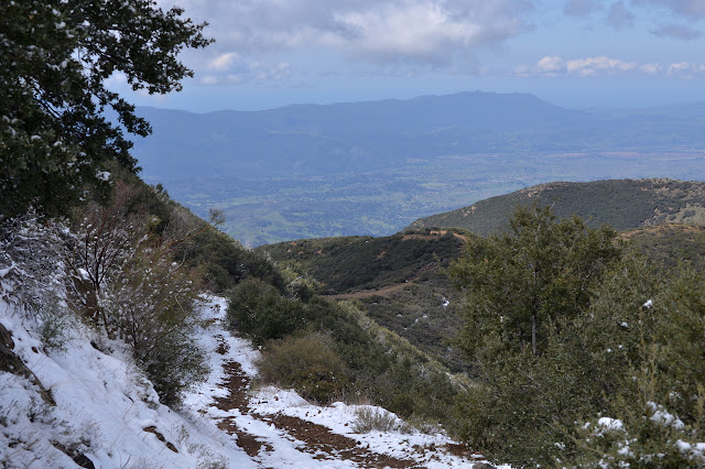
There is not quite an inch to what has stuck of the snow. Not so bad. The thing is, today I get a little over a mile of trail that is new to me just like yesterday, only it climbs 1400 feet from this camp to the road above in 1.2 miles and it is rumored to be bushy and hard to navigate. Now it is bushy, hard to navigate, and covered in what is likely to be an increasingly deep layer of snow. I set about breakfast, packing my wet gear, and admiring how the area that was all deep browns yesterday such that the iron sign was hard to see against the background of dirt, tree litter, and tree, is now a high contrast two color world. My feet are not yet wet, so I can appreciate that the snow is quite pretty. I head out on the trail where bay branches are hanging low with snow. A little encouragement with a stick gets them to pop up from chest height to overhead. There is soon a marker for the second site and I pause to check it out too. The table is a bit more solid, having never been hit by a tree and repaired.


Soon I feel a time pressure from the sun as it creeps down the side of the canyon and into the upper reaches of the trees. I really better get going. This place is about to start to rain. I head back to the trail and up as it leaves the creek and climbs past the trees.


I had a worrying but tiny slip on the trail to the second camp where it was steep, but the actual trail is not so bad even with snow on it. There are not a lot of choices for where to go and even without being able to see the tread, I have no question about the trail. It is brushy, but half of the things reaching out into the trail are ceanothus heavy with snow. When I give them a whack with my hiking sticks, they spring up to stand tall and well out of my way.


The blanket of snow gets thicker as I climb. The brush is not bad so long as I knock most the snow off before walking through. Usually when a section of brush is long and I am standing with it pushing on me from both sides trying to knock more snow off ahead, I just charge through. Every time, I am rewarded with a chunk of snow right down my back. It takes the tolerable and slow to miserable. Fortunately, I can dig it out quickly to make the miserable short lived.


The snow gets thicker still. As my poor, abused lens goes from bad to unusable, I am faced with a bit of a dilemma. As I try to take a picture at full zoom that comes out a nearly uniform grey, I finally realize that I could take the same photo at the widest setting on the other lens. That lens has had more neglect than abuse. It should be fine, except that sometimes it takes some creativity to get the subject in frame.

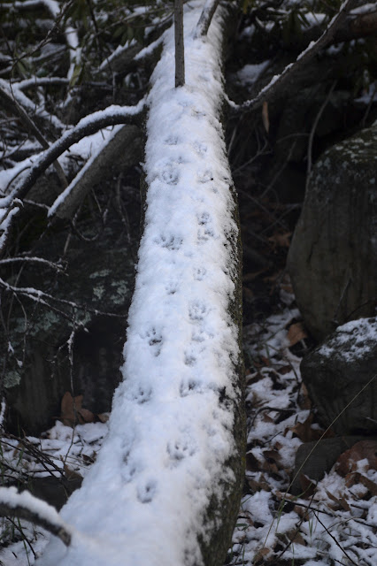
As I near the top, I start to think that the snow has finished getting deeper, then notice it has become as deep as my shoes are high. There are more prints in the snow toward the top. My other wilderness entries had nice signs, but this one has nothing. Not even a sticker on the metal post with a trail sticker.

And so I have finished the last little bit of new trail and just have to walk down the road. I have walked down it in sun and lingering rain, so this blanket of white crossed by rabbit and bird tracks is a different perspective.

The snow stops quite suddenly at a line drawn across the landscape. There are some small drifts caught on the wrong side of the line, but it looks like I found the edge of the storm.
The end of the snow is the end of threats of wet shoes and rolling over hidden rocks. The hidden rocks on slopes were starting to get to me. It does mean that everything looks just about normal again.
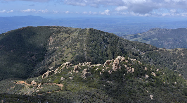


My plans had put Cachuma Mountain as optional and probably. It seems to have a crazy slide area the use trail passes through, but it probably had that before and I did fine through it and thus forgot all about it. Plenty of day left, I may as well go up it. It is right there. Very very steep and right there. Up I go.


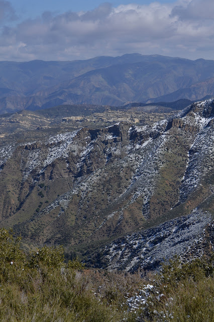
I take a while at the top and start trying to pick out peaks. There is a distinctive end to the Santa Ynez Mountains, so one of those bumps must be Gaviota Peak. Not the highest at the end, though. Antennas on a peak to the north must be McPherson and the big one just to the left Peak Mountain. Something to the right should be Fox Mountain, but I am not certain at all. An interesting bump in the ranches could be Loma Alta. Then I poke my way toward trails going down the other side, but the one heading toward the water tower does not go very far. I was thinking one rocky section on that side looked rather hard to navigate on that side. I head back the way I came and then remember about halfway down that people do use and report using the north ridge. I was sort of trying the northwest one. Ah well. I head on out the long way.

©2018 Valerie Norton
Posted 28 Apr 2018
Liked this? Interesting? Click the three bars at the top left for the menu to read more or subscribe!


Comments
No bivy: Well, it was April already and it just doesn't seem to rain anymore. My shortcut for checking the weather did indicate up to 3% chance, if I recall correctly, but that's just "background noise". The bivy stayed up in the attic. I think I grabbed the Frogg Toggs just as a lighter bit of warmth than my jacket than rain protection.
I have since done some of the trail I'd meant to do on this trip and come to the conclusion that the route I planned would have needed one more day anyway because of the state of some of the trails. I'd have just had the different disaster of biting off more than I could chew. It was better the way it turned out.