San Rafael: White Ledge
Los Padres National Forest
DAY 1 | DAY 2 | DAY 3 | DAY 4 | DAY 5 |
Click for map.
I got cold in the night and being hatless, had to just grab the coat hood and pull it on my head. The rest of the coat spreading out over my shoulders was rather nice in the dark chill. The morning is clear and crisp. I will not be following a lot of new trail today, but there is some nice stuff to repeat. I wave to the folks at the cabin and head off along the trail. The junction marking the east end of the Manzana comes quick. The rest of the Sisquoc would be new trail, at least down to the trail work a couple months ago, but is a little long added to getting up to Cachuma Saddle for just two nights of food. I turn up the Manzana as it climbs along the south fork of the river to Lonnie Davis Camp, a rather nice spot, and then then out into the high and dry. It is not nearly so dry as my on other visit.


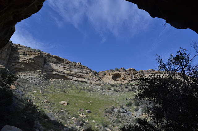
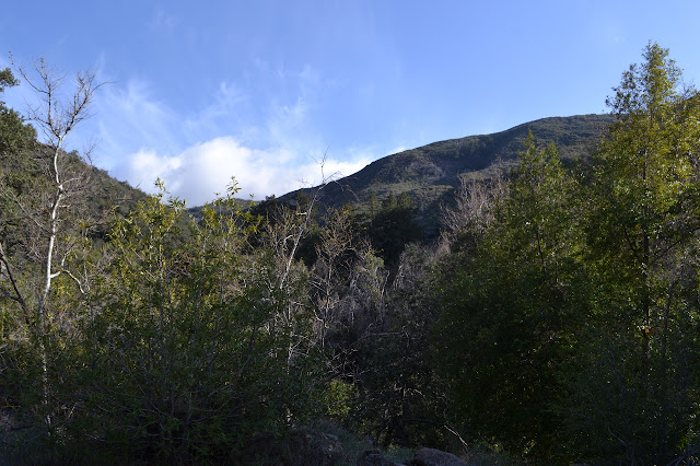
The trail climbs high on the south side of the canyon where a couple fairly dry tributaries cut deep into the soft substrate. In these spots, it drops suddenly to climb again steeply. Across the way, the steep walls are riddled with shallow caves and other carvings by water and weather past.
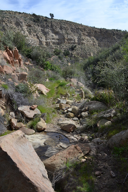


The trail passes by a few rocks full of holes on the south side and then climbs down into the canyon. More water is flowing there. Such clear water would never dream of ruining an old water filter.

White Ledge Camp is beside some particularly nice rocks. I take a little time to admire them as well as the water and the one particular pool that actually did ruin my filter. It is full of little black tadpoles today. It does not seem particularly deeper than the rest, so I have to wonder why it lasted longer.
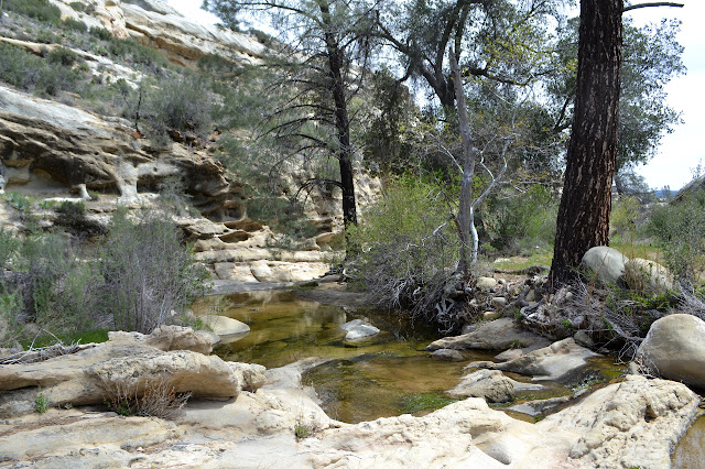
Before, I crossed the creek and started up the trail up onto Hurricane Deck, so this is my new trail. It will only be new to me for just over a mile until just short of Happy Hunting Ground Camp. I turned around there after helping to chop and roll bits of trees on the trail about four years ago. It takes me a moment to realize that to follow this trail, I must also cross the creek. There is a thin grassy path a few feet above the water along the side of the pool. From there, it follows the creek and occasionally resembles a slick rock trail. It is also very pretty.


But then the stretch in the creek is done and the trail climbs out to something that might be a little more pleasant in the event of some rain.

Coming to a little more water flowing, I am almost to the camp and have spotted a familiar rock already. That is it for trail new to me today. Tomorrow, I get another segment just over a mile long that is new to me. The camp itself is a widening in the trail with the fire ring placed right in the center. Water is cradled in the exposed rock beside it. It is so lovely to see all this water.
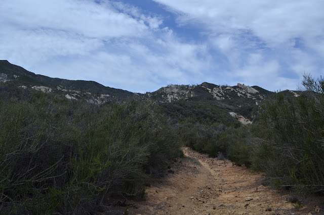
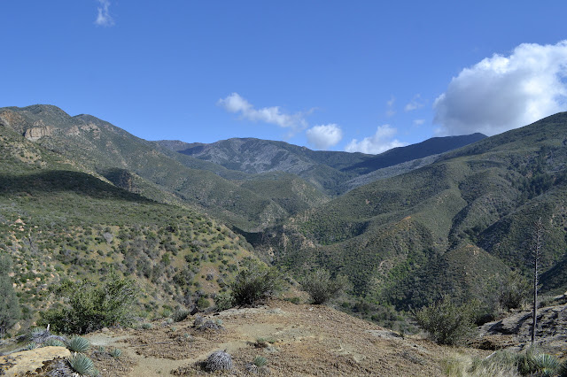
I follow the trail upward still. It has a steep spot edging along a cliff where it looks like someone has found a trail through the brush instead. It only misses half of the steep bit and no one seems to be using it. I wonder who flagged it and why, then take the main route instead. It gets a little better further up as there gets to be less to climb anyway.


It is a long and somewhat flat way down at first. Water comes and goes along the way.


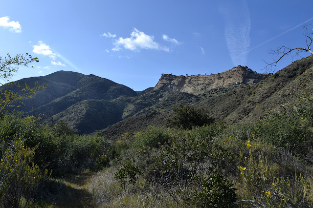
I pass a couple hikers coming up as it starts to drop a bit faster near Alcove. There is just the slightest bit of water going over the top of the falls. There is a slight pool, but thin line actually going over looks like it might just be dripping. Actually seeing the waterfall is a bit of a challenge. There is a bit more water coming out of the alcove itself and I wander on up just because it is a nice spot. This must have been a very small living area once as there are a couple mortars to be found in the rocks, both in the camp and in the alcove.


I head out and down into the canyon passing one more hiker coming up, someone I actually know. He did decide to go for the loop through the lower Sisquoc! Then I forget to check for a view of Alcove Falls as I zoom down the canyon side to the creek below. I have this idea that the climb is much higher than it really is, so the bottom comes surprisingly fast. It is only about 500 feet. Since I believe 3000 feet is "a good climb" and 1000 feet is "a climb", that puts it at just half a climb when going the other way to get out of the canyon.

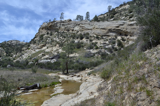
As I reach the creek, a sign points out the way to continue on trail up the creek rather than out of the canyon. The trail is grassy and the creek is hinting at drying up. I know it is trying to fool me, but it is still disconcerting. I cross the creek and turn a corner to find it much more distinct but the creek is still drying up. As I continue, the creek is variously dry or raging along. It simply has many opportunities to go underground. The first part of the canyon I travel through is visibly unstable, which probably leaves lots of little rocks down in the bottom of the canyon for it to run through while being invisible.
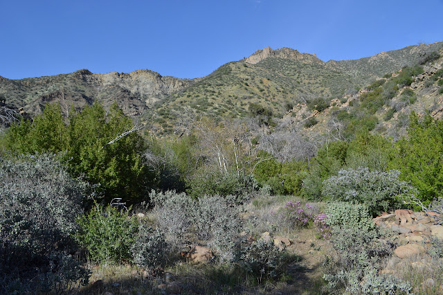
I spot another mortar on the side of the trail where the canyon is wide and the water audible. It might have been a nice spot to live a little while ago. I was warned that this trail has gotten hard to follow and a bit too brushy. For now it is fairly easy to follow, not particularly brushy, and has quite a few trees to hop over. Ooh, and a Humboldt lily starting up. A ribbon right in the middle of the trail at eye level has writing on it, so I reach out and read it. Bee hive in sycamore. I examine the trees around me and realize the large log ahead on the trail is a sycamore. As I look more closely, it is a very large, hollow, sycamore with old honeycomb sticking out the shattered top. A couple bees obligingly enter as I wonder if it is old news. No, it is just that there is no more activity on the now exposed honeycomb. I hop over it as far away from the entry as possible trying not to thump too hard on their roof and hoping they are used to the odd backpacker passing over.

On to the next challenge. The stream crossings are not too bad. I can just about jump some of them and a little rock even near the edge can be enough to help. Sometimes that is all there is, too. A sighting of the named trees ahead elicits a bit of hope that I might be almost there. A hazy memory of there being two camp areas, one not well marked, mixed with that hope inspires me to follow a little trail and look around for camp under the trees. There is nothing except evidence of mighty torrents from a flood. This would be a bad place in a big rain. Then there are the trees. They cross at all heights and conspire with the poison oak to make passage difficult and one particular oak has dropped itself along the trail.
But none of the challenges are all that great, so after one more crossing, there is an iron sign to inform me I am at the camp. Actually, just before it, there is a place to spot the table across the creek and quite a few have beat a second trail into camp climbing a steep bank. I take the official route in. Once in camp, the table is downhill on my left and the spring is uphill on my right. I check the spring, and it is running, but it is a wide, thin sheet of water over the dirt and stones. The creek offers much easier gathering.
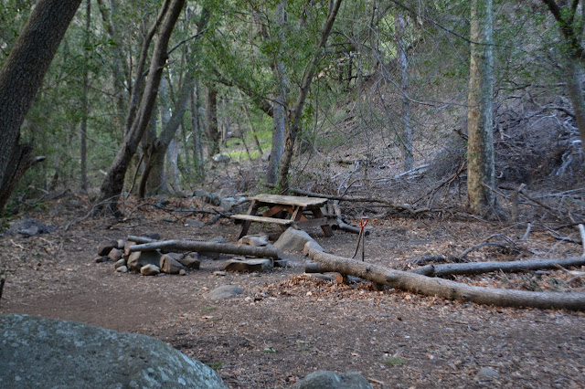
I carefully check the area for the most sheltered spot. It is tucked under a circle of bay trees sprouting from the roots of some ancient fire victim and someone has "helpfully" cleared it to the bare ground and a few holes. At least it has not developed into a water gathering pit the way most campsites treated like this do. Another concern is that one of the circle seems to have fallen recently making the rest suspect. But a lot more sheltered than anything else so I will take it. There is just enough light left for food, set up, and snooze.
Continue on to the next day ⇒
©2018 Valerie Norton
Posted 28 Apr 2018
Liked this? Interesting? Click the three bars at the top left for the menu to read more or subscribe!


Comments