San Rafael: San Rafael Mountain
Los Padres National Forest
DAY 1 | DAY 2 | DAY 3 | DAY 4 | DAY 5 |
Click for map.
It is already nearly 10 AM as I arrive at Cachuma Saddle to start on 6 days of peak bagging and seeing new bits of the San Rafael Wilderness. I checked the Santa Ynez weather and it says it probably will not be too hot out here for those days. Assuming all goes well, I will finally finish off all the Hundred Peaks Section listed peaks for Santa Barbara County and get in an extra along the way. Some of the days are a bit long, but all the camps have good, reliable water. This bit is not new, which does not help when facing a lot of miles on a road. Still, there is good view, and it can be easy enough to think about that and ignore the rather stunningly wide nature of the trail. Sunny, but breezy and chilly, it is not quite time to try out my new sun sleeves and see how they are against the midday sun.


The only evidence of the old pavement is at the start before the gate at the bottom of the road, but there is a tank connected to a trough and a picnic table around where the map shows it ending. These things may or may not be related. I go over to check the trough to see if there is water, but there is none. I thought the recent rains might have filled it a little. As I am thinking that there are no poppies at all out here, I do spot a small patch down the side. They are they yellower, hardier sort rather than California poppies.


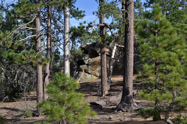
The sun sleeves have found their way on and my first impression is that they are warm in the sun and very chilly in the wind. Maybe the warmth is psychological as I come to an interesting rock outcrop and sometimes destination called Hells Half Acre.


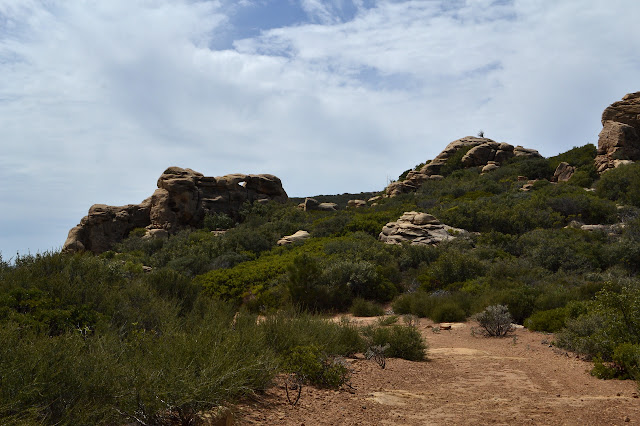
The road climbs again past the short diversion of nature's sandstone sculptures. Ahead, the mountain looks like it has green fur turned almost entirely grey. It is a strange effect.

There is a rat sprawled on the road in an uncomfortable looking position. It looks like it is playing dead except the whiskers keep going wild and the breathing sort of gives it away. I am not certain what to think of it. I pass the top of the Big Cone Spruce Trail, where there is a giant sign and a picnic table. My first plan would have had me coming up this trail from NIRA to loop through the upper Sisquoc. The new plan has more new miles.

I pass a pair of couples coming out, one maybe a quarter mile behind the other, and figure they must go with the two vehicles I saw at the start. There is a clue to the grey hair and then McKinley Spring in the form of oaks burned by the Zaca Fire. Their now grey trunks and branches still reach for the sky as their roots regrow new ones. The camp looks about the same as I last saw it. A little drier without the rather wild storm of that past night still raining down on it and a little more abandoned without my fellow trail crew volunteers or anyone else. It does get plenty of use.

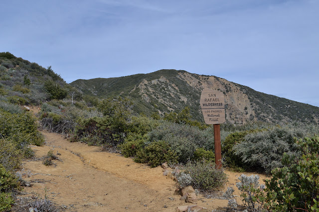
I climb just a little bit further to McKinley Saddle and sign into the register. It says one of the couples actually came up from NIRA and looped through the upper Sisquoc in the reverse of my plan A. McKinley Mountain can wait for after the climb from Santa Cruz Peak. It will make it a little different a climb from the last time. I head into the San Rafael Wilderness that just turned 50 a couple weeks ago.
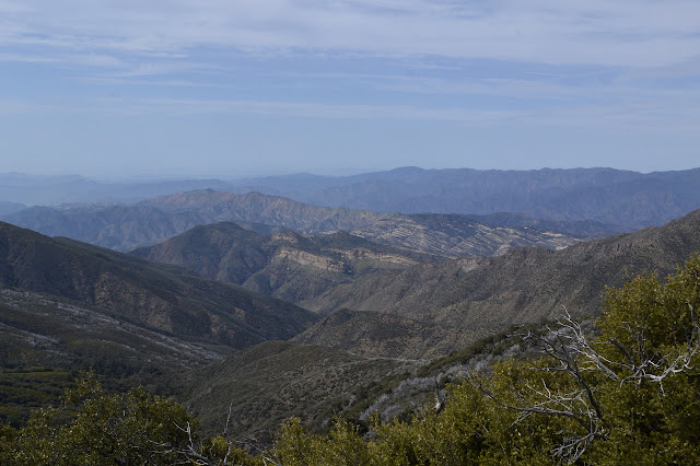
Not quite all of the old burned trunks are remaining standing and I haul a couple off the trail as I go. They are just a little too big to do so easily. The trail is narrow and climbs as it goes toward the high point of San Rafael Mountain. Other spots seem like they must be higher than anywhere the trail goes as I pass them, but the peak really is just a few feet off the track. I pop up to the very top and hear bells coming up the trail as I settle in to enjoy my position on the world. It is a day hiker out to do all three peaks: McKinley, Santa Cruz, and San Rafael. The 33 mile day hike! "Ah, you know it." He says he actually took a mountain bike up to the saddle, but it is still quite a long day. He started at 6 AM. He has been through the Hundred Peaks list twice while I am still aiming at number 101. (Still not keen on counting the drive ups.)


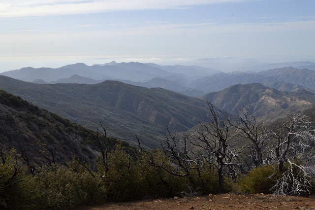
The character of the surroundings changes as I start down the other side of the mountain. The burned up scrub oak turns to huge pines. There is the smallest welling of water right on the trail and then streams down below. There is not much to them, but they do flow. There are also a few trees down. Someone has notched one with an axe so that horses can manage it. The trail follows all to closely in a gully most the time, but is easy enough to find. Still, it does not hurt to have the footsteps of the recent travelers too.

A sign among sticks I expect are willows marks arrival at Mission Pine Spring. I know it well enough now to see the valley and look for the sign rather than seeing the sign first. I also look for a pipe I know is there. One low down to fill a plastic tub for stock that should be right next to the trail. It is, and the tub is even clear of dirt. I head further up to check on the higher pipe where the spring originates. It looks like someone has pulled it out a little so it can pour into another plastic tub. I remember it being shorter and can see some of the holes for the water to seep in along the length by the rocks. There is more water now than I have seen it, but I have only seen it in dry times. Whatever, I am home for the night. I head off to figure out where exactly I want to be before coming back to actually gather some water and then taking over the table to make supper. (There is no one else here anyway.) I set up in a sheltered spot someone has flattened, eat, then pull out the sketch book that has been so neglected and sit by the spring in the last of the light. I finish not entirely certain what my sketch looks like.

It is a bit chillier than I expected as I tuck in under my light quilt. To think I actually thought I might not bring the puffy pants. But they are far too delightful to have and I am already enjoying them.
Continue on to the next day ⇒
©2018 Valerie Norton
Posted 22 Apr 2018
Liked this? Interesting? Click the three bars at the top left for the menu to read more or subscribe!


Comments