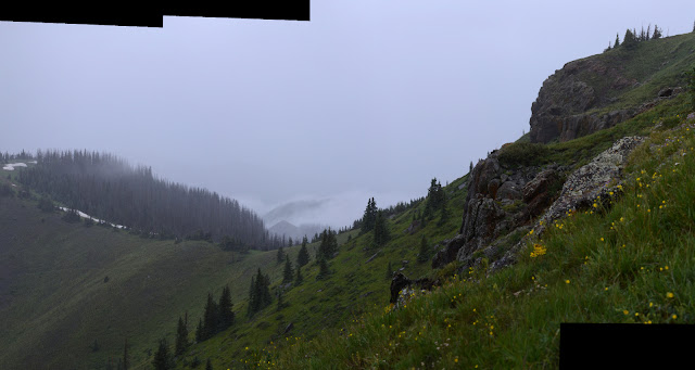
Posts

Showing posts from August, 2019

Cave Basin

Image
San Juan National Forest Click for map. In among many questions, I asked a ranger why Cave Basin was named such. He said there's some limestone up here and it has some caves, but he didn't know where and they are rumored to be hard to find. So probably no caves today. The trail itself is only a little over 5 miles long, but the fellow hefting a big pack makes me question if there might not be a little more to it. The long out of date USGS maps show a trail down Hell Canyon to connect with the Lake Fork Trail. But no, five miles to an overlook is all he knows about. He's just getting set up for archery season for deer and elk which starts tomorrow. I knew I'd seen something was starting Saturday. He seems to think this trail is not well known about. I think it's right there on the map. (The Forest Service topo. USGS shows it on the other side of the peak to the east. OpenStreetMap hasn't got it.) Wilderness information sign and trail register at the

Dark Canyon and Runlett Park on Middle Mountain

Image
San Juan National Forest Click for map. Dark Canyon seems like a good way up Middle Mountain, although with the late start I'm feeling like maybe I should grab the peak in a spur off Cave Basin, which I plan to do later. Anyway, it pops up to Runlett Park which follows the ridge and should be a nice view. Good thing I already knew where I was going. In spite of the prohibition against camping within 100 feet of a trailhead, someone has chosen to park straddling the trail with the sign tucked almost entirely behind their rear to camp in a still shady little hole not far enough off to be legal. There's lots of legal dispersed camping sites just a mile further. The area has a bunch of ATV trails, but this one is a single track limited to motorcycles. Not that I'll quite notice that until it turns into Runlett Park, which allows ATVs, so I'll be a little grumpy about the motorcycles tracks over the next two miles. The trail is surprisingly thin by the sign, bu

Vallecito to Windom: West Mountain

Image
San Juan National Forest DAY 1  |  DAY 2  |  DAY 3  |  DAY 4  |  DAY 5 Click for map. Since I stopped a little short of what I hoped, there are still 15 miles left to the car. My early start gets a little consumed in watching the early light play on the tall peaks to the north. Guess I can't get going at the expense of being where I am? Well, it is important to remember to enjoy the moments. Sunlight on Sunlight Peak and the rest of them. After some breakfast, light is all over here too. I have one more bald hump to get over before descending properly into the trees, leaving the wilderness somewhere in between. There's no sign to note it. Perhaps because the trail pops back in and out a few more times? One more bald hump. A bump with a view. Probably the last time to take in that view to the north. View to the southeast is of the upper portions of Grimes Creek. Down the other side and into the trees is a nice change. They aren't too t

Vallecito to Windom: Silver Mesa and Endlich Mesa

Image
San Juan National Forest DAY 1  |  DAY 2  |  DAY 3  |  DAY 4  |  DAY 5 Click for map. Morning and as I cook breakfast, I seem to have a minor mountain goat infestation of one male. These goats are far too comfortable around people. I watch him, and it becomes clear he's looking for a rock I might have peed on for the salt. Ew. One mountain goat sniffing about for a salty patch. The weather is already threatening, although I get a sense of rain without thunder somehow. The threatening weather is reason number one it might not be a good idea to take Endlich Mesa back as planned since after climbing to 12.6k feet, I stay near that and then over 12.8k feet Thimble Pass. That first bit of staying high is at least under a tall ridge, but the next miles high on Silver Mesa are above tree line in the flat. The next reason to avoid it is that fire warning at the start. The trails I came in on are hardly affected by the fire, but Endlich Mesa will come down through wha

Vallecito to Windom: Windom Peak

Image
San Juan National Forest DAY 1  |  DAY 2  |  DAY 3  |  DAY 4  |  DAY 5 Click for map. It looks like a stunning day for a mountain climb, but little wisps of cloud form quickly. Decorative or previews of what is to come? I could certainly have started earlier, but suspect this is early enough as I make my way to the trail and up, past the sign banning camping beyond. The mountain goats are on their daily commute down. They are a bigger group, 6 or 8, but still keep the wary but not scared attitude. Do they figure it out when the hunters come or are they just lucky that goat tags are hard to come by? Light is still finding its way across the land. The mountain goats on their morning commute down to the lower meadows. As I looked across from Columbine Pass yesterday, I could see this trail cut into the slopes up to Twin Lakes and wondered at the traffic that could have made such a use trail. Also about the way it seemed to flirt with one steep cascade, getting

Vallecito to Windom: Johnson Creek and Columbine Pass

Image
San Juan National Forest DAY 1  |  DAY 2  |  DAY 3  |  DAY 4  |  DAY 5 Click for map. Morning comes without any night rain. I totally got away with leaving the rain fly off. I didn't get much star gazing in, though. The camera said it had taken its last picture on the battery it had, so I pop in the charged one for a picture of the sunrise light on the mountains. The camera promptly explains that it has taken its last picture on that battery, too. I tested that battery before I started! I couldn't remember when it had been charged, so I put it on the charger. The light went red, then a couple minutes later it was green. I start to think that big camera plus 14er doesn't mix, but it went up Quandary just fine. It got up Uncompahgre and Wetterhorn just fine. It was only Williamson where I had a different problem. I seem to be rather emotionally attached to taking photos with the big camera because I feel a swirl of depression coming over me. The sentin

Vallecito to Windom: Vallecito Creek

Image
San Juan National Forest DAY 1  |  DAY 2  |  DAY 3  |  DAY 4  |  DAY 5 Click for map. It's probably the last time, at least for a while, that I can leave Timmy with the lovely woman who has been looking after him when I backpack, but we have decided we can trust him a little longer so I can go out for five days. Five days is what I think it will take me to find my way up a new 14er fabled as one of Colorado's "most remote". Typically, people will just ride the Durango Silverton Scenic Railroad out to Needleton, then 6 miles on trail to a camp site to be ready to climb the peak the next day. So it isn't all that remote. Except for being constrained by the train schedule, people would day hike it like Mount Whitney. Oh, and there are the two harder 14k peaks nearby, so if you "gotta catch them all", you might as well hang out an extra day or two. Since I have no business on class 3 on my own, I'll leave the other two peaks to people who

Treasure Falls

Image
San Juan National Forest Click for map. Another reason I didn't go after Alberta Peak while hiking Treasure Mountain was that I wanted to be sure to have some late afternoon light to hike west facing Treasure Falls, not that it was looking anything but gloom at the moment I turned away from continuing southbound just a little further. There seems to be a parking area for westbound traffic on US-160, but it does leave you crossing a highway (signed at 45 MPH in that area, but everyone doing 60+) to get there and neglects to look like it is meant for parking instead of just a big, random turnout. On the other hand, shaded and uncrowded at this prime waterfall looking hour. Treasure Falls is visible from the parking area at this handicapped accessible viewpoint. Trails to see it go up either side. I really should have taken it, but was too slow on the uptake and I can make that turn. The trailer only makes it harder to do a three point turn, or anything that involves

Treasure Mountain

Image
San Juan National Forest Rio Grande National Forest Click for map. I was thinking I might do a loop of Treasure Mountain Trail, some gravel road, Silver Creek Trail, and the Continental Divide Trail backpacking, but decided against. But I can still do Treasure Mountain. The starting point is up on Wolf Creek Pass as the CDT follows along the Continental Divide. Treasure Mountain Trail drops off the side after about 2 miles. It doesn't actually go up the mountain, but I can fix that with a little bit of cross country. There is an interpretive site at the pass to tell about the divide, the road, and the trail. It gets a surprising amount of business. The trail is off to the left. The trail going south seems a lot more defined than the one headed north. It crosses a meadow and then a creek with a bridge. Talk about luxury. Then up through the beetle killed trees where it needs a lot of maintenance. It has gotten a lot, too, but there is more work now. These beetles

Silver benchmark on the Continental Divide Trail

Image
Rio Grande National Forest San Juan National Forest Click for map. Oh, dear, the weather looks absolutely dreadful, but in the spirit of having no idea what it will really do so I might as well go for it, I'm going for it. There have been some mornings that looked just as dreadful and did nothing much. A random section of the Continental Divide Trail that happens to have a benchmark nearby is the goal with maybe a little extra look about to the south. Access is via a short trail to Bonito Pass, but it goes off the end of an old logging road marked as unimproved dirt road #388 written vertically, both basically code for you ought to have a 4WD and better have high clearance to drive this, especially if it has been raining. It's positively soggy and since I have neither, I have an extra 2.5 miles from gravel road #390 (signed for Tucker Ponds) at a place labeled Campo Molino. My starting point, off the side of an impacted dispersed camping spot spur. Road #388 (on

Lobo Overlook

Image
Rio Grande National Forest San Juan National Forest Click for map. Lobo Overlook sits on the Continental Divide and the edge between the Rio Grande and San Juan National Forests high above Wolf Creek Pass where US-160 crosses over that divide. The road up is gravel, starting about a quarter mile east of the pass where what is most visible is a large dirt turnout. It is finally signed at the road leaving the turnout by a gate. At the top, the road splits to access the lookout area with bathrooms and picnic tables or an electronics site where a short trail connects to the Continental Divide Trail a short way below. The overlook comes with quite a lot of view east and west with more view north to be found near the electronics site. The day was already looking quite stormy when I got there although it never quite turned into anything. The San Juan National Forest side from the overlook. The Rio Grande National Forest side from the overlook. Table Mountain should be o

follow by email