Posts

Showing posts from March, 2020

Hookton Slough Trail

Image
Humboldt Bay National Wildlife Refuge Click for map. The second trail on Humboldt Bay National Wildlife Refuge has a parking lot on up the road, but they've closed the gate on that one too. Parking is a little harder to come by nearby, but I did manage to get off the pavement safely to give the trail a try. There's no long hike to get to it from the road. Another closed gate, but a lot closer to the regular trail parking. Daffodils have joined the wild onions in bloom here. The trail is nice and wide to keep that mandatory "social distancing" if there was anyone else here. The slough is along the right side and water puddles on the left. It is split off from the ocean by the dyke the trail follows, but is likely to be a little brackish. The ducks and herons and egrets seem to like that side better. Some of that wide trail beside the slough. Great egret stalking along some sort of dry land.

Shorebird Loop Trail

Image
Humboldt Bay National Wildlife Refuge Click for map. Under the Humboldt County shelter-in-place order, we are allowed to get outside for exercise with the caveat that "social distancing" is mandatory. They also define the physical distancing that is being referred to as social distancing. I have a permit for more Lost Coast Trail exploration, but realized I still have some closer exploration I could do. I found two trails to try out on the wildlife refuge. For my first hike, I went for the Shorebird Loop Trail which includes another Redwood EdVenture Quest . Due to COVID-19, the gate is closed, but there is a large dirt lot just outside it and the sign on the gate only states the visitor center and bathrooms are closed. Trails are still open. Since that visitor center is more than a mile away, that does mean I'll be walking more to access the trail than I will on the trail itself. Well, I need plenty of walking. No public vehicle entry at this time. There...

Redwood EdVentures Quest at Arcata Marsh

Image
Arcata Wildlife Refuge Click for map. Click for rough map. R saw my patch from the Redwood EdVentures Quest along the Hidden Valley Trail in the King Range and said she wanted one too. I'm not sure if she would do that one because hills are involved, besides it's rather far to go for a short hike. I know she pokes around Arcata Marsh sometimes, so suggested we try the one based there . I wanted to get out for the first day of spring. (Isn't it a bit early for that? Farmers Almanac says it's the earliest in 124 years.) R needed a little extra motivation go just do it, but the county shelter-in-place order taking effect at midnight provided enough push. We're not exactly what we can do after it. I was a little worried there would be others thinking they better get out before getting locked up, but the parking lot has lots of room and the paths aren't crowded. Of course, the Interpretive Center is already closed for the duration. The Quest starts there ...

more big trees

Image
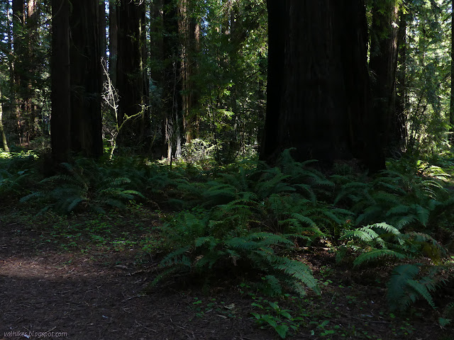
John B. Dewitt Redwoods State Natural Reserve Click for map. I spotted the parking lot on my drive in and it seemed to scream, "There's a hiking trail here!" It seemed like an excellent place to stop and use a few more of the hours of daylight left in the day. Unfortunately, the information board beside the parking lot only offers about six different notices about regulations that apply to here. No dogs. No camping. All the usual and a few esoteric. There's no map or anything else to indicate a nearby trail. A sign among the old growth redwoods. The road with the parking area actually continues after a gate. The sign would seem to indicate that it is eventually a driveway. So there's that to hike. I start up it under the old growth. A history of fire is written on the old trunks. Looking up up up. There actually are lots of little trails. I follow a step carved into a fallen trunk to a little garden of wild flowers, but the trail goes n...

Hidden Valley, Quest Trail

Image
King Range National Conservation Area (BLM) Click for rough map. I remember starting and then stopping the GPS to get a track, but there was none for this hike in the GPS. The second stop after finishing my Lost Coast backpacking trip is actually at the north end of the southern section of the Lost Coast Trail. This is generally not considered at all or considered as the part in Sinkyone Wilderness State Park, but there's actually about 7 miles on BLM land before the 22 miles on state park land. My interest for today is a short nature trail. The box beside the trailhead has both the lovely free maps and a Redwood EdVentures Quest brochure . I've seen these around a few times. It says that if I bring in my Quest Clue to the King Range Office, I can get a prize. Well, I'm already planning to stop there, so I think I very well might. The start of the Discovery Trail and the middle of the Lost Coast Trail. The quest is like an interpretive trail, but there ar...

Mal Coombs Park

Image
King Range National Conservation Area (BLM) Click for map. First stop after the last short day backpacking was Mal Coombs Park for a short look about and to grab a single geocache. The park has picnic tables and playground equipment and grass, but that's not interesting to me. The good stuff is down the steps where there's more tide pooling. Oh, and the Cape Mendocino lighthouse has been relocated to it. I first stopped at the pair of signs at the top of the steps that help identify the animals that might be found down below. They also hold the information I needed to determine the actual coordinates for the geocache. I got a bit antsy about how long it was taking me to sort out the details with the tide coming in and the pools getting less accessible. I could just go down and sort the coordinates after, but that wouldn't be efficient if the coordinates came out down by the beach. Efficiency is something to strive for more in running errands around town, not in p...

King Range: tide pooling

Image
King Range National Conservation Area (BLM) DAY 1  |  DAY 2  |  DAY 3  |  DAY 4  |  DAY 5 Click for map. One single wave must have come up almost to the bottom of the short dirt cliff, not that I noticed. I slept far better than expected. I'm not seeing any of the light weather that was supposed to be coming in for Friday. Just clear skies and sunshine. Well, mountain shade. The sun will get here. From my perch just barely above the beach. The sand is wet far up and the prints (bear, deer, mostly human) are more rounded now, but only those halfway down have had enough washing to smooth away. I obviously should have camped a little further along to get the sun more quickly. Time to move. Just a few short miles to get back to the trailhead, but I have plans for the day, spots I want to visit, so I don't want to take too long to finish it off. My speed is not helped by the tide going out. This was such a bland bit of beac...

King Range: Buck Creek

Image
King Range National Conservation Area (BLM) DAY 1  |  DAY 2  |  DAY 3  |  DAY 4  |  DAY 5 Click for map. Today is peak day! Again! I have to hike back up to the ridge and the spur to the peak is even shorter on this side, so I might as well see it in a little different light of morning instead of afternoon. My first discovery in the morning is that there is a little more color to the place than I could see before. The sun, slow to come even to the slopes around, found a nice clump of madrones to light up eventually. My second discovery is that I didn't look around quite enough for water. I was sometimes hearing some above because about the same distance above as below, there is water in the creek. It just dives under for a short distance. I still have no idea where the spring might be. It's dry down by me, but there is water coming down that little canyon. Then I turn and climb with the trail. It is quickly up onto a ridge line...

King Range: King Peak

Image
King Range National Conservation Area (BLM) DAY 1  |  DAY 2  |  DAY 3  |  DAY 4  |  DAY 5 Click for map. Today is peak day! First I've got to finish off my little bit of closed road walking. Although I expected it to freeze last night, there seemed to be warm air move in instead and the morning is warmer than the evening. There's better opportunities to see the view to the east and north. Eureka looks foggy. I think I had the single proper camp site along this 2.4 mile stretch of road. There was a mediocre pair a quarter mile short of my poking around to get to Hadley Peak, but there's really not a lot on offer up here. Just trying to look about the place. A fairly northerly view from the ridge. The North Slide Peak Trailhead is easy to find. Its information sign is intact and tells me to fill in a permit from the box to overnight in the wilderness, so it's two years out of date. The permit box is gone. I even have a sign to te...

King Range: Kinsey Ridge

Image
King Range National Conservation Area (BLM) DAY 1  |  DAY 2  |  DAY 3  |  DAY 4  |  DAY 5 Click for map. Going to be another sunny day over the water and I think I'll remember to put on my sunscreen even though I totally put it on already yesterday. I sometimes get a little too relaxed about sunscreen, but being on the beach does give a double dose of the high energy rays. There's no part of the trail that is restricted by tides, which is good because the low is still right around sunrise and sunset. The high is going to be higher than normal, so it'll be important to pay attention anyway. I guess it always is. Sneaker waves and all that. Getting ready for the dawn. It'll be a while before the sun is actually shining here. The morning is cool and soggy. It must have dropped below the dew point because my cheap little humidity gauge is reading 35.6°F and 98%. It is tempting to try to wait for the sun to hit. I'm packed up only...

King Range: Lost Coast

Image
King Range National Conservation Area (BLM) DAY 1  |  DAY 2  |  DAY 3  |  DAY 4  |  DAY 5 Click for map. I want to hike King Peak (Humboldt County's most prominent peak) properly and get in a bit of the Lost Coast Trail as a bonus. I should not have squandered all those unseasonably sunny days during February, but with a little chance of rain in the forecast for Friday I finally picked up a permit to hike the King Range last night. (It is $6 and must be gotten online .) Starting Tuesday and Wednesday went from about 10 open spots to 0 while I figured out how many days I wanted, but I actually wanted to start Monday. With still needing to pack, it was tempting to try to push it to Tuesday, so the others booking helped me buckle down and do what I knew I should. I think it might be starting to be the popular season. So the morning saw an hour spent on getting food into the bear canister and another on everything else into the pack, then...