Wooley Creek: Bridge Creek
Klamath National Forest
DAY 1 | DAY 2 | DAY 3 | DAY 4
Click for map.
(Day 2 of

Of course, the junction with the bypass isn't the trail I was looking for. The actual junction along the bypass trail is signed and still there's great tread to be found. So far so good. There certainly seemed like nothing to worry about.

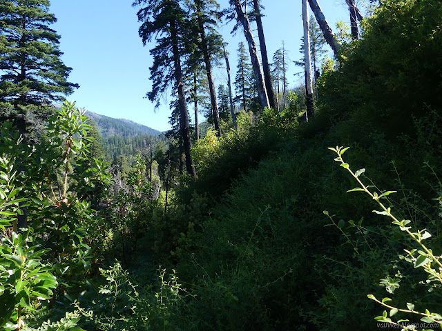
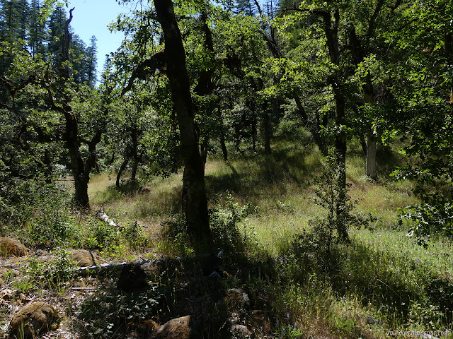
The trail takes a couple switchbacks up the hill, then pops up onto the ridge looking down to Bridge Creek. The canyon is still narrow and steep like at the bridge below, but deeper. There's a bit too many trees to actually get a good look at it or even a mediocre look. The trail keeps the ridge shortly before dropping lower to continue along the slope. There's trees across it. They're annoying. I got past them easily and kicked off a few of the smaller ones, especially the one the bear was walking around instead of over. The trail clearly gets a lot of bear traffic. The leaves and softer areas have regular indentations from the repeated steps. My own feet fell into them where the trail makes short, steep climbs.

I found an insulator stuck up on the side of a big madrone. Fowler Cabin was built 1925, so it's the right time. Once a single wire stretched through it from something up there to the cabin. (It went to the fire lookout on Medicine Mountain, but I hadn't quite connected the fact that there was a three mile trail up the mountain to the only reason they ever put a few mile trail up a random mountain.)

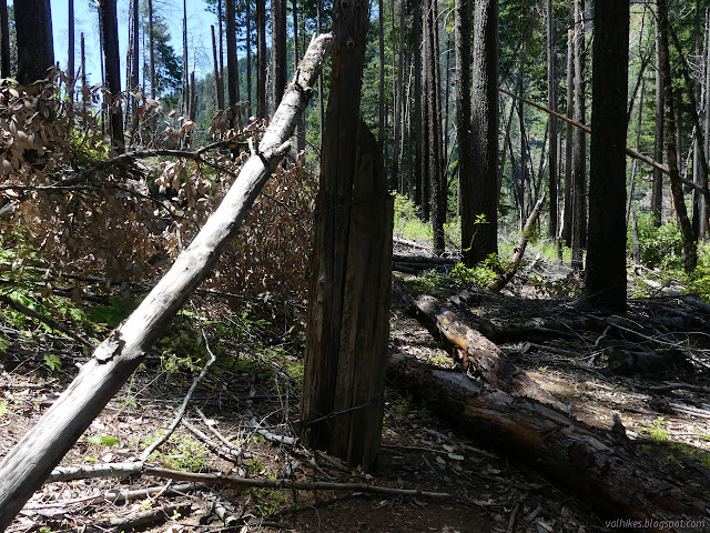
There were a lot of trees to climb over, under, over then under, around, whatever. It took a lot of energy to get up the trail and seemed to be getting worse. Getting to badly burned areas meant adding in a lot of brush and decaying tread. There were still plenty of logs to navigate. One log up to my chin that had been logged out had been joined by a second just as big. I opted to go up and around, but then found myself almost too squeezed as I slid down between them to the trail again.


Then, just past a nicely flowing stream about a mile short of Yellow Jacket Creek and just after finding the first ribbons, I ran out of options. I'd been thinking "just follow the bear" since the trail seemed to be frequented by them. Well, bear seemed to go about three different ways and none of them looked good for a human with a pack. The ribbons were set for someone going the other way and offered no hints for me. There must be a way. No one would turn around and then start setting ribbons. There were lots of little things cut away that I suspect were done by hikers carrying saws.

I took a while to give up. I could see the tread, decaying as it was. I could see cuts on the bushes all over. The ribbons were just a few feet behind me. I was clearly in the right place to find trail. I'd just crawled through a bush of poison oak to get this far, so turning back would mean doing that again. Ugh, the poison oak. A bit of old stuff had fallen and brought down a nice tall bit of the stuff. Even when I got rid of the dead stuff holding it down, it was still in the way. At the end of my travel, as near as I could tell by what I guessed was tread, more bushes had laid down across the trail, but I couldn't crawl through them.


I turned around and I crawled back through the poison oak and I stopped by that little stream with its lovely water. I turned my eye to finding some mugwort, but I'm pretty sure it doesn't grow this far north. There was some sort of mint growing out of the water, and I used it to scrub my arms of the oils. Some claim that the scrubbing is more important than the soap to get the oil off. One can but try. Then I had lunch and took in a little more of the plants of the stream.

The way back down somehow took more energy than uphill had. I had missed the first bit of ribbons. There were some directing downward around the particularly large log. After that, there were none. The rest of the log crossing never seemed to decrease in severity. Maybe it had only seemed to be getting worse because I was getting tired.

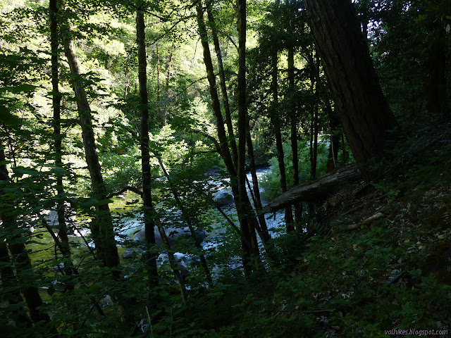
I arrived back at the cabin hot and just about ready for some water access. Having packed up, I was going somewhere, so after a good long rest, I started up Wooley Creek once more. I figured I could get to North Fork Camp and figure out something from there. The trail was not so bad, but still had plenty of logs to navigate.

I bumped into the folks coming back from their temperature gauge adventures and they had rosier views on the trail along the creek, but also deep uncertainties. I noticed a black box on the map and decided to go and see what might still be there. It was well away from the trail and looked like a forgotten relic left on the map from another age.

I found lots of metal in a hole. The midden, sort of. Further down, I could imagine there had been a cabin. Metal was left there, too, but could have just been the leavings of a camp. I could still find the trail down to the water. I looked around a little further in a space that was probably cleared for stock once, then returned to the trail.


Around one corner, I could just see the furry back of a retreating bear over a boulder. Maybe the one I needed to show me the way up bridge. It wasn't going to.

I wasn't moving fast enough to get all the way to North Fork, so I stopped at Bear Skull Camp a little more than a mile before. It is in a large meadow area. There was a fire ring in the meadow itself, but there seemed to be soil crusts developing around it, it has been so long since it was used. At the far end under some trees was another. It also hadn't been used in a while, but seemed more impacted. I went for it and found my way to water to make camp.

As I settled into bed, I found something very disturbing. Legs sticking out of my skin. Tick! I found some more legs sticking out of my skin on my leg. Two ticks! I've wiped off hundreds without one staying. I only saw one on the trail, so there didn't seem to be many. Apparently more than enough. The mosquitoes also don't seem like many, but they certainly liked biting me more than normal, so there were more than enough. While I'm categorizing things that are more than enough, the poison oak doesn't seem too flagrant in coming on trail. I managed to get away without it on the last few exposures, but it sure seems likely I'm still sensitive. After crawling through it, there's more than enough of it, too.
Continue to the next day ⇒
©2020 Valerie Norton
Written 9 Jul 2020
Liked this? Interesting? Click the three bars at the top left for the menu to read more or subscribe!


Comments