Kratka Ridge
Angeles National Forest
San Gabriel Mountains National Monument
Click for map.
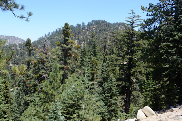
My second little hike of Hundred Peaks Section listed peaks for the day is actually the high point of a ridge. The usual approach for this is from Vista Picnic Area or the old ski resort east of the high point. Not for me, though. I once went exploring up a mystery road just slightly east of the Buckhorn Campground to find use trails climbing both ways on the ridges once at the saddle above. I liked the spot enough to paint it later. I later explored the road further to find myself at the top of Waterman Mountain for the sunset. Today I will explore those ridge routes with a little more idea of where I will end up. First off to the east to grab the ridge high point then off to the west maybe as far as the Waterman benchmark. (This is not quite as far as Waterman where the benchmark reads "Twin".)

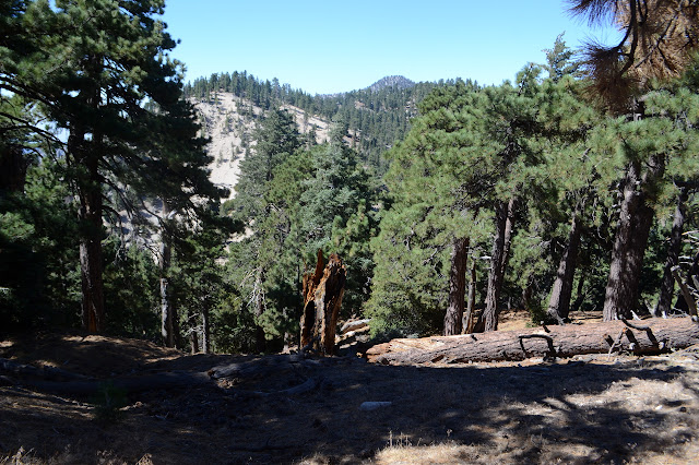
Everything is almost as I remember it. The road curves off to my right to where the map claims you can find Buckhorn Spring and use trail continues up to the saddle. Bits of metal on the way hint at another bit of road existing once near the saddle where there is a short flattened area. Very strong use trail heads west from the saddle, but there is not a lot of indication of travel to the east. That way has lost its allure? Although HPS does not use this approach, they do have a yearly Waterman Rendezvous where groups approach the peak from 3 or 4 different routes, usually including one traversing Kratka Ridge. This year it did, so some 8 or 10 people must have come down this just a month ago. Their passage is not particularly obvious now. I look very closely and decide I can almost imagine footsteps heading up the side, tending to the north where the vegetation is not so thick. Southerly toward the edge of the ridge, the trees start to have brush below them. It is a sensible enough route, so I follow it.

A little way up, old road becomes quite visible as it rounds the ridge northward and upward with a worn path along it. A route for me? The ridge line route still looks mildly overgrown and steep and this is meant to be an easy little hike, so I guess so. It does seem to be going my way and if it stops that, then I can just make a new way.


The road does make an easy climb, but as it reaches another ridge line, it just stops. A cut tree might indicate it cutting back, but if so it has been completely smoothed by time. Whatever. This ridge makes a nice (steep) walk up and I take it just as many have probably done before although the trail is a little less worn.

The ridge levels briefly and there is another bit of road. It is going my way after a fashion, but downhill. Downhill, especially uncertain downhill, is never attractive when trying to reach a high point. Those who passed previously chose both the road and continuing on the ridge line. I pick the ridge line.


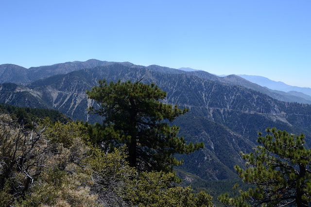
The trail splits and I go high. This just means I have to go up and over a false peak on the way. As I drop down again, the road is maybe 60 feet below. No trails connect the two over the steep, loose hillside between. There is a glimpse of a flattened area a little further along as I turn to climb the last little bit to my destination at the high point. From the top, there is not much view to the north but the south is very open. It is a good spot. Worthy of being listed? Not really my call. Worth of visiting? Definitely.

Heading back down, I explore just a little further to the flat spot. It is the turnaround for road for the defunct ski resort. That probably is a very easy way to come up here. The road I had been following does not connect to it although I expected it would. I head back, then scramble carefully down the steep slope where things are close. It is only a short way. How many injuries result from thinking it is only a short way? None this time. Then it is road, ridge, road, ridge back to the saddle. It worked great coming up, so I stick to it.

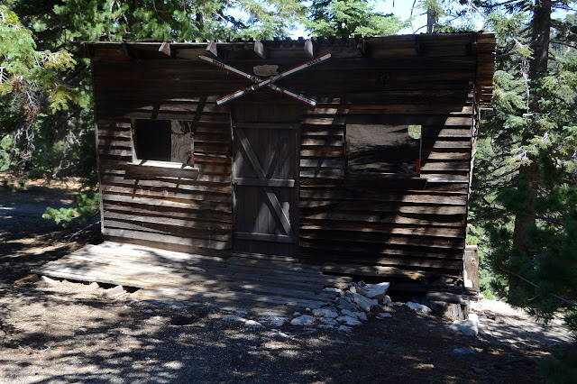
Once back at the saddle, I start up the obvious trail heading west. There are a couple PeakBagger bumps on the way I feel like grabbing and the first one is at the top of this little bump. I take the most obvious trail as I go, but should have taken the higher one. Mine fizzles out and leaves me climbing up to the other one anyway. A ski hut sits quite randomly at the edge of the steep slopes. Above it, the slopes are quite easy and I just pick whatever path, usually the one with the most shadows. It is hotter today than yesterday. The slope is scattered with footprints of those who have done the same.


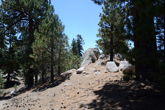
I wander west again and eventually find myself on well used trail. A rocked in post looks like there was once a trail sign up here although the maps seem to contain no hints. It also seems mildly familiar from my Waterman trek. That was a few years ago now. A little bit more gentle climb and then again gets me to the second PeakBagger bump. It is, if anything, even less interesting than the first. The area itself has general interest with its rounded rock outcrops and open spaces among thin trees, but as a peak it is nothing.

My "little" hike is starting to get a little bit long and my water a little bit low in this heat and the benchmark is still a little far away after a little climb after a little drop, and I still have a second little ridge to climb, so I think it is time for a little turn around and to head back.

I almost try for another trail back near the possible sign post, but the footprints do not seem all that indicative that there will be one. I have a slight hope of getting to the old road before the saddle, but end up passing the hut again instead. It is a perfectly good route. I do remember larger rock outcrops along my the route I took years ago, but that could just be memory lending more glory to things.
©2018 Valerie Norton
Posted 15 August 2018
Liked this? Interesting? Click the three bars at the top left for the menu to read more or subscribe!


Comments