Winston Ridge and Peak
Angeles National Forest
San Gabriel Mountains National Monument
Click for map.
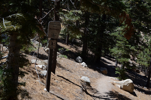
My last hike for the day of a Hundred Peaks Section listed peak is out to Winston ridge. I hiked Winston Peak already one afternoon, but had not realized that I was "supposed" to continue on to the ridge beyond. They are a logical pair. Now I go for the ridge and will probably stop by the peak on the way back. First around the side. The road is a single gentle slope down to the saddle where use trails start out to the high point of the ridge beyond the saddle. The Pacific Crest Trail winds and dips and climbs so that it is both longer and steeper. I have been on both and know this, but the thought of taking the road when the trail is available seems wrong. Besides, it should have a bit more shade in the warm day. So, with my water filled up again, I turn down the trail right of the road at the side of the turnout to wind along the trail.

One little canyon seems to hold a special green that makes me think there is water in it. Nothing shows on the surface, but the line of green holds for a while before vanishing right where the trail crosses. Then it climbs, at which point the trail is the only route (short of meandering cross country) to the saddle.
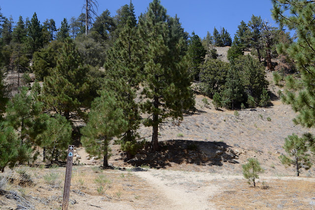


The track of people coming off Winston Peak on this side is so obvious someone has felt the need to place rocks to direct PCT traffic to stay on the east side of the ridge. The track around the side of the bump to the north is a little less obvious, but still hard to miss. I go for the bump itself. Someone marked it on PeakBagger, so I have to! Well, not really. There is a comment that it is the safest way in winter and it most decidedly is a warm summer day today.

There is a little more trail coming down the other side. The dirt is steep and loose there. At the saddle on the far side, there are trails coming from around the side of the peak on both sides and one climbing gently toward the next ridge high point. This must be a very popular spot to hike out to. With the route so obvious, I go for it.
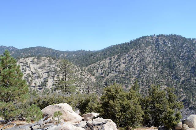


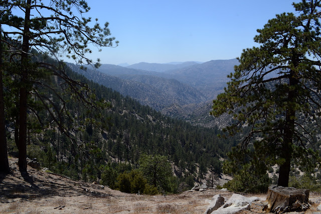
There is only a small trail to the rock outcrop that occupies the high point, but I only need a quick poke around it to find the register. That is the top. Most keep on going. I hang with it a little while, pondering how the land drops down sharply on either side then comes back up even higher. Eventually, I have to admit the view of all that is somewhat shrouded by trees. Curious where everyone else is going well past the high point, I wander a little further down. Then a little further and go ahead and do just a little more than that. They are all going to the good lookout point slightly down the side, of course. It does seem like a good spot to strive to.


I guess I spent rather excessive time on the high point rather than the good spot. The afternoon is wearing on and I really need to get going. I do still want to head up the peak. I do not feel like heading up the bump again, so have to choose a side. A nonsensical fascination takes me on the east side. It is warmer with the afternoon sun and seems less used in recent times. There are a couple footprints along it, but the depression of the general track goes the other way. But it goes to the saddle which is the convergence of many trails. It is thin, but solid as it climbs. There are a couple trees down on it including one that takes more precarious climbing than is really desirable going over age smoothed wood on a steep hillside. Another area of downed tree is just a mess and there are a few trails to choose from. The hillside is cooperative there, though.

From the saddle, it is up to the peak. I recall this trail being really steep coming down with a few spots of uncertainty. The trail seems more distinct now, but it is still steep. It is quite a chug up with a brief pause for a random old road. Happily, it is cooling off now, too.


A rock outcrop rings a bell as the point where things became steep. Stumbling up the gravel slick ramp beside it is rewarded with much flatter land beyond it. The peak feels a lot more like climbing from this side, but still isn't much. Some more rock outcrops make me think, "Wasn't this it?" There is no other hint as I come to it. No register either.


Not much view at the top. I stop because I am hungry, but not for long. The trail down to the road is nicer than the trail up. It is not so steep and is easy to follow. The ridge splits at one point, but the trail stays true. This "little" hike was also somewhat longer than I had quite expected. I had lazy planning just picking out a few I knew were "short", but the whole day has turned out to be nearly 12 miles, quite a bit longer than the previous day. Still, it was easier in the sense that my body was no longer overcompensating for the altitude.
©2018 Valerie Norton
Posted 18 August 2018
Liked this? Interesting? Click the three bars at the top left for the menu to read more or subscribe!


Comments