Ogliby Hills
El Centro Field Office, BLM
Click for map.
I thought I'd do something small before going on to something medium. I picked out a line during the drive up, but probably won't get to do it because I also picked out a couple geocaches to find. One is a multicache that I'm sort of hoping will just lead me along a route up. It seems like a sensible thing to do with a multicache to me, anyway. First, to grab a somewhat random parking spot. A 4WD vehicle can get closer, but there's not a lot of point.
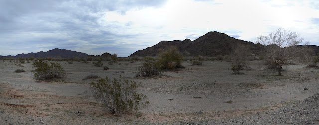

So I head over toward the hills aiming at the first geocache which is a traditional one on a little outcrop that isn't part of my quickly and roughly plotted route at all, but I knew that would happen. Hiking to it is rough, but not hard. It's a spot overlooking the road, so of course I use it to look off somewhere else.


So then onward to the multicache. Frankly, these can be a mixed bag mostly because the written coordinates are often not well enough protected from sunlight or water to still be legible. This one is beautiful when I find it even though it was placed years ago, so it is onward to the next stage. It is in entirely the opposite direction of the high point.


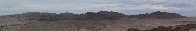
I claim the high point of the random hill as I go past. The next step is a little further down the other side rather than there and once found is the final. So that is it for geocaching for a bit and I can turn my attention to getting to the high point again.


I mostly retrace my steps back down the hill covered in its broken up and rounded lava rocks, then just start up the other side. There seems to be something like a trail, so I follow it across the side of a steep hill, then lose it in a gully. Quite a few trails seem to come up the various other gullies as I pass. There are trails everywhere. And claims. There are claims everywhere too.


Quickly enough, I am at the top. There is even a register and evidence that surveyors have been there.


Then it is back down again. This time, a little more directly. It is a little bit steep in places, but options are endless on where to go. I am back down a little later than expected. Geocaching always takes a little longer than expected.

©2019 Valerie Norton
Written 21 February 2019
Liked this? Interesting? Click the three bars at the top left for the menu to read more or subscribe!


Comments