Pasadena Peak and Stud Mountain
El Centro Field Office BLM
Click for map.
Two days ago was Pasadena Mountain, now on to Pasadena Peak. The peak is really just a warm up for the main bump of the day, Stud Mountain, but I have a feeling one had better get this peak before it gets flattened by mining concerns. This is one of two peaks in the Cargo Muchacho Mountains with 1000 foot prominence. The peakbagger web site helpfully marks their dots with a little "1k" to say, "This one sticks up a bit from its surroundings." I am using roads from the American Girl Wash for my approach to Pasadena Peak. They get me up the side pretty far, then I'll just have to wing it. To go up Stud Mountain, I am using a wash on the Pasadena Peak side, then will head down along a route people have posted on peakbagger using the north ridge back to a flat area that can drop into the top of American Girl Wash with only a few feet of climbing. I had actually wanted to start in the old town of Obregon, but for my car the road into the wash ends at a turn around. I actually park a short way back from the turn around and get started.

Over a hump, the road continues roughly in a single lane. It divides to follow in the wash or climb out the other side and I quickly allow myself to get distracted by a couple of nearby geocaches, so climb over a low hill in a third direction. One leaves me investigating a piece of rusting machinery left in a hole surrounded by rocks of interesting texture. The other is high up for a little bit of a view. It is just a little extra energy and time on what would have been just making my way on road up the wash.

From up high on the hill, I can see a much better road passing to the south of it toward Obregon. My map marks the road up the wash as the better road with this one having a 4WD section in the middle. I guess I picked the wrong route into town. It looks easier to go that way from high on the hill, so I drop down to the south and walk it to where buildings are shown on the USGS map. They are gone. I'm faintly disappointed but not at all surprised. (When operations resumed in 1989, the town was documented and 5 graves were moved. It says this on a plaque the mining company put up on Ogilby Road just north of American Girl Mine Road, but I haven't read the plaque yet.) Now there is just the side of a huge open pit with a pool forming in the bottom.

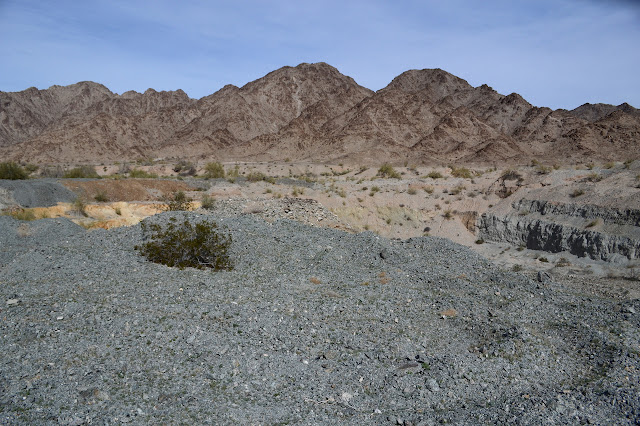

Following along the road, there is a suggestion of a pit to the north and I climb over shallow discarded rock to check it. Indeed it is another open pit. The sound of birds makes me think it might have water too, but I can't see it. I follow the road a little further, but the one I am looking for seems to be gone. Instead, I make my way around the side of the open pit, getting an even better view of its depth. Gravel has been dumped in the area, but there is a wide, level area to walk along. Well, level in an overall sense. The gravel has been dumped in lumps, possibly to discourage ATV travel through the area. The evidence around shows it mostly works. The gravel dump area finally becomes a bit of abandoned road as I have been expecting. There is road down below in the wash that fills in the pit, too. My road takes a little climb to a turn and stops suddenly. I guess I was supposed to walk through the bottom of the pit. There is an old, but generally very solid, trail connecting my position with the road below to help me correct my mistake.

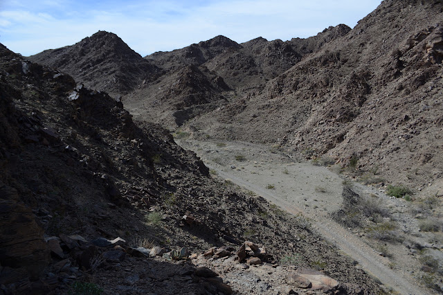
The road below is more like what I was expecting to be following. It turns away from the main wash channel right where I mean to and climbs, alternating between shelves beside the wash and being down in it. As a road crosses, I mean to take the left, but I start to second guess this. There are two canyons that could be prime for climbing up from. Both have prospects high up near the peak, but as I look at the map, I am seeing a steep area that might be just as well avoided. As I look toward the end of the canyon, I can see trails climbing up to the saddle. It all looks quite promising. And there is even ocotillo, which I have started to get superstitious about, at the junction. Many and happy looking ocotillo continue down the canyon. In the other direction, the ocotillo are less numerous and can only be said to look healthy enough. The ocotillo seem to suggest turning. I make a decision. Straight on to the second canyon, then turn. I can always come back if I don't like what I see.


I head up the second canyon. It has a little more than just some walls of tailings at the end. There are also some built walls and a boiler of some kind. The raised lettering and numbers on it would indicate it came from San Francisco in 1891. It looks pretty good. The bricks inside are falling off, though. Other rock walls higher up might have been some structure. I can see a trail going up to the higher wall, so climb up to it and follow it up. From it, trail continues to the top of the high tailings where there should be a shaft. I want to try to work up to some prospects more directly above me and as I examine the rocks, there is a trail there too. The junction is no longer clear, but there is an easy way to get up to it, so I climb.

The trails are really good, even before taking into account that the date on the boiler is probably roughly the last time they ever got any maintenance. The trail I am following does not stop at the prospects, but continues on to the ridge line past a few more prospects. As I pass the shaft, it looks like that trail also makes it up to the ridge, so it did not matter which one I chose of those two. The trail reaches a saddle almost at the ridge and starts down the other side. There is almost a trail continuing up the ridge to the peak, but it is more of a free for all as there are numerous easy walking routes. I pick out mine to the top.


There is a register as well and the peak gets plenty of traffic. There is a peak off to the north that looks almost as high as this, so I have to go and check. The scramble along that bit of ridge is not quite so easy as it was with a trail to follow and it is definitely lower, so I scramble back.


Now off to Stud Mountain. I head down toward those tunnels I saw below as a way to get down to the Guadalupe Mine and a spot marked "ruins" just a little past it. I figure there will be a trail for something that looks so big. There isn't. Just rocky wash to wander down in. I can imagine lines above me that could be trail, but as I follow them with my eyes, they always fail at some point. Just lines in the rocks. As the wash empties into another as big, there is a road. Maybe I should have followed my first instinct and gone over the slightly lower north peak to a row of tunnels, shafts, and prospects to the Pasadena Mine. Maybe I should have followed the trail up over the ridge to the wash just south of this one where there are a few more prospects. My way worked out in the end, it's just rougher than trail.

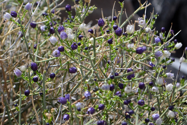
So I visit the items on the map. Guadalupe Mine had a platform for something once that has tumbled down. The ruins are stone walls held together by concrete and a concrete floor. The boiler was more interesting.


Then I am looking to climb again. I catch a prospector trail that is cutting a way into the next wash. It passes a few prospects, of course, and gives me another view of Guadalupe Mine before I catch up with the road that follows the wash. I turn off it quickly between a pair of prospects onto something that may have once been a road. At a washout, there is a large cairn that almost looks navigational instead of claim monument-al. Past it, I pick up trail again and it definitely has navigational cairns along it. I hadn't expected trail here. There are not a lot of prospects on Stud Mountain and I have just passed the last of the ones marked on the map.


The trail climbs up and over the last low saddle and turns up the wash to climb. It is quite distinct and going my way, so I might as well follow it. The cairns continue. Many of them are really puddles of rocks, but they are where one wouldn't expect rocks of different sorts to gather and seem somewhat ordered like they were once stacked.

At a little turn, there is not only a large cairn but also the burned out remains of flares like the ones I have been seeing on the various surveyor marked peaks out here. I wonder if it washed or blew off the peak to get here, but can't help but notice that they are in a mildly critical spot. The trail drops down into the wash and starts following lines of high stuff in the middle of it all. It looks less like a trail and more like a happenstance of nature. Still, there are cairns, or at least the remains of them. Sometimes the ones that are a single bit of white quartz on a well varnished rock work better than the piles. The cairns start climbing up a wash before I want to make my turn, but since we seem to have a common goal, I follow them up. Then they stop.

I stop at that last cairn and look around carefully for another. This is not the first time I can't find the next, but then I could find something like a line and as I followed it, there would be another. Now I don't even have that. Maybe I should return to my plan. It is not that much down to get going up the other wash branch. The cairns pointed this way, it must be possible. So I start up again, hoping to find another. It never comes. Either my instincts finally diverged from those of the trail maker or there are no more as it gets too steep. It gets really steep.
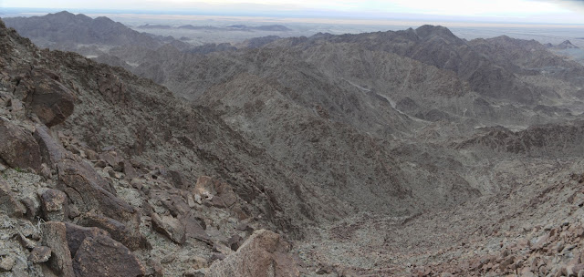
There are options, though. As it gets particularly steep, I can usually move over a bit to avoid that. Sometimes I cross to something like a ridge and start climbing, sometimes move off to a more washed area, depending on what feels best in the moment. I look out and find the height a little bit dizzying and think how glad I am I won't be coming down this way. That is such a wrong thought. I don't know what will happen. Maybe up there it gets impossible and there is no choice but to come down the same way. I sure am glad I actually put on my good shoes today although these rocks seem to be tearing up the uppers something fierce. And then there is ocotillo. Along with ocotillo is barrel, who would never hurt you unless you got at least a little bit attacky at it. They are in a slight bowl. It is not quite the beginning of the end, there is one more steep part, but it is a rest of sorts.

As things get steep again, I realize my legs are actually feeling pretty near done. Another bad thought. It takes plenty of energy to get down, too, so some needs to be saved for that. I think being on uncomfortably steep stuff tends to make me try to hang on to everything a lot harder. I don't know if it works to keep me more connected to the mountain, but it certainly tires out arms and legs a lot faster. I look out north over a peak along the mountain's main ridge line and realize the top is not far, then pop out about 50 feet south of it. Now it's the end, at least of up in service of getting to the top.

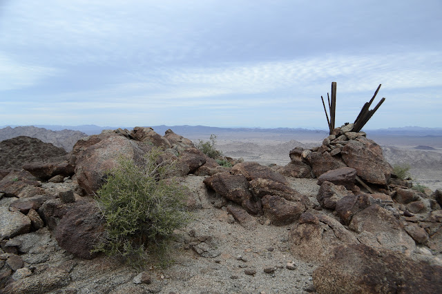
I drop my pack, but don't rest quite yet. There are benchmarks to be found. Reference 1 is sitting next to a cross chiseled into the bedrock and the station looks like someone tried to remove the stamping. The others are stamped "AMERICAN". When I do sit, I take a moment to find out where the azimuth is. It is north on the ridge along my planned route down, so that's handy. Also, the chiseled cross is the old reference mark from before the disks were placed. There is no information other than that of what was placed for that monument in 1910. They all call the station "unstamped" even though there is some stamping on it and something has taken it off along with part of the triangle. There are a lot of routes up the mountain. The second group says to "follow trail marked by cairns up wash to eastward" in 1941. Maybe they left the flares and I accidentally followed their route. Do cairns last that long? I suppose if flare shells can without washing away, stacked rocks can.


I eat a bit, but decide that I want as much time as possible to navigate the ridge back down. Just because a few other people have used it as a route doesn't mean I'll feel comfortable on it after not seeing it going up. The surveyors all come up various washes. Getting out to the azimuth is easy enough, though. It is another reference disk stamped "NO 3" as advertised.

It gets steeper as it goes and there are a few spots where it goes rocky and jumps down suddenly. These are the sorts of things I really like to have seen coming up. I overestimate their danger coming down. I just can't see all that is there from above. There are a few times I retreat and drop down the side, then continue forward around. Sometimes it looks like there is trail that way, sometimes not.

I have some fun finding a keyhole, they really do seem to be everywhere, but it is in the middle of a slightly less uncomfortable climb along the side of a ridge instead of going right over the top of a thin bit. There is a spot where the ridge splits where I have been liking what I see on the map to the left better. I'm not even sure how to get down onto the right bit that others have been following. I just have to admit the ridge is really doing me in. The other isn't much better. I leave it for the wash down the middle instead. I turn back to see it undercut. Cute. No way I was getting down that. Sure, there was probably a way around, it just doesn't bode well. The only time I was feeling studly on this mountain was for a brief moment between thinking, "Yes! I did it!" and thinking, "Well, the up bit. There's still the down." This day really feels like I moved my hiking solo from the realm of "foolish" over to "courting disaster".

It is a very long time going down the wash. There are some waterfall spots, but they have easy routes around that don't even require much around to get to. It takes longer to get down than it took to get up. Eventually it starts to level out and there's some ocotillo and something like a path along the side. I glance at the GPS and it says I've only been 8 miles all day. I am absolutely exhausted after only 8 miles? It is minutes to sunset as I hit the road, but getting to it before dark is honestly what I wanted most in the world.
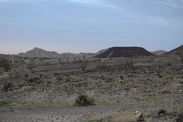

Walking on the road actually feels better than resting. It does have some ups and downs, but nothing long or hard, and now I think there should be no more navigational challenges. The wiggles of the day made the outbound journey much longer, but now I am going fairly directly along and things become familiar, just from a different point of view, quite quickly.

Then things get particularly familiar because I've actually been there. Near the lack of remains of Obregon, I pass one road heading off to the north and suspect I should be following it instead of passing along the south side of the huge pile of trash rock again. If I had just come in directly, I would have known, but I got creative. As the road thinks about climbing into the low hills, another comes off going my way, it just doesn't get very far my way. No worries, I am walking and can go over the 2 foot rock waves and down into the wash, even in the dark, if I need to. So that is what I do. The road in the wash delivers me quite directly to the car. I feel better after the last 3 miles than I did before them. Road miles really can be very easy.
©2019 Valerie Norton
Written 23 February 2019
Liked this? Interesting? Click the three bars at the top left for the menu to read more or subscribe!


Comments