Palm Canyon
Kofa National Wildlife Refuge
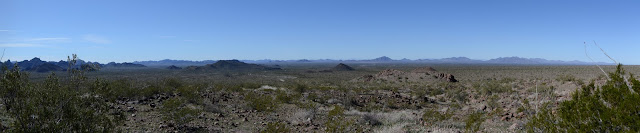
Click for map.
At only half a mile of trail, it is a bit shorter than my usual, but California fan palms are something special. Almost all of them are in California, but there are a few in Arizona and all of those are in the Kofa National Wildlife Refuge, according to the literature at the trailhead. These are snuggled into cracks in a canyon in Signal Peak. Besides this canyon, there is a Four Palms Canyon to the north and Old Palm Canyon to the south, so there might be some more palms in the area. This is the one with the road to it and since it is a west facing canyon, I thought it might be best to get to it in the afternoon.


Signs at the trailhead go into geology of the area, suspected history of palms, and a bit about the creation of the wildlife refuge for the protection of desert big horn sheep. They're the ones who make all the trails and used to make even more. There's people coming and going although it is hard to make it take a long time, so it must be a very popular place. I start down the trail where there is a brochure as well. I take one to read at the palms. Meanwhile, spires and cliffs reach up high around me.

There are cracks in the sides and things growing up there. Some Mohave yucca probably tricks a few people until they see the actual palms. After a couple cracks, there is an actual palm. One single solitary palm all alone in the sun.

A couple cracks later, the main group of palms come into view. The brochure has a bit about a fire that raged through the crack about 60 years ago killing off a portion of them but that the rest seem to be hanging on well. They do indeed look to be surviving huddled in their crack in the north wall. A little more and the trail end at a sign that points up to these palms.


The brochure suggests you can scramble up to the palms for a closer view in about 40 minutes. I go for it, but without paying enough attention to where I am going up at first and finding myself in a narrow slot at first. The other side has rocks I decide are just the sort of thing that makes me particularly uncomfortable coming down and maybe I could just leave the palms to themselves. Instead, I follow the braiding trails further up the canyon. People have been everywhere and done so a half dozen different ways, many of them setting cairns to battle for who has a better trail.


There is something quite unexpected, at least to me. Hiding away in another crack are four more palms. That I actually thought I might find, but these are in a south side crack. They should stay a lot cooler and hardly ever see any sunlight at all in their position, but there they are anyway.

I keep going up until it feels like time to turn around. I do still need to drive a bunch of miles and find a camping spot today, although truthfully the camping in the refuge is very tempting for just being nice. That monolith of rock that is Signal Peak may not make it quite so nice in the morning.

High up, there are pools from the rains. There has not been much rain recently, but it looks like these stick around in the deep shadows anyway. Little things swim around in them like there is always a little water left.

And then it is time. I drop the brochure off in the box on my way past.

©2019 Valerie Norton
Written 17 February 2019
Written 17 February 2019
Liked this? Interesting? Click the three bars at the top left for the menu to read more or subscribe!


Comments